Tuesday, August 9, 2016

Pictured Rocks National Lakeshore - Day 1

Map of this blog's locations click this link to open the map

Pictured Rocks is a big park that stretches from the town of Munising to the west and Grand Marias to the east. It covers over 40 miles of the Lake Superior shore which is way too big to see it all in a day so we decided to break it into two days. In hindsight, we should have allotted 3 days to see things better.

Our first stop on the east side of the park was the Grand Sable visitor center. We did a hike out from there to Sable Falls. It was neat to be hiking on the NCT or North Country Trail. We have done a fair amount of that trail in the Pennsylvania and New York areas and have done some sections in Ohio as well. But given the trail is 4600 miles long, and goes through 7 states, we still have most of it to experience.

Sable Falls were not all that impressive. Not sure if it is because of the extreme dry weather the area is experiencing or we have just seen a lot of other falls in our travels. However, the dunes along the shore at Grand Sable were quite impressive but off limits to people.
Grand Sable Dunes
Then we drove over a few miles west to an area know as the Log Slide Overlook. Named because the steep sand dunes down to Lake Superior worked as a means to get trees cut in nearby forests down to the water to be rafted to sawmills in Munising in years gone by.

One of the features of this area is that people are allowed to actually walk down (and back up) the dune. The sign at the entrance does warn about what to expect. It is about 500 foot walk from the top of the dune to the beach level. Not bad, until they point out that it is a 300 foot vertical drop in that distance!

I managed to get the nerve to get a close perch up top to take some pictures, while Chris opted to stay well back from the edge. We saw several people walking down. Even though it is obviously steep, the sand is so soft and deep, that it looked fairly easy to walk down - it's not like they were tumbling uncontrollably. But part way down the dune, all the people disappeared from my view, so it's tough to say what the bottom two thirds was like. I only saw two people come back up while I was standing there. They both looked very tired, hot and thirsty as they made it to the top. I suppose its just as well we didn't try it.
One Couple Starting the Downward Trek

A Couple Guys Trudging Back Up

The Water Had a Shimmering Appearance Today
Dunes Stretching to the Horizon
After lunch, we headed to Hurricane River for the 1.5 mile hike to Au Sable Light Station. The hike was pleasant enough except for some pesky flies again. Since there were many other people doing the walk, the files probably were better fed, so they weren't unbearable. The light house was pretty but nobody there to give any tours at the time of day we stopped.
Along the Hike to the Light Station

Au Sable Light Station
By the time we got back to the car, we decided to head into Grand Marias and check out the town. There is a nice little harbor there and a long break wall out to another small light house. And just like we have seen in many places during this trip, there are plenty of kids jumping off the pier into the water.
Beacon By the Coast Guard Station

A View of the Harbor at Grand Marias
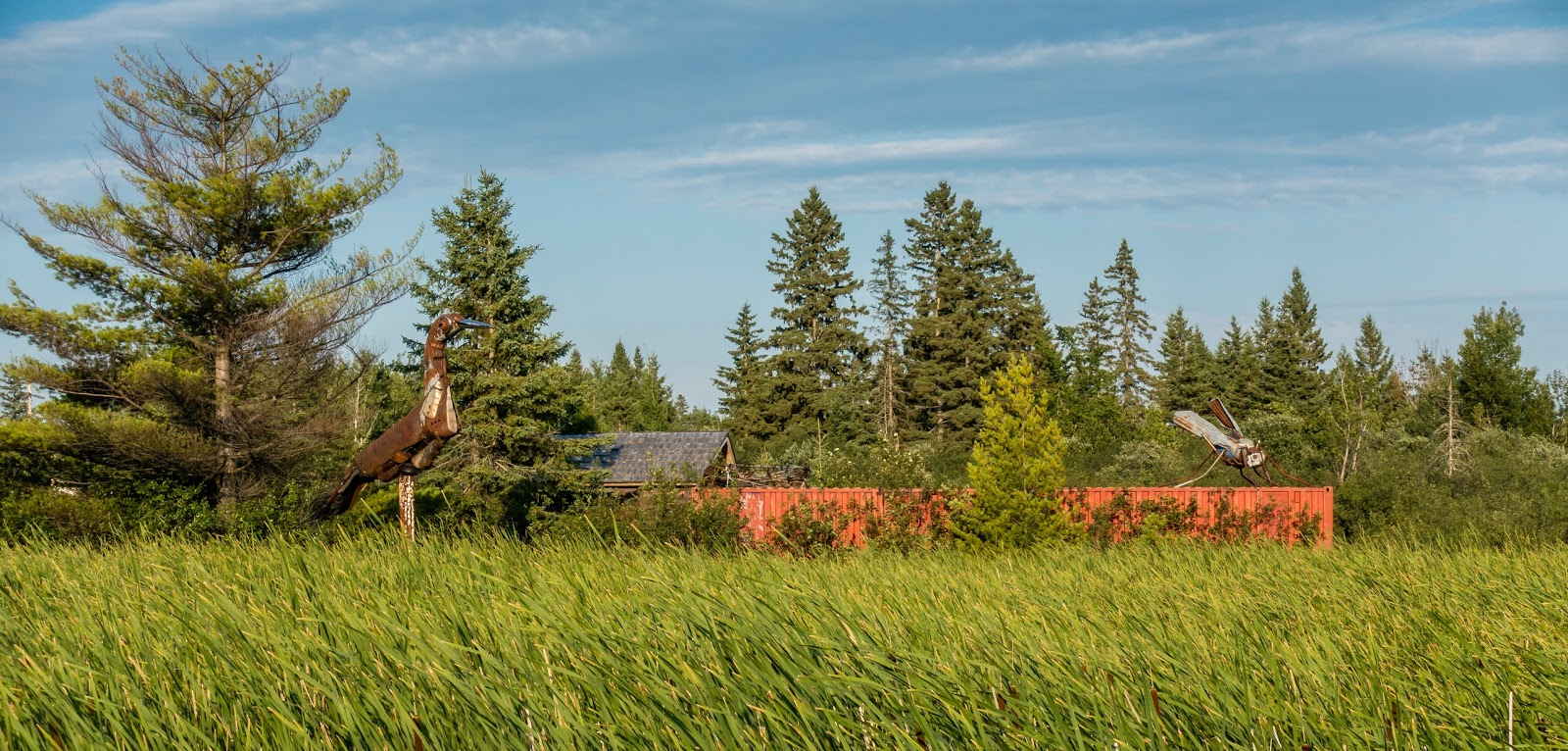
Quirky Little Building - Now the Visitor Center

Monday, August 8, 2016

A Day Trip to Wildlife Refuge

Map of this blog's locations click this link to open the map

We decided to take a short trip to Seney National Wildlife Refuge. Its only a 30 minute drive from Newberry. There's not a whole lot of infrastructure here - just a nice visitor center and observation platforms to see nearby wildlife. But where this 95,000 acre park shines is the extensive dirt road system around all the ponds and marshes that have been created for the wildlife.

We asked the ranger about bike riding and he suggested we drive part way thru the one way scenic drive that meanders seven miles or so through the park, find a gated road along the way and then ride the bikes back into areas where cars aren't allowed. Sounded like a plan.

We did just that, but found it took a long time to drive very far because every few tenths of a mile, the view was compelling enough to get out of the car and take some pictures. We eventually got to the point we thought would be a good ride and swapped the car for our bikes.


We ended up doing about 8 miles on the bikes but did find that the flies and other bugs were hungry at 7 PM when we were there. So even though the views were great, not as many pictures were taken along the ride. At one point as I was following Chris, I noticed a swarm of flies just behind her keeping pace. If you stop, you were a goner. I was grateful we did not have a flat or other mechanical problems.


We got back to the car, loaded the bikes and finished the auto tour route. On our way back, we stopped at a secondary entrance to the park and found an odd double tee-pee structure. As we  approached the water, a few swans gracefully glided over and actually got quite close. Apparently they find enough people to feed them even though the signs clearly state not to.
The Double Tee-pee

Some Swans Looking for Food


Sunday, August 7, 2016

Next Stop Newberry

Map of this blog's locations click this link to open the map

We found Kritter's Northcountry Campground had availability and was centrally located to many of the places we wanted to see as we continue our clockwise tour around Lake Michigan. We booked 6 nights with them and headed to Newberry. The drive was not all that far and really only planned on stopping somewhere along the way to pick up groceries since Newberry seemed like it may be the middle of nowhere.

As we were driving up US 2 just entering Gladstone, we came to a single track railroad crossing that seemed in good shape. I had down to about 45 MPH as we crossed. The crossing felt smooth but as I was going to start accelerating again, I noticed a strange vibration in the coach. 
Snapshot from Garmin Dashcam Just Before Tracks

It took a few seconds to realize that the Jeep was fishtailing fairly significantly. I could see it moving back and forth in the rear camera. Worse, I could see the two mountain bikes on the hitch rack behind the Jeep seesawing back and forth wildly! I slowed the coach down and by the time I was at 10 MPH, the uncontrolled motion had stopped. We drove a few more miles until we could safely pull over - the whole time keeping a close eye on the rear camera monitor.

At the pull off, we discovered the bikes firmly mounted in the racks, but the brackets and bolts holding the racks to the cross member were all bent up and loose. Seeing the end result made me wonder how the heck the bikes didn't completely come off. Guess the fact that we bought a very sturdy rack had payed off. Fixing the rack at that point was out of the question, so the bikes went into the Jeep and I made sure the rack was not going to fall off over the next couple hours of driving.

At the campground, I was able to bend the brackets enough to make them usable. The upside was that I was able to justify bringing along some of my clamps that I decided not to sell. The next day we drove into town to pick up some replacement bolts, only to discover that the dreaded "check engine" light was on. 

To our amazement, there was  Jeep dealer in town. Newberry Motors got us in and read out the codes. The service manager asked me to take a look since he didn't know what to make of it. Most of the 8 messages had the word "implausible" or "invalid" in them related to steering and ABS systems. I described what had happened so he had a tech check things over a bit and we decided it was safe to clear the messages. So far so good.

This was the first time where I was grateful to have the Garmin dashcam in use while driving the motor home. I was able to go back to the files and see what was going on at least with the forward facing camera. And by having the GPS coordinates and speed, I was able to figure out all sorts of things, with the exception of exactly what happened to cause the Jeep to behave like it did.

Friday, August 5, 2016

A Day Trip to Marquette

Map of this blog's locations click this link to open the map

One day trip we wanted to make was up to Marquette Michigan. We had heard from our winery host of several things to check out, plus the visitor guides made it sound like an interesting place. I naively thought Marquette University would be there, but that would have been too easy. Northern Michigan University is located in town.

Marquette is just over an hours drive to the northwest along the shores of Lake Superior. We had picked a day that was not going to be as hot and humid as recently, so we brought along the mountain bikes in case some trail called to us. As is turned out, we found too many other things to see and do.


Our first stop was to a little place just to the east of town called Lakenenland. I'm not sure of the exact history of the place, but some local artist has a big parcel of land and has been creating unique pieces of art and placing them around the property. For the last 10+ years, he has the place open to the public to come and be amused, amazed or perplexed - and sometimes all three at the same time.


There is a dirt roadway that winds thru the property taking you by all the metal sculptures he has on display. Hard to say how many he has but it must be approaching 100. There is also a massive pole building made of huge timbers and boulders where you can sit and enjoy a picnic lunch you bring. Apparently they have a stage where you can come and play your instrument of choice with other musicians on Sundays.


We opted to just walk the paths since we wanted to check things out more closely. Other than the guy is some sort of metal worker and must have some broad source of oddball metal parts, his creations did not follow any particular style or theme. Not sure if there was one particular work that I would say was my favorite, so here are some of the ones we liked.

Rebar Gator


13 Piece Band
Chris Looking Out Window
Hmmm!?!


Chuck and Snoopy in Bi-Plane

Flowers in Bloom

Owl After Rabbit
Funky Cyclist

Chris Plays the Slots

Fun Fact About Bowling Balls

Semper Fi
Mermaids

Two Man Saw Competition

Dare Devil


After having lunch at Lakenenland, we headed to the north side of Marquette to Presque Isle Park. This is a wonderful park that juts out into Lake Superior. It's a popular destination so after we found a parking spot, we opted to just walk the full perimeter of the park - maybe 2 to 3 miles doing 15 geocaches along the way.
At the very north end of the park is a little harbor created by a rock outcropping. There were dozens of people here jumping off the rocks into the water below. And since we had just done what's called and Earthcache there, we know the drop is 20 feet or so.

One guy had brought his 12 year old son and two friends. They were trying to get the dad to jump. They would keep jumping over, swim around a bit then scale the rock wall to repeat. The father removed his shirt and looked like he was about to jump several times. By then, many of the other visitors had gotten into the action by cheering him on and encouraging him to jump. In the end, his brain won out and he opted to skip the jump. As we wandered around the park, we stumbled onto a concert of sorts with loads of people, even a big tour bus. Turns out there was a Shriner's convention in Marquette and this was the spot of one of their outings.

Some Jumpers, Some Spectators
Rugged Coast

Calmer Side

Next was a drive to Sugarloaf Mountain. It was one of the spots we may have otherwise missed had it not been for the recommendation at the winery. We arrived to a nearly full parking area and started up the trail. Only 100 feet in, you're greeted with a fork and a sign "Difficult Trail" to the left, "Easy Trail" to the right. I suppose it's all relative, but difficult wasn't really too bad and calling it a mountain might have been pushing it.

That said, the view from up top was spectacular. There were 15 to 20 people up there, but the top has multiple viewing platforms so it didn't seem crowded. The geocache up there was well hidden underneath one of the platforms, so it took a bit of waiting for just the right opportunity to crawl underneath to retrieve it.


Panorama from Sugarloaf

Windswept Trees

Peaceful Beach
We we getting hungry so we decided to head to the downtown area and see if we could find some good grub. A couple blocks of streets were blocked off for some big event. After parking and walking thru it, we discovered another big Shriner's party. Lots of guys with silly hats and shirts with emblems showing where they were from. Many had driven quite far to come to it.

We ended up finding a nice pizza joint with some of the best pizza we can remember. Fortunately we were in one of the side rooms because just as we were finishing up, from the main room came the music of what sounded like a full marching band! Apparently a Shriner Drum corps from Minnesota was waiting for a table and decided to play a few songs. Given how loud it was at our table, I can only imagine how loud it was for the patrons near the entrance. These guys need to learn there are more volume levels than 0 and 11. But I suspect that the five songs they played managed to get somebody to leave, opening up a table for them!

After dinner we walked through town and down to a marina to enjoy the beautiful evening.


Beautiful City Hall Building
Old Clock Tower
Marina

Tuesday, August 2, 2016

Heading on U.P.

Map of this blog's locations click this link to open the map

We were having a bit of trouble reserving spots in some of the campgrounds we had hoped to stay in while in the Upper Peninsula. So we had to come up with an alternative plan. We found there were several casinos that had "camping facilities" and some of them were even free. Generally they only consisted of a special spot in the parking lot with an electrical outlet. Supposedly those even provide you with tokens to gamble with in the casino.

Instead we found one, Island Resort and Casino RV Park, that had an actual campgrounds , just west of Escanaba Michigan.  They were full the first night we wanted to stay, but available for a week after that. We likely could have extended our stay where we were in Door County, but it turned out our motor home was effectively the left field wall for the baseball field. And being a weekend, the kids were out playing often. We didn't want to push our luck and end up with a home run broken window, so we headed out and stopped at a Walmart near the halfway point.

We got to the casino and found the campground hidden in the back corner of the parking lot, a good 1/3 mile from the hotel/casino in a nicely wooded area. The sites were a little tight, but worked fine since it only needed to be our home base as we toured the surrounding area. We also discovered this place had the best showers we have run across in all our travels. We did walk through the casino and found they were almost exclusively slot machines or a few video poker machines. Oh, and a bingo hall too. We decided to skip it all.

Turns out there weren't as many destinations in the vicinity as we had thought, so staying a week was a bit of overkill, but it did allow us time to do more mundane things. For one, I did some routine jobs around the motor home and started to wax the coach. The fact I did not finish was a combination of not enjoying the job and finding other things to do.

One of the other things was to start playing disc golf. We have often found ourselves on a disc golf course while geocaching and thought it might make sense to try our hand at it. If for no other reason, the equipment takes up little room and in our younger days we played ultimate frisbee. We had ordered a couple starter sets before leaving Rochester, but hadn't used them yet. There are a fair number of courses in the surrounding towns, but the first one we attempted was a very challenging course right next to Lake Michigan. We opted to skip most the holes in order to not lose all our discs on the first round.

We ended up finding a nice 18 hole course in Iron Mountain Michigan. It was very wooded so most of our throws were thwarted by trees. But we had fun and enjoyed our walk in the woods. We even went back a few days later to try again after having practiced our throwing at a couple baseball fields in the town park. Since we don't write down our scores, we aren't sure how much better we were, but we at least "think" we did better. Eventually we may actually keep score. During that second round, we met Eric, who had designed this course and was in the process of adding beginner's tees. If we ever make it back here, we might do better from those.

One day trip was to the north and east of Escanaba around two bays off Lake Michigan - Little Bay de Noc and Big Bay de Noc. One destination was Fayette Historic State Park. It is a state park on the grounds of what used to be a little town surrounding a pig iron smelting plant from the mid to late 1800's. Many of the buildings are still standing and have been restored - or are in the process of being restored. It was very interesting to walk around the town reading all the history of the buildings and the operations. The water in Big Bay de Noc was incredibly clear and several boats had come into the little harbor there.
A View of Some of the Town's Buildings

Overlooking the Harbor

Gulls Taking a Break

The Harbor Through Windows of Old Wall

Entrance to Smelter


We slowly worked our way back hugging the roads along the coast as much as possible. While searching for one geocache along the rocky shore, Chris found what appeared to be some giant's pencil. The rocks along this portion were difficult to walk on and almost sounded like we were walking on pieces of glass.
Let Me Sign Right Here
Gulls on a Spit
Peninsula Point lighthouse is out on a narrow spit of land between the Big and Little bays. The road to it was very rutted and narrow with an occasional pullout to let an oncoming car pass. We got to the end and were greeted with a pretty light house (non-functioning) that people are actually allowed to climb up. The keepers house apparently burned down years ago, but the lighthouse was repaired to keep it standing. Chris managed to climb up the cool spiral stair case, but had a harder time heading back down. 


Looking up the Stairs
View from the Top

Lighthouse

On our way back the one day, we just had to stop to check out the big skeeter and bird that somebody had constructed on their property near the highway. Not sure the story of these guys and could not get very close without trespassing.


A few other side trips included a very nice walk along Portage Point just south of Escanaba. A drive in most of the way leads to a trail that heads over to the beach and up to the point. I was only able to get as far as I did by allowing my hiking shoes to become water shoes. But eventually the vegetation was just too thick and the waves were crashing on the beach on this windy day so alas I didn't get to the tip.
Near the Tip of Portage Point

We also took our mountain bikes to Days River Pathway north of Escanaba. There were many miles of trails thru the woods with the main trail making a big loop and several intersecting trails allowing you to cut your ride short. The trails were in excellent shape and many of the steeper sections had some interesting rubber matting pinned to the ground to help prevent erosion.

The biggest problem we had with the trails were sections of fairly deep sand. Many of the sandy sections were at the bottom of the downhills. Sometimes they were only 6 or 8 feet in length, but other times closer to 20 or 30 feet. It took a fair amount of skill and/or nerve to navigate thru them without ditching the bike. I came close to falling a few times whereas Chris took the safer approach and would often walk the bike thru.

One other short trip was to a winery just a few miles from the campgrounds. Northern Sun Winery is a small operation run by a husband and wife team. We were the only two visitors at the time, so we managed to have a lengthy discussion with the wife on all sorts of topics. She gave us some pointers about places to visit when we go up to Marquette later. 

They grow all the grapes they use locally. The wine was good and she allowed us to have more samples than the tasting fee covered. We picked a bottle of the one we liked best. Right across the street is a huge dirt track (Bark River International Raceway) She told us they have one big race a year and it had just happened. That explains the noises I had heard when we first got to the camp - the race was going on. Probably also makes sense as to why the campgrounds were booked full the first night. 

Another nearby side trip was to  Piers Gorge State Park. Apparently a newly designated park since our map did not show it with the typical green designation. It is right along the Menominee River which separates the U.P. from Wisconsin. We had tried coming here early in our stay but needed a state park sticker and the booth was not manned. Today, with sticker attached, the booth was manned - go figure. We knew there was rafting along the river but turns out it was fully booked for the day we were there.
The Relaxing Part After the Rapids

A trail follows along the river and has several viewing areas to look over the various sections of rapids. Not sure how many times they would repeat the process, but several rafts would do the extreme drop off, come to shore, walk up the trail and board another raft to do it again. We saw several rafts that got caught up on one of the big rocks just below the drop off. It may take them a few minutes to dislodge themselves and drift downstream. One raft hit the rock in such a way to send a few occupants flying out of the raft. When the one guy was pulled to shore, you could tell he was a bit shaken up. Maybe it was just as well the trips were booked.


For the past few weeks we have been in the Central time zone, and had more or less gotten used to it. Turns out the 4 counties in the UP that border Wisconsin are also on Central, but the rest of the UP are on Eastern. Well this campground is about 1/2 mile from the dividing line. We were constantly confused. I was half tempted to set the clocks in the motor home to the half way point.

One last thing about the casino campground. There isn't somebody there overseeing the people coming and going. You are to pick an open site, set up and go to the casino to register and pay. One morning before we left for a day trip, a small Class C motor home pulled in right next to us and plugged in. Didn't think much of it. When we came back around 6 PM, a different motor home was there. Again did not seem to matter to us who our neighbor was. Well the next morning just before 6 AM, there is a lot of commotion outside. The original Class C was back for their site and someone else was there. A bit of a shouting match and a little swearing and then it was quiet but only for a short time. Apparently the security from the casino was called, and our current neighbor was unceremoniously asked to leave. I was impress with how quickly he was able to pack up and pull out. Maybe he has done this before?