Map of this blog's locations click this link to open the map
We knew we wanted to check out the San Francisco Bay Area but didn't want to stay too close to downtown. The Elks Lodge in Petaluma was recommended by another Newmar full timer couple we are friends with. In fact, Petaluma is their home lodge. The one really nice thing about this lodge is not only do they accept reservations but they have their reservation system on their website. We had booked a spot for 9 nights several weeks ago. The drive from Eureka to Petaluma is about 250 miles which many RVers wouldn't even flinch at. We are still trying to stick with our 200 mile limit so we had planned an intermediate stop at another Elks Lodge in Ukiah about 150 from Eureka.
The Ukiah lodge is right next to US 101 near an exit, so it is an easy overnight stop. Of course when we pull in mid-afternoon, the parking lot is packed with cars. This meant that the RV spots were not accessible. We go into the bar and find out the lodge is having a Veteran's Day luncheon celebration. They expect the crowd to start thinning out in half an hour or so. We were able to pull to the back of the lot and waited for people to exit. We meet one woman already camping there and she suggests which of the open spots we should go for once we can get to it. Eventually enough people have left and we are able to get into a spot. Just as we head into the bar to register and pay, another rig pulls in. We end up sitting at the bar having multiple beers and talking with the other couple and the bartender until we are the only ones remaining.
Other than some traffic noise from 101 and some sort of truck lot next to the lodge, it is an okay overnight stop. We now have an easy 100 mile drive to Petaluma. Well easy until we hit Santa Rosa which is where we run into a lot of traffic. We had been in mostly remote areas so we haven't seen bumper to bumper traffic in quite some time. I suspect this will just be the start of the traffic we are in for around San Francisco and later LA. Some of the really bad fires had struck this area in early October. We could definitely see indication of that fact as we made our way south. We didn't see complete devastation but there would be a building or two that were completely destroyed right next to ones that seemed to come through the fires unscathed.
We pull into the lodge and find that our reserved spot was open - always a good sign. It wasn't too difficult to get into the spot and we quickly got setup. Since we had registered and paid online, we didn't even need to go check in. Our immediate next door neighbor had the paperwork for us with the rules and wifi password. He was filling in for the full time host who had gone out of town for the weekend. We spent the rest of the day sort of planning our game plan for the nine nights we will be here. Admittedly we don't make set plans for each and every day, but we do try to come up with a list of things to do and then try to figure out how to work them in based on weather or other factors.
 |
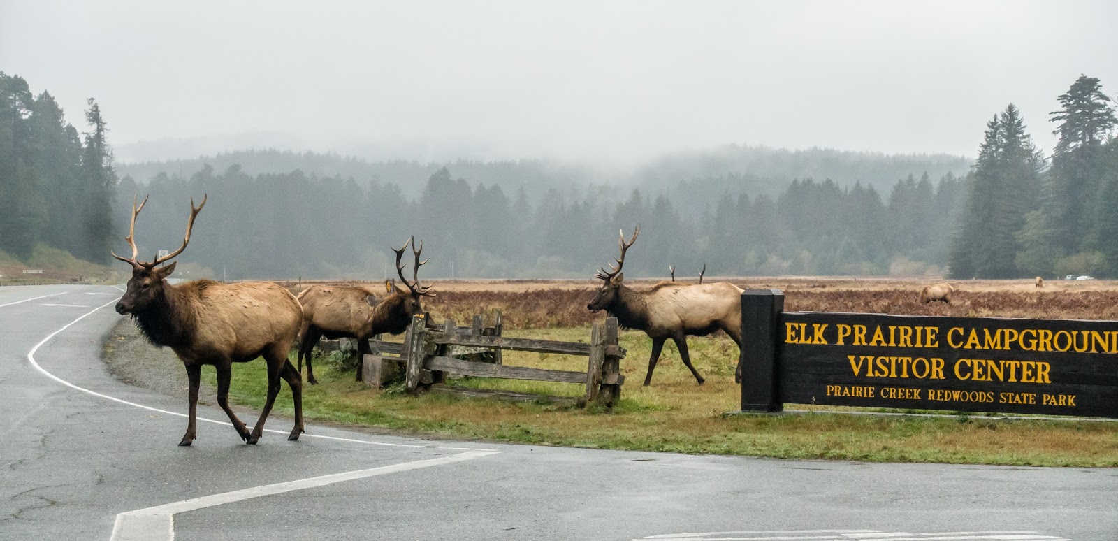
| A Favorite Photo from This Part of the Trip |
Our first day trip takes us about 20 miles southwest to Point Reyes National Seashore. It is an odd shaped peninsula sticking into the Pacific Ocean. Even though it is a reasonably large park at about 71,000 acres, there is only one way in and not too many road choices inside the park. We stop at the Bear Valley Visitor Center to pick up a park map and figure out our game plan for the day. Right next to the visitor center is the Earthquake Trail. It sounded interesting and there is an earthcache along the trail that helped entice us into doing the short walk. There are numerous interpretive signs along the walk that provided us with all sorts of info. It turns out that the park is situated right over the San Andreas fault. During the 1906 San Francisco earthquake, this peninsula being on the Pacific Plate moved nearly 20 feet with respect to the North American Plate. One of the pictures showed a picket fence on a farm that had spanned over the split and was now displaced laterally. After learning this fact, I found myself wondering if another earthquake were to occur while we were visiting, would we be on the chunk of land that breaks off and falls into the ocean?
After the short walk, we drive to the northern reaches of the park - Tule Elk Reserve. We were told the likelihood of seeing elk was quite high since the reserve is about 2600 acres with over 400 elk at last count. They were right. About a mile before we got to Pierce Point Ranch, there were a few dozen of the elk in the field not too far from the road. Multiple cars were pulled over with people out taking pictures and admiring the elk. Tule elk are not as large as Roosevelt elk but are still big. Based on the lack of reaction from the elk, I suspect they have grown accustomed to having people gawking at them. Fortunately everybody gave them their space so there were no incidents.
 |
| Thule Elk with Pacific Ocean in Background |
 |
| Thule Elk |
 |
| Looking Down on Pierce Point Ranch |
Next we headed down the hill to the parking lot for the short walk to McClures Beach. There were quite a few people out enjoying the nice weather. After lunch, we headed to the parking for the old ranch. The parking lot here was packed yet there were few people checking out the ranch. It turns out this is the starting point for the very popular Tomales Point Trail. It sounded like a nice hike but the total length of the hike is over 9 miles. We hadn't planned on doing the full hike so we headed out about a mile taking in the great views and discovering some more elk. There was thick intermittent fog and in fact as we pulled out, the fog had rolled in where the elk were and they were barely visible.
 |
| Heading Towards McClures Beach |
 |
| Gulls Along the Beach |
 |
| Trees Near Pierce Point Ranch |
 |
| Along Tomales Point Trail with Fog |
 |
| More Hikers Head Toward Elk Along Trail |
 |
| Male Elk Chilling in Field |
Our next stop was the Point Reyes Lighthouse. It is a 20+ mile drive on what turned out to be a paved but very curvy, narrow and undulating road. So it did take some time to get to the lighthouse. The parking for the lighthouse was packed as well. I suppose that's what we get for visiting on a Saturday. It is a pretty intense walk from parking to the lighthouse. The first part is on a closed road, so the "path" is plenty wide but it is fairly steep. At the top of of the he hill is the visitor center but the lighthouse itself is down on a bluff. It is another fifth mile, all downhill with 308 stairs to get there. We know this fact because we needed to count them as part of a virtual geocache at the lighthouse.
 |
| Lighthouse Volunteer Residence |
 |
| Fog Bank Below Lighthouse |
 |
| Lamp/Lens at Lighthouse |
 |
| Point Reyes Lighthouse |
The lighthouse is open for viewing and there was a park employee there telling about the history and answering questions. Turns out the actual lighthouse lamp is no longer used but there is an automated beacon nearby that comes on at dusk. With so many people visiting, it was difficult to maneuver inside the tower or on the catwalk around the outside. It was even crowded on the 308 steps back up to the visitor center and the stairs are not really wide enough for easy passing of people.
 |
| The Fog Has Cleared a Bit |
It was getting late in the day but we were so close to the elephant seal overlook that we just had to go see them. There is a path from the parking lot to an overlook. We weren't positive whether they would actually be there, but well before we got to the overlook, we could definitely hear them. Even though the sun hadn't set yet, it was already pretty dark. The area would likely be much better during the early morning hours instead of the late afternoon. There were dozens of them just laying on the sand at the cliff bottom. Most were not moving so they almost looked like pieces of driftwood. We could see many of them were out in the water. In fact two of them came closer to the overlook and were making a ruckus just below us. We didn't stay too long since we knew the road was going to be even more challenging in the dark. Of course darkness wasn't the only problem, much of the drive was accompanied with dense fog until we got a bit further inland. In hindsight, Point Reyes could easily have been a two day trip in order to get in some of the numerous hikes - maybe next time we are back.
 |
| Elephant Seals Along Beach |
The next day we set our sights on Jack London State Historic Park. It is a 20 mile drive northeast of Petaluma. The drive there took us though very pretty rolling hills with lots of vineyards. It was apparent where the fires had been only a couple months ago. We didn't see complete devastation but there were plenty of homes or out buildings that were no longer there. Usually with only a chimney standing to identify its former existence. This state historic park is on the land formerly owned by Jack London. The author probably most famous for his book "Call of the Wild". I remember reading the book back in my younger years. Maybe it's time to find a copy and reread it. The park had been evacuated during the fires. In fact, many of the artifacts from his life that were housed in the museum on the grounds had been removed for safe keeping. For the rest of the year, the park was celebrating the fact it had been spared by offering free admission.
 |
| Museum at Jack London Park |
The park is over 800 acres with many miles of multi-use trails. The entrance is in the northeast corner of the property where all the house and farm buildings are situated. The majority of the hiking trails are accessed by a single trail out of the main parking lot. This layout makes it difficult to do a hike, come back for lunch then do another hike which is often our strategy. We improvise and spend the rest of the morning checking out the various sights near the entrance. The museum was housed in the former residence of Mrs London. As mentioned, many of the display cases only contained signs describing what had been in them. It wasn't clear how long they were planning to wait before bringing things back. It was still a nice old home to check out.
A little over half a mile down a path is the place known as the Wolf House. This was going to be the mansion the London family lived in. A massive 15,000 square foot building started in 1910 and finished in 1913. Unfortunately the place caught fire a month before they were to move in and now all that is left are the stone walls. One can only imagine what this place would have been like. A fence keeps visitors out and many of the stone walls now have metal support braces to keep them from falling over. Scattered around the park are numerous geocaches so we managed to keep busy along the way. The Londons are buried on a little hill near the Wolf House in a fairly peaceful setting.
 |
| Front of Wolf House |
 |
| The Inside Reflecting Pond |
 |
| Peaceful Resting Spot |
After lunch, we headed across the road to the farm buildings that are still standing. From the interpretive signs, Jack London tried many different farming and forestry techniques even though he really had no background in those fields. Many of his attempts didn't pan out, but I suspect he had fun trying them. I suppose I'm a bit jealous. Of all the things we saw, the Pig Palace was likely our favorite. It is a circular stone structure with a center feed house surrounded by 17 pens for the pigs.
 |
| Entering Pig Palace |
 |
| Pig Stalls |
 |
| Nicely Restored |
 |
| Peeking Thru to Vineyard |
From here, we head across the one trail that leads to the rest of the trails in the park. Once we got past the congestion of this bottleneck, we saw very few people out on the trails. We managed to get in several miles of hiking but only explored a small portion of the park. There is a vineyard in the middle of the park that is privately held. The leaves of the grape vines had already turned colors and made for a scenic backdrop for some of the walk. Since the gates are closed at 5 PM, we couldn't stay too late. This could have been a full day hiking expedition had we planned better.
 |
| Colorful Vineyard |
 |
| Jack Does a Tree Climb for a Geocache |
 |
| Jack London Grew Cacti Too |
Rainy weather can definitely impact our plans. We tend to favor outdoor activities like hiking and biking rather than indoor venues like museums. So when we get a few days of wet weather, we must make do. Fortunately there are a couple nice parks very close to the Elks Lodge here in Petaluma. So we can keep an eye on the weather and slip out when there appears to be a brief lapse in the rain. Shollenberger Park is practically right across the street from us. It has a two mile walking path around a few ponds. The views might not be the greatest, but for being situated next to an industrial area, it is nicer than the alternative. The Petaluma River runs next to one edge of the park and on the opposite side is a large material handling facility. While we were there, a tug brought in a big barge complete with its own payloader for removing the gravel on board. We also headed into downtown Petaluma to just wander around once the rain passed by. There is an former old bank building that is now a very crowded antique shop. It was interesting to walk around checking out all sorts of things that we don't need. Even the vault had things displayed in it although it didn't appear this stuff was any more valuable than anything outside the vault.
 |
| Barge on Petaluma River |
 |
| Waterfowl Enjoying Ponds |
 |
| Bank Safe Door |
 |
| Looking Down on Antiques |
 |
| Unique Seed Pod???? |
A few blocks to the east of the lodge is Ellis Creek. Okay, it is part of the Petaluma water treatment facility, but it is nicely designed with numerous holding ponds creating about 30 acres of wetlands. There are miles of trails with benches to allow people to sit and watch the geese, ducks and swans enjoying the water. They are called "polishing wetlands" and don't have any of the smell that one might associate with a water treatment plant. We came out expecting to run into heavy rains but the forecast was wrong so we managed a couple mile walk without getting wet.
We headed to the Lagunitas Brewery one afternoon. They are headquartered in Petaluma. Admittedly we hadn't tried any of their beer yet, but we had heard of them before but at first we couldn't figure out why. Turns out they sponsor a couple of the NPR podcasts we listen too. Their tag line is "We put the pub in public radio." They offer free tastings and tours. There were about 10 of us for the tasting. Their tasting room was the former bar area that has since been replaced by a much larger one. The "decorating" in the tasting room was eclectic to say the least. The beer can collection was impressive, but I suspect my collection I had was a bit larger. I was never allowed to display my cans as prominently as they did! Our group sat at the bar and were served up four or five decent sized glasses of some of their beers. We had two host bartenders that each had a variety of offbeat stories around the formation and history of the brewery. It brought back memories of the Bully Hill Winery tours back in the Finger Lakes area of New York state.
 |
| Lagunitas Tasting Room/Employee Lounge |
 |
| Part of Tasting Group Finished Up |
After the tasting, our host offered to take us on a factory tour. That would save us from needing to wait around for the one we signed up for. We were given an opportunity to hit the bar and buy a beer to bring along on the tour as long as we asked for a plastic cup. Let's just say the tour was just as laid back as the tasting. It is an impressive facility. Obviously not of the scale of the Miller brewery in Milwaukee we toured last summer but good nonetheless. They have even expanded their footprint to include adjacent farmland and raise sheep and cattle which they offer in their restaurant area. As we finished the tour, a live music act was just starting to play so we sat down and had another beer. We soon found ourselves salivating for some of the food being served to others and decided this was going to be our dinner plan for the evening. After dinner, we hit the gift shop and bought some shirts. Obviously Lagunitas has a good business model for their factory tasting and tour. Our "free" tasting set us back well over one hundred bucks. But it was an excellent time with good food and beer.
 |
| Holding Tank |
 |
| More Tanks at Lagunitas |
 |
| Artwork in Packaging Area |
 |
| Covered Dining/Drinking Area |
Every so often, the stars align and we stumble into good fortune. One such event took place while we were here in Petaluma. A simple Facebook post tagging one of my friends made me remember he used to live somewhere out in the Bay area. Kevin was one of my best friends from high school that I haven't seen in nearly 30 years. About eight years ago, he discovered me on Facebook and we have traded a few emails since then. I recognized that although he has a Facebook account, he really doesn't use it. If I try to get in touch that way, I knew it likely would be missed for days, months or even years! So I tried a few other avenues to reach out. A quick search in LinkedIn gave me another option and from that I found a business email. Fortunately he saw my email and responded back. He lives in the Palo Alto area which is on the southern side of the bay. We come up with a plan to go and visit.
We headed to San Francisco on Friday with the intention of spending the day sightseeing before heading to Palo Alto for dinner. We realize spending 5 or 6 hours will not do San Francisco justice but we pick some of the sights we want to see and map out our strategy. Traffic heading south on US 101 was not fun. I cannot understand how the people living here deal with this on a daily basis. I suppose they just become accustomed to the traffic? Our first stop is the Golden Gate Bridge. We want to see things from the north side but the main viewing area is most easily accessible by northbound traffic. We head to the Fort Baker area and find lots of parking near the Moore Road Pier. From here we get a nice view of the bridge from water level. We also lucked out that there was no morning fog to contend with. Even though I have seen some pretty cool photos of the bridge in fog, we really preferred a clear day and we definitely had that.
 |
| Golden Gate from Water Level |
From here, we are able to follow Conzelman Road under the bridge and then head up the rather steep incline to get up to the bridge deck level. Fortunately, the road is closed to public vehicles. Other than a maintenance cart and a few cyclists, it was a solitary walk. There is a pedestrian walkway underneath the bridge to allow access to the view point. This was an extremely busy place. It seemed like everyone wanted a selfie with the bridge in the background. It was definitely selfie stick central. After a brief stop, we headed back down the hill which was a much easier direction.
 |
| Monument at Upper Viewpoint |
 |
| Very Detailed Coast Guard Plaque |
Next stop was the parking area near the Fort Mason Center. It was not crowded and $12 for all day parking seemed pretty reasonable given the area. East of the parking lot and up the hill is a community garden. One of the more popular geocaches in this area is hidden there. It did take us a minute to figure out where the entrance to the garden was, but once we got in, we were amazed by how large and nice it really is. Not the type of thing one expects to see in the middle of tall skyscrapers and the mass of humanity nearby.
 |
| Community Garden |
 |
| Bright Flowers |
A short walk down a steep hill led us to the Municipal Pier. We had a great view of the Golden Gate Bridge, Alcatraz and a large sailing ship coming in. At the tip of the pier, we watched with a little concern for a kayaker that was coming out as the sailboat was coming in. Fortunately they managed to avoid one another. There were numerous people swimming laps in the center of the cove. We weren't sure how cold the water was, but they all had wetsuits on. The biohazard signs posted along the beach warning against swimming were slightly disconcerting but the guy that came out after his swim didn't appear to be glowing or have extra fingers or toes.
 |
| Golden Gate Bridge with Sailboat Coming Our Way |
 |
| Alcatraz Island |
Since we were right next to Ghirardelli Square, we just had to go in. The free sample was enough to hold us over until we found a real lunch spot. Speaking of lunch, there was no lack of choices as we walked along the piers. We eventually settle on a place with an incredible view of the docks and enjoy a nice seafood lunch. The next stop was another oddball find. There is a virtual geocache located inside one of the businesses along the Embarcadero. It likely would have been completely passed by but for this geocache. Musée Mécanique on Pier 45 has over 200 coin operated mechanical arcade machines. The place is free to enter and all the games are available for place for a quarter or two. We spent some time just wandering around amazed at the collection on display. Put this on your list for your next visit.
 |
| Christmas Tree at Ghirardelli Square |
 |
| Fishing Boats at Pier |
 |
| Old Bulldozer Game |
 |
| What We All Need |
A little further east, we hit Pier 39. Our main goal was to see the sea lions near the end of the pier. This place is quite the shopping mecca and there were hundreds of people out enjoying the great weather. We stopped to briefly watch a street performer juggle knives while balanced on a rope held by people pulled from the audience. Glad we were on the second level so we didn't get selected to participate. The viewing spots for the sea lions were extremely crowded. It seems like we weren't the only ones with this idea. There are about two dozen floating platforms tethered together. We were fortunate that the sea lions were mostly clustered on the ones closest to the pier so we had a closeup view.
 |
| Old Merry Go Round on Pier 39 |
 |
| Lounging Sea Lions |
There was a mixture of the sea lions just laying in the sun and barely moving while others were basically playing some sort of game with the goal of jumping onto the dock and pushing the other ones off. It was a fun time. We also had a secondary mission while we were here. There is a webcam geocache here. The idea is to place yourself in the frame of the camera and grab a picture off the website. The biggest problem while we were there is the camera is mainly pointing out at the sea lions with just a small corner of the frame on the people. In order to figure out where to stand, we needed to watch the output of the webcam and figure out which person was visible, then go stand behind that person until they left. Yes, geocaching can be a strange pastime but we enjoy it!
 |
| Our Webcam Photo - We're at Lower Right |
We had some more time before we needed to head south to Palo Alto. We decided to walk to the "crookedest street in the world" - also named Lombard Street. It was just over a mile from the pier but being San Francisco, it was a steep up and down walk. It too was a busy spot with lots of people standing at the bottom or the top of the eight hairpin turns taking pictures. Plenty of cars were driving down the hill as well.
 |
| Part of Lombard Street |
 |
| Alcatraz From Up High in City |
We had another mile or so to walk back to the car. Along the way, we ran into a large group of kids with skateboards attempting to do tricks on some sort of metal artwork that likely wasn't intended to be used in this manner but did provide a good challenge for the skateboarders. We watched long enough to get an idea of which kids were proficient at the trick. After each one made their attempt, they would run back to get in line for another try. When we got into the car and plugged in Kevin's address to the GPSR, the estimated arrival was 5:09 PM. We had told him we would get there around 5:30, so we were optimistic. As we slowly headed to US 101, the arrival time kept getting pushed out. First by 10 minutes then an additional 20. Turns out a big accident had brought the expressway to a complete stop. We eventually got out of traffic and onto an alternate route and made it at a reasonable time. Not a commute I would want to experience each day.
 |
| Solo Boat |
 |
| Skateboarder Goes for It |
We had lots of catching up to do. It's hard to condense twenty plus years into a few hours, but we do our best to at least touch on the highlights. Since they had just been back to Ohio visiting family, they had some of the latest news to share. We really enjoyed hearing about his family. Of course, I remember his brother and sisters when they (and I) were much younger. I guess we all grow up. I was glad to hear his mom and dad were still doing well. I definitely have fond memories of his mom when I would go over to their house. It was also good to meet his wife and daughter and to hear some of their stories. We realized we could talk all night but we wanted to have some energy for whatever we decided to do the next day, so we hit the bed and got a good night's sleep.
We decided we would keep it fairly simple and go over to Stanford University to just wander around the campus. There are numerous geocaches around campus (no surprise there) and it would be fun to mix a nice walk, more catching up and introducing them to the wonderful world of geocaching. We have gone caching several times with friends and their kids and we always seem to get a kick out of how the children will get into it. This was no different. There was a good mix of different types of hides and even had a puzzle cache we were able to figure out. Of course no caching day would be complete without a DNF (did not find)! Even with five sets of eyes looking for 15 minutes or so, we could not come up with the hide.
 |
| Arched Hallway |
 |
| Ornate Building |
 |
| Water Fountain of Sorts |
The campus was getting crowded by that time. Stanford was playing one of their rivals - California Berkeley. An endless crowd was streaming by on their way to the stadium while we searched for that last cache. We wandered back to the car and headed back to their house to collect our things and head back north to Petaluma. It was a brief but wonderful visit. The drive back wasn't great but not nearly as bad as it was the previous day. We got back and started to get things ready for our departure the following day as we continue south.
 |
| Kevin and Family |
 |
| Kevin and Jack Reunite After Too Many Years |