Monday, June 21, 2021

More from the Smokies

Map of this blog's locations click this link to open the map

The next journey from our private spot near Waynesville NC is for a train ride. The Great Smoky Mountains Railroad runs out of Bryson City about a 40 minute drive to the west. We had seen some advertisements about the train ride and checked out several YouTube videos to get a sense of what to expect. They offer a two different routes: the Nantahala Gorge Excursion & the Tuckasegee River Excursion. The first one is about 44 miles round trip and heads generally southwest from Bryson City to Nantahala. The second one is 32 miles round trip and heads generally southeast to Dillsboro.

We decided to go with the longer ride for a couple reasons: it runs more frequently and heads away from the towns to the east of the train station so in theory may be more scenic. Then you get the choice of which locomotive - steam or diesel. The price differential is around 10 bucks so we opt for the nostalgia of steam. The next decision is which class of service to select. They have 6 options if you don’t include the private caboose party (starting at $699 for up to 15 people). Four of the options are in enclosed cars with windows. We are taking the train ride to see the countryside not be served lunch on a train and looking out occasionally. The open air gondola has a premium option which includes a box lunch and a couple souvenirs which we can do without. So we picked the open air gondola and found a date with availability and a reasonable weather forecast and booked our tickets. We found out they consider 55 and up as seniors and get a 10% discount. About 8 hours after reserving the spot, we received and email telling us their steam locomotive had a mechanical issue and wouldn’t be available for our trip. We decided to stick with our original date and got refunded the price difference.

Mural at Train Station

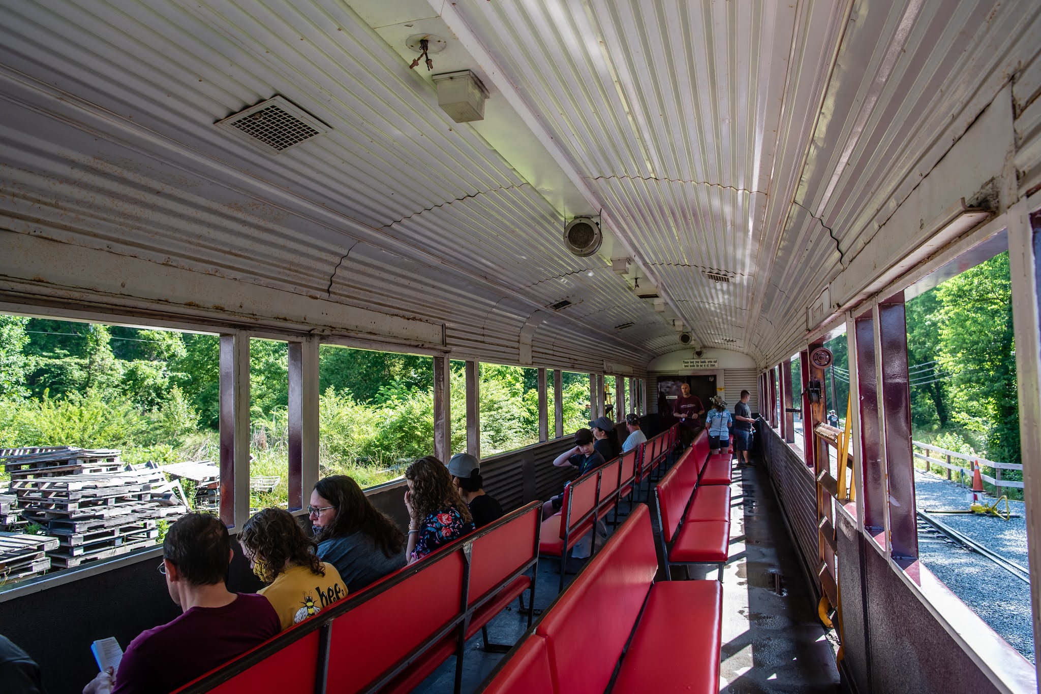
We arrive in Bryson City, get parked and head to the counter to pick up our tickets. The train was sitting there ready to go. Each of the passenger cars are about 80 feet long. Add in the two locomotives, one caboose, a dining car and possibly the generator car for electricity used for lights or air conditioning, our train was close to a quarter mile long! They had 6 boarding spots along the length of the train and ours was the furthest away except for the group that were in the caboose. Given how far we were from the locomotive, the fact we had a diesel instead of steam powered seemed inconsequential. All the cars seemed to be in good condition. Our open air gondola was the Whittier - fourth car from the end. These cars don’t have assigned seating so we picked a spot at the end of series of long benches that face out the sides of the large openings. We picked the side on the left of the train but at the turn around point, they have each side switch with the other so we all get both views. On other cars with assigned seating, I might argue the left side offers better views.

Locomotive for Ride

Whittier - Our Open Air Gondola

The Caboose

Inside Whittier

The first mile or so of the ride coming out of Bryson City isn’t all that pretty. But once we cross the Tuckasegee River, the scenery improves a bit. There seem to be some nice rural homes within view of the tracks. Besides this daily train ride, it doesn’t seem like these tracks get a lot of train traffic. One unmistakable feature of the landscape in this part of North Carolina is the kudzu. It seems to grow just about everywhere and many of the hillsides along the track are completely blanketed with the invasive vine.

Scenic Countryside

Rounding a Curve

Kudzu Hill

At around the 8 mile mark, we start to see glimpses of Fontana Lake on the right side of the train. What’s nice about these open air gondola cars is the “window” openings are huge so it is possible to see things on each side of the train even if the other passengers are standing up. Fontana Lake is a rather odd shaped lake. The dam was constructed in the the early 1940’s and the valleys in the area have filled up creating a 29 mile long lake with 240 miles of shoreline. I suspect at any point on the lake you’re well within a half mile of the shore. At just under 11 miles on the ride, we cross another large truss bridge over one of the arms of Fontana Lake and can now see close up some of the boaters out on the lake as well as the marina in the town of Almond. It was around this point where the curves of the track and the terrain permitted us to look out the window and see both ends of the train.

Approaching Bridge - Watch Your Head!

Fontana Lake

Another Lake View

Almond Marina


This arm of Fontana Lake eventually becomes the Nantahala River although it isn’t clear where the naming designation changes. This section is quite pretty. The gorge is narrow through here and follows the river quite closely. There are numerous rafters and kayakers out enjoying the day on the river. At the 16 mile point, we pass the Nantahala Outdoor Center (NOC) which is ground zero for most of the river activities. More on this later.

I'm Being Watched

Whitewater Section of Nantahala River

Kayakers

Rafters Preparing for Trip

Following the River and Road

The complete 44 mile route is supposed to take about four and a half hours but for some reason we were running a bit behind schedule. Unlike a plane that can sometimes make up for delays by just going a bit faster, we have some tight turns on the track and the train is forced to go slowly through them. It’s not like we are in a hurry, so we enjoy the ride. Just over 22 miles out, we come to a stop on the track where there is a second set of tracks. We are asked to trade spots with the people on the other side of the train. This too worked out well because while we are waiting, the locomotive disengages from the front of the train and slowly makes its way the the other end. Had this been the steam locomotive, we would have been in for a real treat, but it was still neat to see it slowly rumble by. We only have about 6 miles to go to get back to the NOC. This time we come to a stop for a one hour layover.

Locomotive Switches Ends

NOC Camping Area

At least one large group of passengers had signed up for the special Raft and Rail package that only does this first portion of the trip by train and then does a rafting trip on the Nantahala River. The rest of us get off the train to wander around the NOC. Everyone is warned to not attempt to eat at any of the restaurants here since you generally cannot be seated, served, eat and make it back onboard in the allotted time. I suspect they have lost a few passengers from time to time. We simply walked around and checked out a store. It is definitely a busy place. There is a whitewater kayaking course that can be seen quite well from many vantage points. The dozen kayakers out on the water were not doing the course but simply taking turns going into one of the large standing waves. Some of them were better than others in riding the wave.

View Above Kayak Course

In He Goes

Coming Out the Hard Way

The Appalachian Trail crosses the footbridge over the Nantahala River and it looked like this is a good overnight stop for many of the thru hikers. They also had other activities including a large treetop adventure course. There were lots of people playing around the course that includes tunnels and slides. Since the whole thing has a net underneath, the participants don’t need to use a harness or safety equipment. If I were only 10 years old again!

Treetop Adventures

Beautiful Old Home at NOC

After a brief tour of the NOC, we headed back to the train and re-boarded for the remaining 16 miles or so back to the terminal. Like I mentioned earlier, the view from this side of the train isn’t quite as nice. The rock walls remaining from when the tracks were installed in the late 1800’s are much closer on this side of the train. In fact you really need to pay attention if you decide to stick your head out for a look. Back at Fontana Lake we get a chance to see many of the hundreds of houseboats that dot the lake. One thing we notice when we’re on a train, most people we pass will wave at us - whether at a house, houseboat, raft or car. We get back to the station about 30 minutes later than expected, but it was a nice ride. Maybe not quite as scenic as the Verde Canyon Railroad in Clarkdale Arizona (the Sedona area), but still worth the money.

Exceptionally Green Water!

More Fontana Lake

Houseboats on Fontana Lake


Old House Starting to be Consumed by Kudzu

Nantahala Gorge Excursion Route & Elevation Profile

There is a model train museum located near the terminal that train passengers get to check it out for free. With the large crowd going thru immediately after the ride, we opted to find an ice cream shop for a treat and to let the crowd thin out. The museum is rather extensive with some very large model railroad layouts constructed in two different rooms. The detail of the cities and landscapes was impressive. There are glass cases on every wall of every room with many hundreds of different model railroad cars of all different gauges. We had to rush our visit a bit since the museum closes at a fixed time instead of an offset from when the train ride returns. It was still worth the visit. I’ve edited a short video of our train ride to give you an idea of what it is like.

Impressive Model Train


Cool Train Station

Train Moves Fast on Curve

Triple-Decker Tunnel

Old Train Cars

More Old Model Trains

Newly Painted Locomotive with Patriotic Theme

Video Link

We have visited the Smokies and Asheville a couple times prior to going full time, so we have found geocaches in many of the surrounding counties, but there were still a few counties in southwest NC that we could use. So I planned out a big driving loop that would get 2 of them. Our route takes us past the NOC and along the roads next to some of the Nantahala River. It’s a pretty drive with lots of twisty roads. We stop along the river at a viewpoint and check out some of the kayakers and rafters going thru one of the small whitewater sections. The seemed to be having fun - even the raft that ended up going thru it backwards!

Kayaker Navigates Rapids


Heading in Reverse Can Work Too!

We eventually made it to the town of Andrews where we found a rather nice rest stop to have lunch and get our caches for Cherokee county. Next we backtrack a bit and then head north to the town of Robbinsville for Graham county. The cache we picked out happened to be very near a very pretty log cabin that had chinking with stones imbedded in it. We’ve seen lots of logs cabins over the years but never one quite like this.

Very Unique Log Cabin in Robbinsville

Closeup of Log/Chinking

By this point, our original mission was accomplished and we could have just headed home by backtracking, but we had picked out a short hike just to the west of Lake Santeetlah in the Joyce Kilmer Memorial Forest. Kilmer is most famous for his poem “Trees” (I think that I shall never see a poem lovely as a tree…) and was killed in France during World War I. Some of the trees in this forest are rather large. It was a pretty hike although one half of our intended loop was closed so we needed to do it as an out an back.

Deep Red Flower on Carolina All Spice Bush

Chris Poses with a Big One

Bridge Over Creek

Six-Spotted Tiger Beetle Looks Metalic

From here, we continued north of Robbinsville and stopped at an interesting pedestrian suspension bridge over the Cheoah River. Another spot the majority of people will drive right by except for some geocaches. There is a pullout along the side of the road for one or two vehicles. The bridge probably spans 150 feet across the river. It really isn’t clear why the bridge is here. There is a bit of a trail on the other side but not a trail coming from the across the road. We head out to the middle with Chris even making it even though the bridge has quite a bit of sway with the two of us moving on it. There is a very large structure just up from the bridge that appears to be some sort of pipe. Given its diameter, I suspect a water pipe. From subsequent investigation, this pipe carries water from Lake Santeetlah to a power plant on Cheoah Reservoir just below Fontana Dam.

Chris Proceeds Cautiously

View from Middle of Bridge

Huge Water Pipe Over Road

From here we continue north and then east to check out the aforementioned dam. Little did I realize that our route took us right past the southern end of a road affectionately called “Tail of the Dragon”. The 11 mile stretch of US 129 just north of us has 318 curves in that short distance and is a favorite of people with sports cars or motorcycles. Probably just as well since our Jeep is no sports car. The visitor center at Fontana Dam is closed because of COVID abut it is still possible to wander the grounds and head up to the observation deck. The dam is over 2300 feet across and 480 feet tall - making it the highest dam east of the Mississippi. We were rather beat by the time we got here so we checked out the displays and the dam and then headed home.

Fontana Dam

Dam Visitor Center

Downstream of Dam

View of Spillway and Lake

Spillway's Exit

For an easy day, we head into downtown Waynesville to do a bit of a walking tour provided by a geocache. The historic district is a quaint area with several blocks of small shops and restaurants as well as some unique artwork. Walking distance down the hill from the historic district is where the railroad thru town was built. This area is called “Frog Level” probably because it is right by Richland Creek. We stopped by Frog Level Brewery to enjoy a beer while sitting outside by the creek.

"Old Time Music"

Metal Flowers

At Frog Level

Another nice thing about this part of North Carolina is the Blue Ridge Parkway runs through the area. The BRP generally runs in a southwesterly direction from its start in northern Virginia,  but just to the south of Waynesville it switches to a more northwesterly track as it heads towards Great Smoky Mountains NP. The upshot of this is we can actually head west, south, or east from our spot and run into different sections of the Parkway. One morning, we picked up the BRP near Maggie Valley and headed to the Waterrock Knob Visitor Center. We weren’t expecting rain but the clouds like to hang in the hills. We stopped at a few overlooks on the way there and wondered if we would get wet on our planned walk.

Dramatic Clouds on Blue Ridge

Another Pullout View

When we got to the large parking area at Waterrock Knob, the clouds were rolling in over the ridge but it wasn’t actually raining. We did a quick stop at the visitor center and Chris stamped her National Park Passport book before we headed up the trail to the top of the knob. It’s not a long trail at just under 1/2 mile but it is rather steep with an average 18% grade to get to the top. The first half of the walk is a paved incline that is tiring but good footing. The second half is a rocky trail that requires oneself to pay attention to your footing. I was still nursing my leg injury, so it was a slow climb, but we made it and got some nice views of the surrounding hills and valleys.

View from Trail at Waterrock Knob

Looking at Town of Cherokee 10 miles Away


Rocky Trail Up Waterrock Knob

View from Knob

Paved Section of Trail

Next post: some excursions into the Great Smoky Mountains National Park.

Saturday, June 12, 2021

Chilling in the Smokies

Map of this blog's locations click this link to open the map

The drive from Kodak Tennessee to our spot near Waynesville North Carolina was just under 80 miles. It was a pretty drive along I-40 as it goes thru the mountains. I did feel sorry for the westbound traffic. A semi had been in an accident and was on the side of the road needing to be pulled out of a ditch. I wasn’t able to tell if all lanes of traffic were blocked, but nevertheless, the traffic jam was impressively long - about 6 miles or so based on my estimate!

Our next stop would be a bit unusual for us. We typically stop at campgrounds, be it private commercial ones or public ones like state parks. We’ve also stayed many nights at Elks Lodges or boondocking in places like Quartzsite Arizona. This spot is a half acre lot in a rural but residential area north of Waynesville. The lot owner lives in a home just a couple hundred feet up a gravel side road. She had some work done to get a gravel pad and water, electric and sewer installed and now rents it out to travelers and named it “Chill Hill”. We have looked at similar arrangements over the past few years, mostly in the Arizona area for the winter months, but have never given one a try. Our 4 months in Show Low Arizona last summer was on a site owned by a person that was willing to rent by the month had us dealing with an individual but it was in a large resort with hundreds of other residents.

We were a little concerned with the entrance to the lot. The side roads off of US-276 looked to be rather curvy and narrow. The owner had told us to “come up the hill steady and don’t brake” and a 45 footer had been there just before us and made it okay. We decided to unhitch the Jeep before we made the turn from 276 and drive in separately. The couple of side roads were narrow and curvy just like “Street View” in Google Maps had shown, but we managed to get there without incident. After talking with the neighbor about the hookups, we got the rig situated for the next 2 months. There are four other homes that share the same driveway access but the main side road we are on dead ends into the mountains with several dozen homes further up the hill, so the overall traffic is quite limited. Save for some of the neighborhood dogs occasionally going into barking outbursts, it’s a peaceful setting. It might not be everyone’s cup of tea, but it is ideal for us. The best feature is, this area doesn’t have cicadas!

Sitting Atop Chill Hill

Nice Setting for 2 Months

We had all sorts of ideas for lots of hiking and sightseeing in this part of western North Carolina. Our camp is just a few “crow miles” from Great Smoky Mountain National Park although the drive to an official park entrance is closer to 30 miles. Plus there are endless trail options in the vicinity not within the national park. Unfortunately when we arrived, I was nursing a bit of a leg problem. Walking the 25 feet from the front of the rig to the bedroom was a challenge so I knew a real hike was out of the question! Over the next couple weeks, I would limit my activity and when it started to feel better, we would head out to explore some easier options in the area.

Lake Junaluska is a small community just to the north of Waynesville. It’s less than a 10 mile drive from our spot at Chill Hill. The 200 acre man made lake is a picturesque spot with the Smoky Mountains as a backdrop. The grounds are home to the United Methodist Church. There is a beautiful chapel and a large conference and retreat center. A paved path goes around the perimeter of the lake. The full path comes in at 3.8 miles but taking the footbridge over the lake near its midpoint will reduce the walk to 2.5 miles.

Lake Junaluska with Mountains


Chapel at Lake Junaluska

Chapel Breezeway

Chapel Reflections

Lambuth Inn Overlooks Lake

Swan Watches My Approach

Swan Relaxing on Lake

Besides the several lodges and inn on the grounds, there are some beautiful homes surrounding the lake although some of them are on very hilly sites. The entrances look like they may have been gated and manned in the past,  but now the lake is open to the public. There is plenty of parking around the lake and the couple times we visited the place, it was a very popular destination. There is a large in ground pool that the public can use for a small fee. They also have kayak and canoe rentals. Since gas motor boats are not permitted, it looks like a pretty nice paddle. When doing the full walking path, a section of it goes beside a very busy road so the 2.5 mile loop around the eastern half of the lake is the more peaceful route. There are also a couple gardens within the grounds that seem to be very well taken care off. There is even a golf course and campground across the road from the lake. It is a nice place for a relaxing walk and was almost within my capabilities during our early visits there.

Home on Hill with Lift System on Left

Pedestrian Bridge Over Lake Junaluska

Bushy the Dog Topiary

Swan Family


For the past 14 months or so, our sightseeing activities have been greatly curtailed but with things getting back to normal and restrictions being lifted, we ventured off to do a popular tourist destination in our area. The Wheels Through Time motorcycle museum is very well known in this corner of North Carolina. It’s not like we are motorcycle enthusiasts by any stretch of the imagination but this isn’t our first visit to a motorcycle museum. We checked out the Sturgis Motorcycle Museum a couple years ago when we were in that part of South Dakota. We just assumed it was going to be a very similar place and would kill an hour of time to check it out. The place was rather busy with most of the visitors, not surprisingly, arriving on motorcycles. But this museum is probably about 8 times larger than the one in Sturgis so even with the big crowd, it didn’t seem crowded. The entrance fee is $15 per adult - unfortunately we didn’t meet their senior citizen discount. In the entrance/gift shop area was a motorcycle being raffled off in their annual drawing. It is a very nice looking 1948 Panhead HD with the drawing around Thanksgiving this year. We don’t need to be present to win but also don’t know what we would do with it so we pass.

Wheels Through Time Museum

Lawn Mowing Made Fun!

"Win This Bike"

Entering the museum, we are amazed by its size. With a footprint of roughly 25,000 square feet and a partial second floor, it’s hard to know where to start. There are several hundred motorcycles with many of them from the early 1900’s.  Many of them are completely restored while others are in their original paint and hardware. Like any type of collection, it’s a balancing act to determine what should be restored and what should be left alone. Lots of the early motorcycles have pedals showing their heritage to early bicycles.

Reading Standard

1912 Sears

1904 Marsh

1913 Henderson

1915 Indian Twin

Of course the restored motorcycles are the more visually appealing since I have no real knowledge for some of the old, unrestored relics.

Bright Yellow Indian

Indian 4 Police Cycle

1933 Harley-Davidson Flathead 45

Wonderful Paint Job

Winner of "Most Blinged Out" Cycle

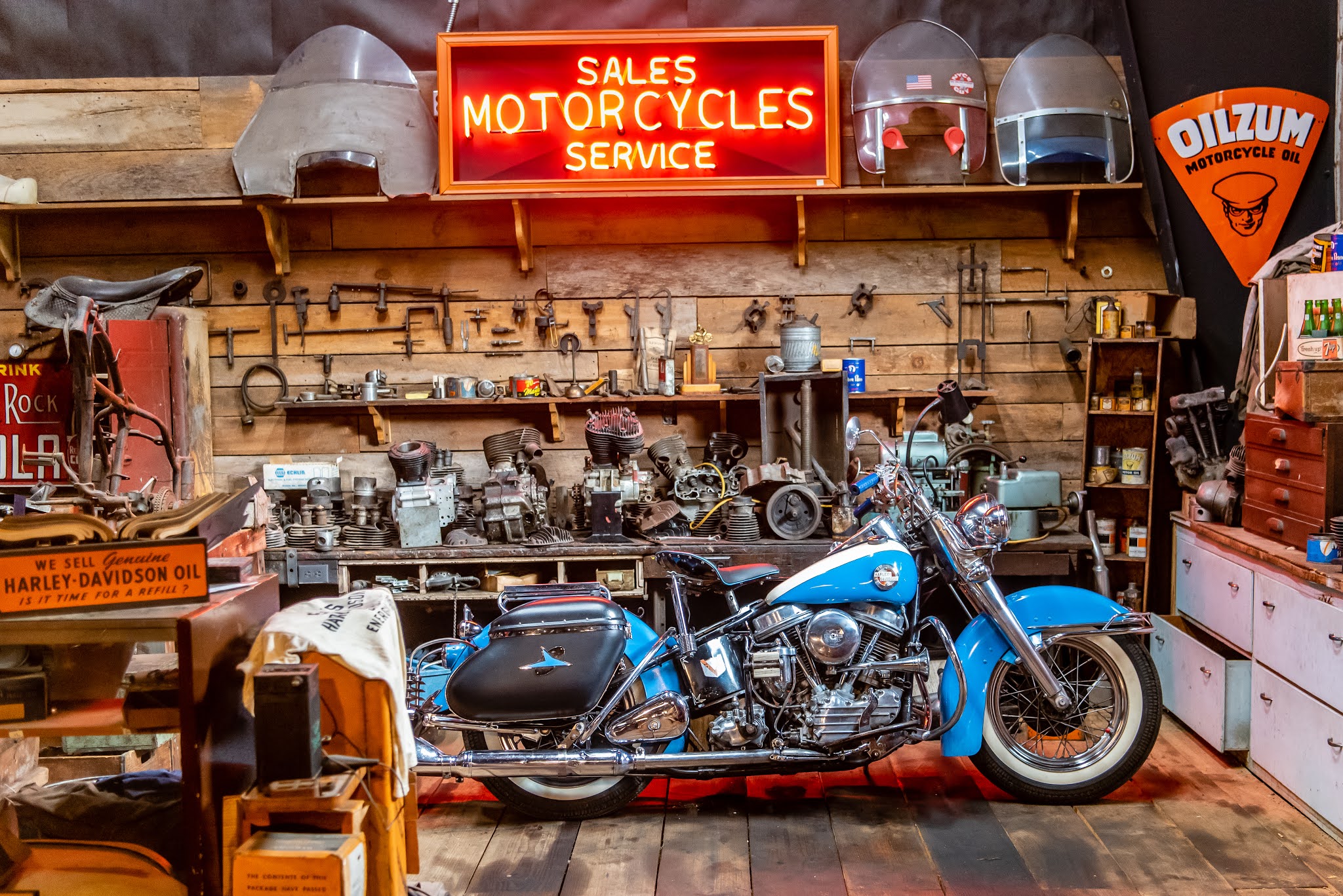
There are numerous groupings of motorcycles from their use in wars over the years, to hill climbs and track bikes. There are even some nicely done displays with an old style motorcycle service facility. One thing rather unique about this museum is its an operational museum. What’s that mean? Well, we were there for a couple hours and heard three different motorcycles started up and driven around the inside of the place. We all know how loud motorcycles can be, especially Harleys, well start one up inside this big metal building and it’s hard to hear yourself think. The one that drove past us early in our visit was driving in a calm, well behaved manner giving visitors a chance to get out of the way. But while we were upstairs, one was started and actual left a patch of rubber on the concrete floor! We couldn’t actually see the motorcycle in question but there was no mistaking what was happening.

H-D Hill Climber

Service Facility

H-D Track Racer

View from 2nd Floor

While the museum is predominantly centered around motorcycles, there are a fair number of old cars on display. I didn’t detect any particular theme to the cars so I’ll assume they were ones the museum’s creator had some connection with.

Cadillac Convertible

Supercharged Austin Seven

1932 Ford Model-B

There are some other displays that didn’t always seem to have a motorcycle theme but were quirky nonetheless. The random prosthetic leg and “peep show” display were two that caught my eye.

Missing a Leg?

10 Cents a Peek

Old Neon Sign

Wooden Indian

Fill Her Up

There were also a handful of bicycles scattered about the museum. One of our favorites was the side by side tandem. We have bicycled across the USA on a tandem - but the more conventional style. We were tempted to ask if we could give this one a spin but the “Please do not touch” sign told us not to ask. But the winner of the whole museum (in my mind) was the display of the Schwinn Apple Krate. I don’t specifically remember Captain Kangaroo being a pitch man for them but back in the early 1970’s I wanted one of these bikes so very badly. The kid that lived across the street from me had one and I was jealous. Of course the $102 price tag ($678 equivalent today) kept the 10 year old me from getting one. I wonder whatever happened to Greg’s Lemon Peeler?

1896 Punnett Double Bike - Side by Side Tandem

Apple Krate