Tuesday, January 10, 2017

Sonora Desert Museum and Mt Lemmon

Map of this blog's locations click this link to open the map

Even though Catalina State Park probably has enough hiking and geocaching to keep us busy for our stay here, there are other things to see and do while in the Tucson area. It has been a month since we have been in a city of any size. The last one being San Antonio Texas 30 days ago. One of the first things we did was a bit of shopping. My slippers had seen better days and were being held together by tape for several weeks now. Chris was unwilling to let me continue wearing them for fear some neighbor would come in and see the pathetic things. Fortunately there is a shopping center directly across the street from the park so this was remedied fairly quickly.

We had two potential 'touristy' things to do while here. Old Tucson Studios has been the location of hundreds of western movies and is a theme park up sorts with shows and re-enactments of shoot outs and other old time things. Just down the road from this is the Sonora Desert Museum. There are many gardens, exhibits and even desert animals like a mini zoo. Both venues are on the far western side of town and either would take the better part of the day to experience.


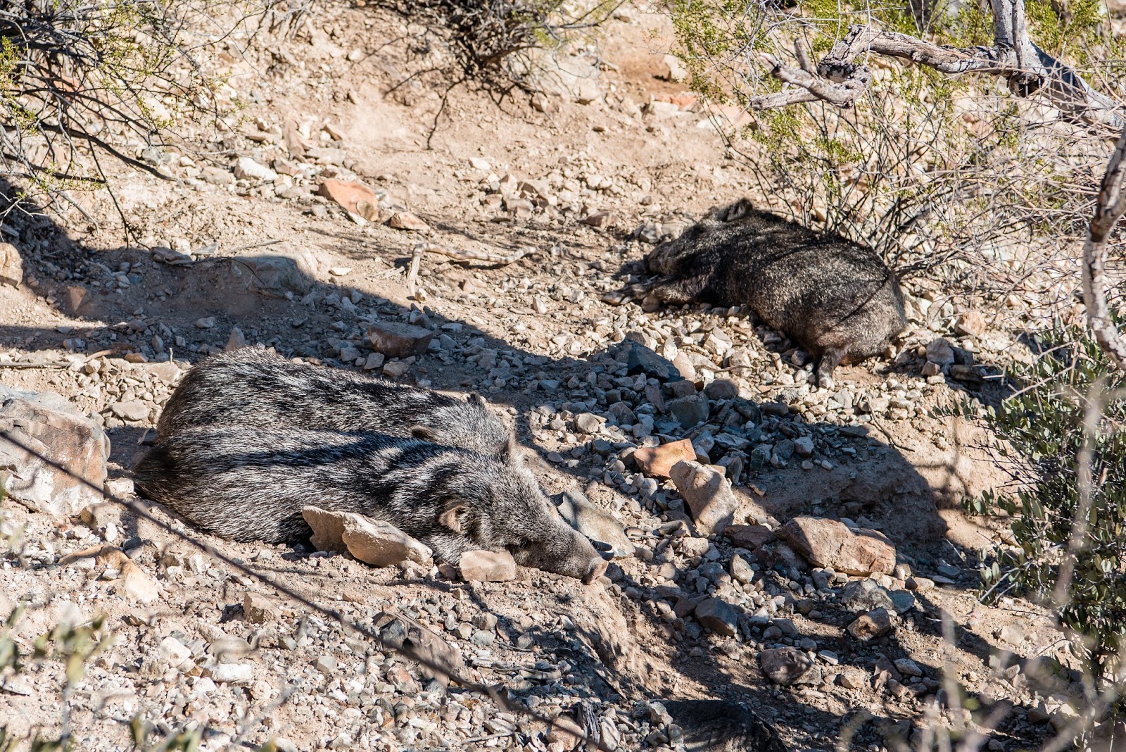
We decided to try the museum. Boy was this place crowded based on how far out in the parking lot we ended up. Once inside, the crowds never seemed too bad, only occasionally did some of the spots seem too crowded to enjoy. Being a warm day, many of the animals in the outdoor displays were trying to stay cool and were sleeping in the shade.
Overlooking the Sonora Desert

Chris Earns Her Wings
The mountain lion was quite active, pacing back and forth in front of its thick glass panel, eyeing the small children on our side. As we wandered past the other side of the enclosure, protected by both fence and moat, it came out explored the rest of the area before heading back to the window.
Mountain Lion on the Prowl
The four bighorn sheep, were also moving around a bit, almost posing for pictures from the group of people watching them. Their environment included some large boulders so they could show off their climbing abilities.
Bighorn Family

Look at My Horns
There was one loop that went through part of the desert and included a small group of javelina - sleeping of course. The coyote was also sleeping on top of a big rock, but was at least out in the open. The fox had also found a good sleeping spot. But the prairie dogs were very active.
A Few Sleeping Javelinas

Fox Sleeping in Sunny Nook
Prairie Dog Checking Us Out
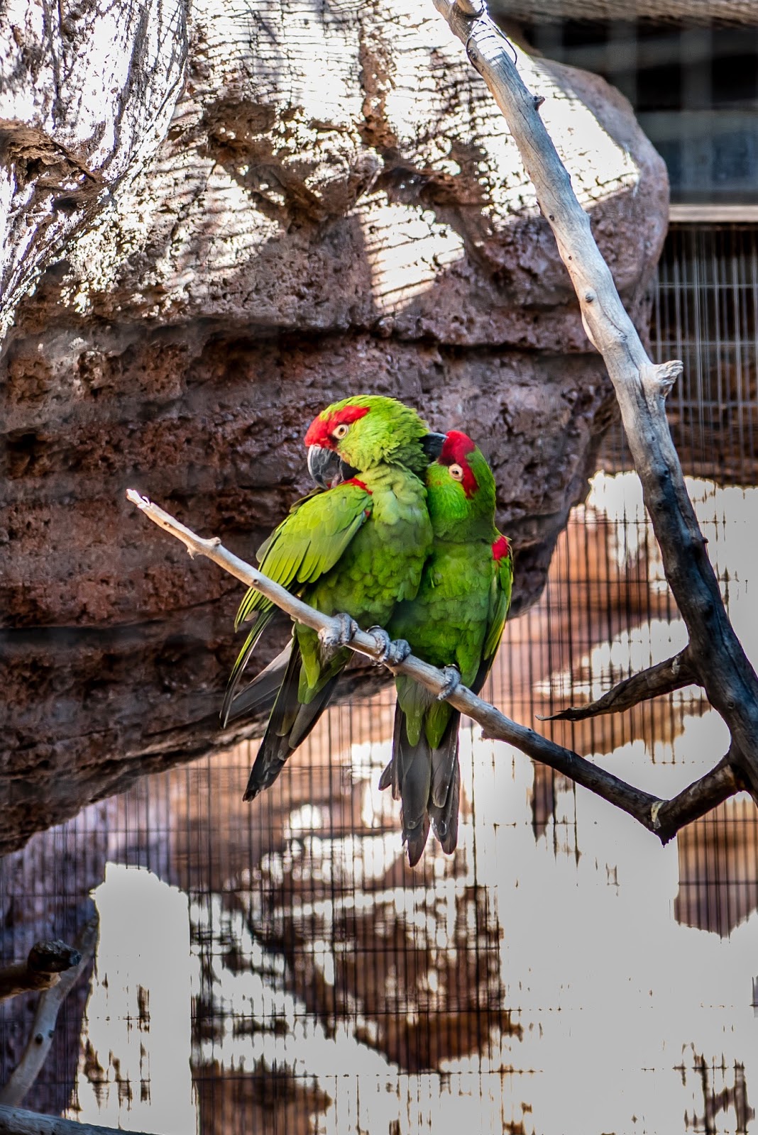
There were quite a few birds on display as well. Some were in their individual cages like the parrots while others were in a large aviary. It was interesting to walk around and see so many different types of birds. There was also a hummingbird aviary with quite a few of them flying around and often perching here and there.
Bright Parrots

Feeding Bird
Of course there was the reptile and amphibian exhibit with many snakes and lizards.
Resting in Plain View

Uncomfortable Looking Spot

All Coiled Up
There were also many garden areas with a wide assortment of plants with many even in bloom. Quite a few of them were just odd looking to somebody from up north.
Blooming Cactus

More Cactus Blooms

No Caption Required!

Strange Cactus
After a long day at the museum, we stopped at one of the many pullouts that are trailheads within the Tucson Mountains County Park in order to keep our geocaching streak alive.

Our second day trip was to the top of Mt Lemmon. At over 9100 feet in elevation, it is the first thing one sees when they drive into the Tucson area. It is possible to just hike to the top right from our campground. It is about a 13 mile hike one way. We opt to drive even though it is a very long drive from the campgrounds to the summit at nearly 2 hours. The good news is there are dozens of pullouts all along the route to check out the views. The warm weather we have been experiencing down at the campground elevation has been warm enough to melt all the snow at least on the road. A cache we attempted near the top allowed us to experience a little bit of deeper snow. The last mile or so of the road was closed beyond the restaurant and ski slope, so we didn't see the very top.

Impressive View From a Geocache

Ski Slope at Mt Lemmon

View from Near Top of Mt Lemmon
At one of the pullouts we stopped at (Windy Point), we had a couple caches and earthcaches to attempt. In fact while we were out taking measurements of one of the rock formations, two guys walked up and asked if we happened to be geocachers. Yep and they were there for the same thing. From one of the viewing points, I turned around to face the parking area and noticed some guy with a large skateboard, full helmet and apparent padding walking to the middle of the road while his buddy got in a car and started to follow him downhill! When we later came back down the road, we never saw any indication of him splattered against a rock face so hopefully the fool made it down safely. We had seen dozens of people bicycling up the mountain and presumably going back down, but they have brakes.
View From Windy Point Vista

More Rugged Terrain

Crazy Skateboarder Heading Down Mt Lemmon!
Hoodoos

Thursday, January 5, 2017

Catalina State Park

Map of this blog's locations click this link to open the map

Catalina State Park is just north of Tucson in Oro Valley Arizona. It is a popular park with a wonderfully beautiful view of the Catalina Mountains. Their are two camping loops with water and electric sites plus an equestrian camping area with actual stalls for your horse.  The restroom and shower facilities (at least in Loop B) were nearly new and very clean. This is helpful when we are staying for 8 nights but don't have sewer hookups.
Sunrise at Our Campsite
We had picked this place based on its good reviews but hadn't really investigated the geocaching in the area. Well it turned out to be a pretty wonderful place for that as well with 60 or more caches in the state park and plenty more in the vicinity. Our first hike was right out of our campsite - no need to even drive to some trailhead. We headed up to the equestrian area and the trails adjacent to them. We quickly discovered a couple things. First this area is very sandy and on trails with horse traffic, the sand was quite loose and tough to walk in. There are many washes running thru the park that sometimes work as trails but other times not so much. Not that there was any water in them, but brush and debris often got in the way.
Young Barrel Cacti
Horses Passing By
There are thousands of saguaro cacti in the park. Well not just the park but all over the area. They are just as common as maple trees are in Upstate New York. Some of the saguaros are enormous, but the base of many of them don't appear to be large enough to support them. Obviously they do well here even when the ground appears to consist of only rock and sand.
Saguaro Cacti
One of the hikes very near the campgrounds is the Romero Ruins trail. The area was inhabited by Indians back in the 1100's and then by rancher Francisco Romero in the mid 1800's. There are many interpretive signs along the route describing the past. One of the more interesting geocaches we did while in the park was at this location. (Walk with Me) The cache owner had a link to an audio file and explained in order to find the cache, you needed to listen to the audio and walk the trail and follow his instructions. It was sort of like having a tour guide as you did the walk. The only issue was his pace was a bit slower than we usually walk so we were constantly ahead of his description and needed to slow down. At one sign, he describes how to determine the location of the container based on the info on the sign. We have found over 9000 caches but have never done one similar to this.
Remains of Old Building

This is a BIG One!

All Lined Up with Mountains As Backdrop
Although the area appears completely dry, there are a couple of the washes that have water flowing. Enough water, that it takes a little bit of planning on what path to attempt in order to not get a wet foot. There were many 'birders' out on the trails. Admittedly there were very few of them that we could identify. The ones that had homes in small holes in huge saguaros were interesting to watch.
Water Crossing
Beautiful Afternoon Mountian Views
The park had many different guided walks and programs scheduled while we were there. We picked a geology session early one morning. We were expecting that one of the rangers would meet the attendees at the shelter, show us a few different types of rocks, and then walk along a trail describing a few interesting geological things along the way. Instead we were greeted by a retired geologist that volunteers at the park. She had all sorts of show and tell materials and gave us a great geology class for an hour before we hit the trail. We stopped at many interesting spots and she had good explanations of what we were looking at. Nearly 3 1/2 hours later we finished up spending a lot longer than anticipated but feeling a bit smarter for it.
Our Group Stopped for a Lesson
Another Saguaro
One last hike we took was a bit more strenuous one. We started following the Canyon Loop Trail which is a very popular and pretty tame trail but after doing 1.7 miles of this trail, we intersect the Romero Canyon Trail which heads up into the mountains we have been looking at for the last week. We knew we didn't have the energy to do the complete trail since it comes in at just over 7 miles, one way! At one point as I came around a bend, I see something move just off the trail ahead of me. After weeks of not seeing any javelinas in the wild, we are face to face with about half dozen of them. They were not too photogenic and kept their distance as I approached but at least we saw them. The mountain area we are in on this hike is part of a Bighorn Sheep Management Area. We kept our eyes open, constantly scanning the mountainside but never spotted any of them during the hike.

Looking Back Down the Romero Canyon Trail

Elusive Javelina - Left Center
Intricate Rock Formation
Our Rig at Sunset

Tuesday, January 3, 2017

Rodeo Wrap-up

Map of this blog's locations click this link to open the map

There aren't that many touristy type things to do in this area. There is Fort Bowie but it is  over an hours drive. The Chiricahua National Monument is part of this section of the Coronado National Forest but it is even a longer drive. We decide if we want to see these things at some future date, we will camp further west - a lot closer to them.
One More Clear Night in New Mexico (click on image for full resolution)
So what does that leave to do here? Well some more hiking of course.  We head back into the National Forest and take Herb Martyr drive. Our first stop is at Crystal Cave trailhead although we don't plan on taking the trail. There is a geocache overlooking the cave and from the logs of previous finders, it sounds like the trail isn't the best route to the cache. Our instructions were "go to the green cabin and follow the ridge up to the cache." Sure enough that was all we needed and we found the cache in great shape. From this vantage point, we were able to see up to where we were a few days ago hiking to Silver Peak. After coming back down, the green cabin had some interesting ornamentation. We had read that Crystal Cave is now locked because the crystals inside we being taken. I suspect I know where a couple crystals went.


Silver Peak is Up There Somewhere
Green Cabin With Some Crystals Adorning It
Next we continued to the end of Herb Martyr Drive. We didn't have a specific trail in mind and when we tried to follow one, our track did not line up with the other trails we had on our GPSr units. It turned out to be a pretty decent climb but after a mile or two we came to a creek crossing. With all the rain we have had, it was flowing pretty good and we didn't see the trail continuing on the opposite side so we opted to take the sure thing and turn around.
Stream Uncrossed

Faint Rainbow on Our Hike
For our last full day we decided to try our another more strenuous trail. The Greenhouse Trail used to start at the end of the Greenhouse Road. But that road was more or less washed out and is no longer maintained so the first part of the hike is to hike up the road over a mile to the actual trail. This trail goes for quite a distance and connects up with several others once you get higher up in the mountains. Our goal was to only go as far as the Winn Falls Overlook. We had not researched this one as much as Silver Peak but we more or less knew where we were going and Chris even had some intermediate waypoints to shoot for along the way.
Trailhead for Greenhouse Trail
About 2 miles up the trail, we ran into a couple guys heading back down. We stopped to see how it was but they told us they never made it to the overlook. They had done the last creek crossing and lost the trail on the other side so they had given up and headed back. This did not really help our confidence, but it possibly did ignite my competitive side and make me want to get there even more. About 10 minutes after passing them, we too got to where the creek crossing might appear to be, but since we had our GPSr with this trail and Chris also had coordinates for the creek crossing, we knew we had about 0.15 miles before we were there. We eventually figured out where the trail was and made it to the crossing. 
We Are Heading Somewhere Up There
This crossing was a little bit of a challenge since the water was flowing quite fast and the exposed rocks were covered with ice. We found a tree fallen across the stream that couldn't be walked across, but could be used to hold onto. Then I chipped the ice with my hiking stick until our path was more or less safe. Shortly after the crossing, we lost the trail again. So we decided to try and find our own trail. Bad mistake! This area had been hit with a big fire back in 2011 and there were lots of downed trees. Plus some of the new grow were trees with many good sized thorns. It did not make for a pleasant walk but since we were nearly there, we pushed on and eventually crossed something that resembled a trail. I started to follow the path where it was more defined but Chris realized we needed to head the other way.
Fire Remnants

Beautiful Area Even with Fire Damage
The rest of the hike went reasonably well. We were still gaining altitude but we had fewer obstacles to overcome. The view from the observation point was nice. Across a steep canyon was Winn Falls with its constant stream of water crashing against the rocks below. We sat and enjoyed our lunch, took some pictures and headed back down the trail determined to stay on it this time. For the most part it was easily followed, but there were times where it nearly disappeared due to overgrowth. We came across one place where we had been before on our way up but hadn't recognized the trail for what it was. We lost the trail right before we crossed over the creek again. This is definitely where we had problems on the way up. The rest of the hike was easy going.
Chris Makes It Up

Winn Falls Across the Valley

Proving We made It

View Back Down the Valley We Came Up

Our Actual Tracks - Note Meandering in Upper Right Where Up and Down Don't Match


The next day was a travel day. We've had a good time here at Rusty's but it's time to move on. This would be an easy drive. Head north back to I-10 and then west towards Tucson and Catalina State Park. On the way, we stop at a rest stop that is actually called Texas Canyon Rest Area. It has some amazing rock formations on both the eastbound and westbound directions.
Amazing Rock Formations

A Rest Stop Worthy of a Stop

Notice the Balanced Rock Up Top