Saturday, April 20, 2019

Habitat for Humanity Build and Florida Wrapup

Map of this blog's locations click this link to open the map

Our next stop was North Fort Myers Florida. We are scheduled to attend the 30th Anniversary Habitat for Humanity RV Care-a-Vanners Rally and Build. We had heard about this back in August and decided it sounded like fun so worked it into our Florida travel plans. First a little bit of background. The RV Care-a-Vanner (CAV) program is part of HFH. Local HFH affiliates around the country bring in people in RVs to help with home builds in their area. We had done our first Care-a-Vanner build in July 2017 about an hour north of Seattle Washington. That had been the typical 2 week stint whereas this one would only be a week long. Our first build only had one other RVing couple while this one was going to have over 110 rigs and close to 220 people! 
We're at the Right Place
The location for the rally was at the Lee County Civic Center - basically the county fairgrounds. We were asked to arrive at 10:30 on Sunday morning. Coming in from 125 miles away made for a unusually early start for us but our timing was nearly perfect. Many of the rigs were already setup so there wasn’t really any wait to get parked. The fairgrounds has water, electricity and sewer hookups which is nice but we are parked “rally style” which is a polite way of saying close to one another. All of us were assigned to one of 18 teams with about a dozen members on each team. The rigs were assigned spots to put each of the teams next to one another which was nice to be able to meet the people we were going to be working with for the week. Go team #7! Our team leaders were a couple from Pennsylvania that have around 75 builds to their credit!
Panorama of Care-a-Vanners

Close Quarters
On Monday morning, the whole crew met in a big open field of the fairgrounds for several speeches from HFH and CAV staff as well as the local affiliate. Many of the volunteers have done multiple builds with others so, it seemed like a big homecoming of sorts. Next they had us all stand on the outline of a house with the initials CAV below it so they could get an interesting group photo with a drone. Each team was assigned their own home to work on scattered around the general North Fort Myers area. Our home was only a 25 minute drive from the fairgrounds and is new construction. Others had closer to 45 minute drives and some were working on demolition and reconstruction projects. 
Group Photo Of House Outline (We are bottom right hand corner of front door)


Up for Sunrise
Being April in Florida, the work days seemed to be rather warm but safety and hydration were a big priority so it didn’t seem too bad most of the time. Our home was mostly up with rough plumbing and electrical done. The first day was spent mostly indoors installing wall insulation and a few other things to get ready for an inspection that would permit us to start hanging drywall. I helped to install a window and sliding door so we would be able to actually lock up the house each night making tool theft a little less likely. The remaining part of the week was spent working on installing some vinyl panels on the outside porch ceiling and hanging lots of drywall. I felt this build worked out a lot better than the first one for a couple reasons. First it was only a week long. Secondly, the home was further along so the required tasks were much less physically demanding. It was fun to work with the different team members during the days and learn a bit about them and their RV and building experiences. 
Posing in Front of Our Build
Patio Door Install


Rear Porch Ceiling
It seemed like the work week flew by. We were required to take a 4 hour safety class that seemed to drag on a bit too much. We went out for a group dinner at a nearby restaurant on the water which was fun but we were unable to all sit together. We went to a house blessing on the other side of town. All CAV teams were invited to the one build and it was a pretty packed spot. We all placed our hands on the outside of the home for the blessing. Saturday was a morning full of various seminars and we did seem to learn a few things about Habitat and the CAV program. There was a big dinner Saturday night in the main hall. It was followed up by a Neil Diamond Tribute by Keith Allynn. I hadn’t set my expectations too high but I figured I since like Neil Diamond songs it would be okay. It turns out this guys is very entertaining and quite talented. It capped off what was a very fun week where we met a few more friends.
"Neil Diamond"
House Blessing
The next morning people pulled out at all different times so it wasn’t chaotic getting out of the place. We had a longish (for us) drive of 215 miles to our next stop. We were heading to the town of Santos Florida just south of Ocala. There is a small campground that is right at the trailhead to another very popular mountain biking trail system. It was a pretty easy drive up Interstate 75 and the campground is pretty nice. 

That first afternoon we walked over to a nearby nature trail for some highly favorited geocaches. The first one was behind the sheriff’s building near the start of the trail. This one was rather unique and considering we have found well over 12,000 caches, that’s saying something. There was a two foot by four foot board on some posts. Each side of the board had 30 to 40 small hinged flaps that had some Olympic sport written behind it. The goal was to find matching pairs of sports which would then give a combination to a locked cache container. 

We each picked a side and the race was on. We hadn’t gotten very far when a young sheriff walked towards us. We knew this cache had the permission of the department, but apparently this guy hadn’t actually looked at what was there. We explained it was like the game of concentration and he started to work with me on my side of the board. As we got matching pairs, we wrote down the numbers and in a few minutes had the combination. He opened the lock for us and then got a call on his radio and excused himself as he ran to his car and was gone. We finished up signing the logbook but when we went to lock it back up we didn’t see the lock. Had our sheriff friend put the lock in his pocket and taken it with him? After a little searching, I discovered it on top of the board above my line of sight. Problem solved!

The next morning we headed to the mountain bike trails. We did a series of the easy rated trails and got in a 13 mile ride. The trails here are excellent! Mostly winding through wooded areas plus there weren’t many others out. We did get glimpses of some of the more challenging trails but didn’t see anybody out on them. The Spider Kingdom section was identified as an intermediate trail but found it to be not too much more challenging than the Pine Tree and Dog Bone trails closer to the campground. 

Chris Suggests I DON'T Try the Widowmaker!
A Portion of the Bike Trails at Santos

In the afternoon, we headed into the nearby town of Belleview. There were a lot more of the gadget caches placed by the same guy that built the one by the sheriff station. There were some very creative hides. One involved using a pair of binoculars to try to find the combination of a lock to get to the logbook. Another one was placed in the front yard of the guy’s house. Since it was the middle of the afternoon, we thought we could get in and out without being observed but before we even got out of the car, his young daughter ran over to tell us he was on the phone and would be out shortly. We had just figured out how to pull down a tape measure with a pole and hook to get a combination for a lock when the cache owner came out to chat with us. We told him how appreciative we were of all the creative hides and hoped to be able to get most of them before heading out of the area. 

The next day, we put the bikes on the rack and dove to another section of the trails to the southwest of the campground. The Landbridge trailhead has a large parking lot and was pretty busy with others out for a ride. The reason for the name is that they have built a bridge over Interstate 75 but it isn’t just a normal bridge but a land bridge with soil and plants presumably to make it more conducive for animals to use it to cross the busy road. We had seen something similar in Washington state although that one was intended for much larger animals like elk. Don’t think we will see any elk here! We managed to go out 7 miles to the west before turning around. This section of the trail wasn’t quite as nice. A lot of it was in a more open area so it was rather sunny. The trails continue one for many more miles to the west but we didn’t have the time to check them out.

Creative Geocache Hide - A Wooden Duck

Land Bridge Entrance
Looking at Land Bridge from Bike Path
Having the bike trails so close to the campground was really nice. We went out for another ride on them, but this time I took a couple of the intermediate trails while Chris did the easy ones with the plan to meet again at a set location to continue our ride together. I was trying to go faster on the more challenging trails and ran into a couple problems. The first was a series of 8” tall roots on a short uphill section of trail. I managed to lift the front tire over the first root only to have it come down right in front of the next root. The tire and bike stopped as I did a slow motion vault over the handlebars. I only needed to straighten the handlebars to the front wheel and moved on. 

The next problem was when I encountered what is called a “skinny” section. I came around a corner and there was a 40 foot long “bridge” to cross. It isn’t a bridge over anything, but built to challenge your bike handling skills. It started out about 2 feet wide, then dropped down to a single board about 6 or 8 inches wide. Then back to two feet before going to another narrow board. I made it through the first half without too much trouble but on the second narrow section, there were a couple trees right next to the board so you needed to shift your body and bike over to avoid the tree. Apparently I didn’t shift enough and I clipped my left handlebar on the tree which forced a rather abrupt left hand turn off the side of the board. The bridge was probably only 8 or 10 inches above the ground, but there was no saving it once the front tire dropped that far. This time I went over the handlebars fast enough that my head slammed into the ground. Fortunately the ground was a bit sandy so other than needing to shake the sand from my helmet and wipe some blood from a couple cuts, I was back on my way to find Chris. We kept it safe for the remainder of the ride.

Hazardous Skinny Bridge
On the last full day, we did a mixture of paved and dirt trails. We rode the paved greenway down to the Landbridge parking lot and then took the dirt trails back. It turned out the paved trail was quite pleasant. It wasn’t just a flat and straight trail but had some small hills with plenty of sweeping curves. It is wide enough to deal with other cyclists or pedestrians and was generally nicely shaded. Had we been here longer, I may have swapped out the knobby tires for our road slicks and gone for a long ride on the greenway trail. This is likely a place we will visit again and will plan on staying for longer than 5 nights.

This stop will be our last one in Florida for awhile. We have spent a total of 145 nights in the state since arriving last November. But it’s time to head north. Our next reserved spot is just south of Birmingham Alabama which gives us two driving days. The original plan was to use Elks Lodges in Valdosta Georgia and Auburn Alabama, but when we checked the schedule of the lodge in Georgia, we found they had some activity scheduled for the Friday night we would be there. We were worried that the parking lot would be crowded and since they don’t have any hookups available, we opted to find a plan B. We found a full hookup campground in Hahira Georgia that is part of Passport America. This gets us in for half price. As we were heading that direction, we called and told they had plenty of space. 

The drive was not completely uneventful. There was a strong weather front moving through the area and by watching radar, we stopped at a rest area in Florida half an hour before it arrived. We stayed put for about 90 minutes while the front came through. The rest area definitely got very busy with other travelers trying to avoid the heavy rain and winds. We enjoyed being safe in our home while most others were holed up in their cars. We eventually got back on the road and made it to Cain’s Creekside RV Park. Nobody was there to greet us but we put our $20 in the envelope and found a nice spot overlooking a small pond. 

Our Spot in Hahira Georgia
The next day we headed out for Alabama. We have been making good use of an app some fellow Newmar owners had recommended while we were at the Habitat rally. “Trucker Path” is an app intended for truck drivers to show things they might be interested in. It includes the ability to route to a destination and show places along the route. The thing we really like about it is that we can have it show diesel fuel prices along a route and it only shows those stations that are geared for semis. Plus it has the ability to show a satellite view of the station so we can see the path in and out. It sure beats the method I used to use with Gas Buddy and other maps to try to determine if our rig would fit.

It was a very pretty but quite windy drive over to Auburn. We got in fairly early only to find the lodge wasn’t open. I suppose because it was the Saturday of Easter weekend. I suppose that turned out to be a blessing because while they did have a decent size parking lot and a grass field to park in, the whole place is on a bit of a hill. We walked around the parking lot trying to find a spot that would work. By parking on the top of the “hill”, we were able to get level front to back and only had a slight left/right tilt. 

We headed over to Auburn University to walk around the campus and find a place for dinner. I’ll admit, the real reason for heading there was to do the webcam geocache. This type of cache is rather rare since new ones are not permitted to be entered into the website. So when we find one along our route, we tend to give it a try. After getting our webcam picture, we walked the campus to see what it is like. Other than the rolls of toilet paper strewn in one of the trees (ah the good old days!), it is a pretty campus. There were a few gardens and natural areas as well and found another geocaches along the way. We stopped at a good BBQ place and had a good meal. Back at the lodge, we got a good night sleep even though it was fairly close to a busy road. Next stop Oak Mountain State Park. 

Auburn Campus
Our Web Cam Photo
Waterfall on Auburn Campus


Saturday, April 6, 2019

Alafia River State Park and Summer Plans

Map of this blog's locations click this link to open the map

I’ll admit, it felt good to be back on the road after sitting still for 3 months. I suspect our limit in the future will be somewhere in the one to two month range, but who knows? Our next stop will be to head a bit further south. I know, it’s early April and most snowbirds are starting their journey north but we have signed up for a Habitat for Humanity build and rally in North Fort Myers. We have five nights to kill and had booked a site in Alafia River State Park before the build starts. 

If you do a Google search for mountain biking in Florida, it’s likely this place will be at the top of the results. It was a bit of a surprise that there is any real mountain biking in Florida other than in the panhandle, but we figured it was worth a shot. Even though it was a weekday, the drive through Tampa wasn’t too bad. We had reserved one of the pull thru sites and found it to be pretty nice with a couple shade trees to set our chairs underneath. Nearby were some tall, high voltage power line towers that had some bird platforms situated on top. The closest one was only a few hundred feet away and a couple of ospreys had built a large nest. We got out the binoculars and discovered there were three young birds in the nest as well. It was fun to watch mom and dad going out for fish from the many nearby ponds and tear off small chunks for the youngsters. 
Incoming!

Adult and One Young Osprey
Adult and Two Young Osprey

In Flight
We headed out before dinner on the first afternoon and did a couple mile hike to scope out the park. There are many miles of hiking and equestrian trails besides the ones for biking. There is even an equestrian camping area in another loop from our campsite. It isn’t required to have a horse to camp in any of those sites and most of the rigs there did not have horses. North of the campground is the day use area. There is a large parking lot and it was pretty full. This is the start of most of the mountain biking trails. We picked one of the hiking trails that meanders next to some of the mountain bike trails to find some of the many geocaches hidden in the park.
A Dragonfly Visited Our Campsite

Green Face
Alafia River used to be a phosphorus strip mine but was abandoned well before mine operators were required to return the land to its original condition. In the intervening years, nature has reforested the area and it was turned over to the state. In a way, having the land all distorted by the mining has created a perfect topography for a mountain bike course to be built. They have four “easy” trails, seven “intermediate”, thirteen “advanced” and four “expert” trails. We discovered that there are quite a few man made features added to the trails to make the riding that much more interesting and challenging. As we walked the hiking trail, we passed by one of the tall wooden ramps but no cyclists were there to show us how it should be done. It turned out that what we saw was actually part of one of the intermediate trails - the North Creek Trail.
Part of North Creek Trail
Alafia Bike Trail Map

The next day, we hit the trails with our bikes. We figured we should start with the “easy” trails just to make sure we knew what we were getting ourselves into. There is a trail out of the equestrian campground that gets us to the 1.5 mile Hidden Rivers trail. This single track trail winds through a nicely wooded area. Fortunately this bike trail, like many in the park, are one way. So we shouldn’t need to worry about oncoming traffic. There are lots of twists and turn but not much more than a few feet of elevation change. There also aren’t many sandy stretches and the biggest obstacles to overcome are tree roots, rocks and a few spots with trees on both sides of the trail where it isn’t clear our handlebars will clear.

This trail ends up on a multi-use trail that we can follow up to the next “easy” trail - the Sand Pine trail. This one is 1.7 miles long and is in a much more open area. The terrain is sandy but not to the extent that traction or cornering are compromised. The most obvious thing about this trail was the fact it had been burned recently and still had the smell of burned wood in the air. We later found out that this area had a prescribed burn less than 4 weeks ago. This trail merges into another “easy” one named Rock Garden which is mostly back in the woods and was a lot of fun for its one and a quarter mile length. Combining these three trails in a loop from the campground is 7 to 8 miles long.
Prescribed Burn Aftermath

Charred Sand Pine Trail
The next morning there was a park hosted “camper coffee” event. We attended it and met one of the campground volunteer couples that happen to be geocachers as well. They have placed the majority of the caches in the park. Another thing mentioned at the event was an app called Trailforks. It is a mountain biking trail map app that includes all the trails with descriptions and elevation profiles. But the best feature is it works with the phone’s GPS to show exactly where we are while out on the trail. Plus you can download all the trails for a state so you don’t need to have cell coverage while on the trail which will be good in more remote areas. We started using this app during our stay and are not sure how we have lived without it. With as much biking as we do, this app will be a big help as we travel the country. 

After the event, we hopped in the car and drove to Bok Tower Gardens in Lake Wales Florida. It’s about an hour away but was closer from this stop than our stop in Hudson. Chris had heard about this place and added it to our list of things to see while in Florida. What’s so special about this place? There is a very large carillion that stands 205 feet tall constructed mostly of marble that houses 60 cast bronze bells. The smallest bell weighs 16 pounds while the largest comes in close to 12 tons! The 50 acres that surround the bell tower were designed by Frederick Law Olmsted Jr and includes some very impressive gardens.
Bok Tower and Reflection
Visitor Center

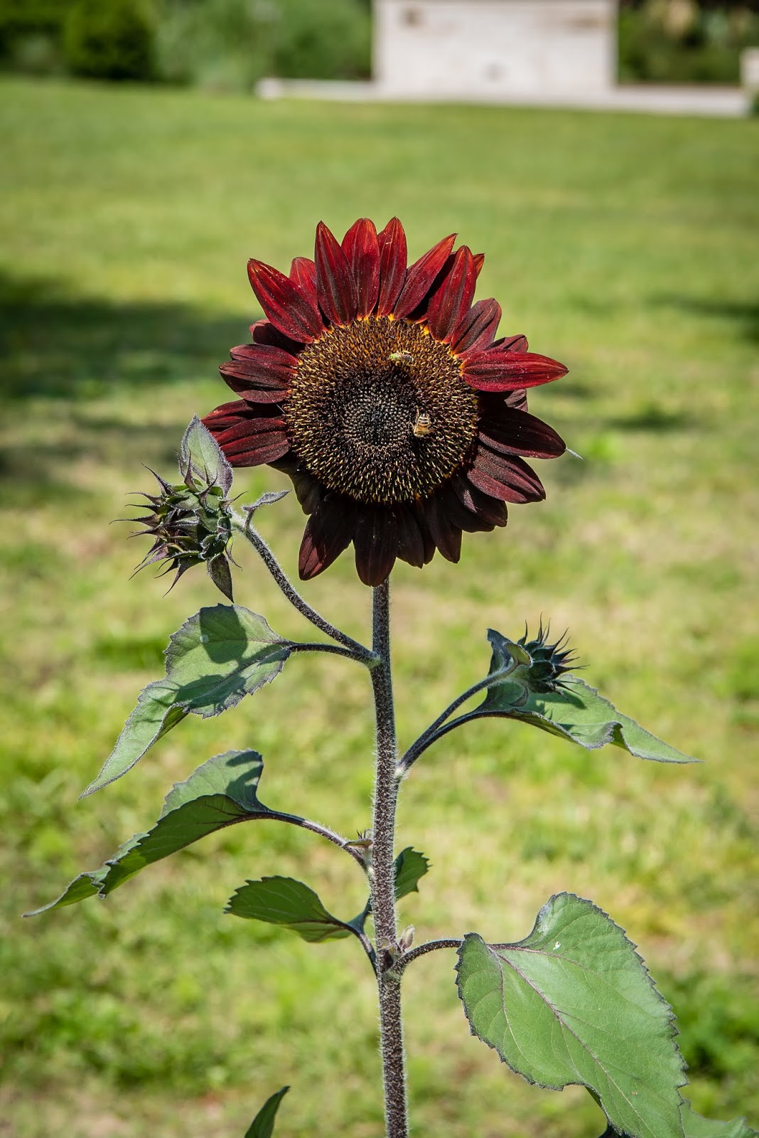
Dark Sun Flower

Impressive Entrance Door

Tower
The tower and gardens were constructed back in the 1920’s for Edward W. Bok. He was the editor of Ladies’ Home Journal and apparently had more money than he knew what to do with. After it was completed, he gave it as a gift to the American people. The place is now open to the general public once you pay your $15 admission fee. They have concerts twice a day, so make sure to plan your trip accordingly. We arrived early enough to catch on of the free docent led tours that explains the history of Bok, the gardens and the tower. Our tour ended at the tower just in time for the 1 o’clock concert. The sound from the tower was very impressive although I would have preferred to hear songs I knew. Maybe the carillonneur should take requests? How about “Freebird” or “Stairway to Heaven” or “Born to Run”.

Sundial on Tower
Intricate Stonework


After the first concert, we grabbed a snack at the cafe. Then we wandered around more of the gardens our tour didn’t get to including a couple geocaches on the grounds. The detail of some of the carvings and other features of the tower are rather impressive. They have a closed circuit TV showing the carillonneur playing the “instrument”. He presses levers that are attached to wires which move a striker into the stationary bells. Apparently only very generous donors are permitted into the tower and even then only one day a year. Bok Tower Gardens were a nice side trip to something a little different. Too bad we didn’t take my sisters to the place, I bet they would have enjoyed it. 
Adam and Eve with Serpent


Closeup of Door
Carved Stone Pelicans
The next day, we did some more hiking to get a dozen of the newer caches the local volunteers had recently placed at Alafia River. This park has a lot to offer beyond the excellent mountain biking trails. After lunch, I did a solo bike ride of the same loop from the day before. I really enjoyed the ride but even though I was able to ride fast, I did get passed by a couple of guys that seemed to come out of nowhere. As hard as I tried, I couldn’t keep up with them. If I was only 20 or 30 years younger! On my last bike ride in the park, I tried my luck on the North Creek Trail (see earlier picture). There were definitely some intense parts but I suspect if I had tried it earlier in our stay, I would have done much better after a few runs.
Green Cove
Mile Six Guardian

Resting on Handlebar Grip

Showing Off
Even though Alafia River has some great mountain biking trails, there is another very popular place only about 6 miles to the west. Balm Boyette Nature Preserve has 20 miles of trails for biking. There is a large parking lot and it was 75% full when we arrived. All the trails are about half a mile from the parking area. We stuck to the easy trails on the southern end of the preserve and really didn’t get a chance to see any of the more advanced trails. It seems like most of the people here are on those difficult trails because the ones we rode were pretty empty. I think we only saw 3 or 4 others during our ride. If you enjoy mountain biking at just about any level, this area of Florida has two excellent parks to keep you entertained and in shape.
Balm-Boyette Trail Map
Pretty Butterfly
Over the past couple months we have been working on figuring out what are travel plans will be for the rest of 2019. One area of the country we haven’t checked out are the Dakotas, Montana and Wyoming. With that in mind, for the last year or so, I have put together a Google map with pins at spots we might want to check out in that area. If I read somebody’s blog or watched a YouTube video with some interesting sounding spot, I would add it to my map. There were also the obvious additions like Glacier and Yellowstone National Parks. 
Possible Stops on Google Map
The next step was to stare at that map and get an idea of what might make sense for a route. There were a few things in Minnesota that just didn’t seem logical to add to this plan. We have gotten in the habit of trying to spend a bit of time in a spot of interest rather than seeing how many spots we can fit into a given timeframe. That’s an advantage we currently have and really enjoy the slower pace of travel. We also added one of our items from our bucket list. The Albuquerque Balloon Fiesta is one of those things we have always wanted to attend. We checked out a couple different methods for attending and decided to go with a rally hosted by the Escapees club. They have a few options and we went with the longer, 11 night option. That way, we won’t miss anything during the show! The fiesta starts in early October so we now had some dates to bound our travels and it gives us about five and a half months to spend on the trip up north. 

We previously used Microsoft Streets and Trips to just roughly map out our travel routes. But this program is no longer supported so we wanted an alternative. We had read about a web based mapping tool called Furkot that sounded interesting. After watching a few YouTube videos, we decided to give it a try. It is free to use although they offer a pay version as well, but we haven’t determined if that provides options we need. We created a trip and added our starting point of North Fort Myers Florida and our ending point of Albuquerque New Mexico as well as the known dates. Then we simply started to add some of the more important stops like Glacier National Park, Custer State Park, the Badlands, etc. Initially we put in 2 weeks as a placeholder for any of the National Parks and a week for lesser stops. 

During the early stages, it’s really just to get a sense of where we will be and roughly what timeframe. The feature that comes in handy for us with Furkot is we can tell it that we don’t want to drive more than 200 miles on travel days. (That’s our unwritten rule.) This causes the route to have stop over pins placed so it is easy to gauge roughly where we may want to find a stopping place. It’s not like we use Furkot for finding campgrounds, but it can be set up to show campgrounds in an area rather than hotels.
Our Travel Plans
We probably worked on the plan on and off for 6 weeks during February and March. As the timing and locations got firmed up a bit, we started to check out availability at some of our stops. We determined that many of the places in and around the National Parks were starting to fill up and we needed to firm up some of the plans. We ended up putting together a trip where many of the stops are reserved. A few stops we picked are first come, first serve sites so we will see how our luck works out for those and a few more don’t take reservations more than so many months out, so we have them on the back burner. 

We are really looking forward to this upcoming trip and hope the weather and wild fires don’t cause too much turmoil