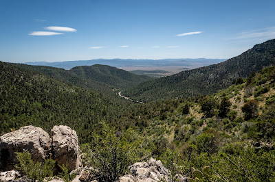
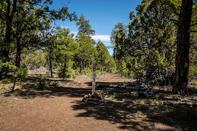
Sunday, May 24, 2020

Camp Verde Part 2

Map of this blog's locations click this link to open the map

One hike we hadn’t had a chance to try when we visited the nearby V Bar V Heritage Site a couple years ago was the Bell Trail. It sounds like a popular hike and since we’ve already seen the petroglyphs at V Bar V (plus they are closed due to Covid 19) we came back for a hike. It’s a 7 mile out and back with only about 500 feet of elevation change so we figure it should be a rather easy hike. It was a fairly crowded parking lot at the trailhead as we set off. The trail was created in 1932 by a rancher to move cattle through the Verde Valley. 


Sign at Trailhead


Starting Along Bell Trail


It was a beautiful clear day but the trail offers very little in the form of shade. The trail runs parallel to the Wet Beaver Creek but we only catch a glimpse of it a couple times over the bulk of the hike. The rock formations to the north of the trail add some visual interest along with the many wildflowers and cacti in bloom. There are even some rock outcroppings with the unmistakable look of Sedona red rocks. There are a couple side trails that head up to the top of the mesa but the Bell Trail is well marked.


Remnants of Wet Beaver Creek

Red Rocks Like Sedona

Hedgehog Cactus in Bloom


At about the 2.3 mile mark is another split. The Bell Trail splits to the left while the Weir Trail heads straight. The sign for the Bell Trail is smaller and not as obvious but we figured it out. The next mile of so has the bulk of the climbing but it wasn’t bad and the views got better as we moved up a few hundred feet. There were the ever present lizards that sometimes stop for a photograph.


Less Obvious Trail Marker on Left


Pretty View Along Trail

Lizard Poses
As we approached the 3.5 mile mark, we could start to hear lots of voices. We had made it to “The Crack”. There were a few dozen people here enjoying what Mother Nature had provided - a swimming hole with some rock walls on either side. Not being a swimmer, I had no desire to scale the rock wall and jump in but the younger people here seemed to have no real fears. We found a spot out of the way but with a decent view of the activities below. There was a group of 4 young kids that provided the bulk of the entertainment. For two of the jumps, I composited several frames showing the jumper at various points in his dive.


Overlooking "The Crack"

People Enjoying the Weather


Three Frames of Same Jumper

Five Frames of Same Jumper

We stuck around long enough to enjoy our lunch and do some people watching as well. As we started to head out, there were several more groups of people arriving. It’s easy to see why it is popular even though it isn’t the shortest hike to get to it.


Heading Back

Interesting Erosion Patterns in Rock


Another day trip took us to the Rim Road (or Forest Road 300). We heard it was a pretty drive and better yet it is a couple thousand feet higher in elevation so it will help us beat some of the heat we have been experiencing in Camp Verde. The road starts about 2.5 miles from the intersection of Highways 260 and 87 along the latter. The Rim Road is over 40 miles long and while there is no requirement for a high clearance vehicle, it was nice to be driving the Jeep in some of the rougher sections.

At about the 1.5 mile Point was something called Baker Butte Lookout. We tend to be suckers for this sort of thing, so we stopped at the pullout and started walking up the several switchbacks on the road up to the lookout. Our goal of getting to a cooler area was obviously granted when we came upon snow! Admittedly it was at a switchback where it had likely drifted months ago but it was still a couple feet deep in spots. At the top of the hill was not only a fire tower but also a small residence. Nobody was home but it looks to be actively lived in. Based on the sign at the base of the fire tower, it might still be accessible by the public although it was currently closed. Bummer!


SNOW!!!!!

Baker Butte Lookout

Very Neat Horned Lizard

Insect Patterns in Log
We had multiple stops along the road. Sometimes for a short hike, or a geocache or a great view from the top of the Mogollon Rim. Pronunciation varies but most locals say “muggy on” Rim. Between all of our stops and the fact the road is not built for speed, it was early afternoon and we had only gotten to the 12 mile mark. There were a few campers out here along the way. Some of them had absolutely gorgeous spots although I’m not sure we would be willing or able to get our rig back here.


Lots of Pines

Edge of Mogollon Rim

Windswept Pine

Rugged Rim Terrain


Another Horned Lizard
We knew we weren’t going to make it all the way to the end of the Rim Road so we stopped at a geocache at the 12 mile point with the plan to turn around there. We noticed a trailhead marker for the Col Devin Trail that included something called the RR Tunnel trail. Intrigued, we got out our hiking stick and headed down the trail along the side of the large ravine.


Sign That Encouraged Us

Heading Down Ravine


The sign had implied the tunnel was only 0.15 miles away. Let’s just say we didn’t see anything remotely looking like a railroad tunnel. In fact, the terrain in the general area didn’t look to be a likely location for a set of railroad tracks. At about a half mile or so, we came upon another trail marker but this one had the tunnel back from whence we came! So we turn around and start trudging back up the hill. At one of the switchbacks, we noticed a small sign on a log. We thought the log was simply to make sure hikers make the turn for the switchback but the sign pointed past the log for the tunnel. This section of trail is only about a tenth of a mile but it is steep (up) and extremely rocky making for terrible footing. The side trail brought us to an area that was even less plausible for a train track. But sure enough after climbing over the last fallen tree, we came upon the hole in the side of the hill. It wasn’t much to see and a bit of a letdown after the effort we went thru to get here. Hard to say how far in it went. We entered maybe 50 feet before we decided without flashlights, proceeding further made little sense. We subsequently looked up info on the tunnel and found that what we found represented the work of 42 men in the summer of 1883. There is a bit of a stone structure near the entrance but it’s not clear what it’s purpose was. The hike back down the steep loose rocks wasn’t much fun and then we had the long climb back up to the Rim. We came across a small group looking for the tunnel and we gave them instructions as well as the suggestion it wasn’t all that special.


There's a Railroad Tunnel Back Here????


I Guess So

Out Building to the Right of Tunnel
With the heat continuing back at camp, we headed up I-17 towards Flagstaff. Some of the trail areas within Flagstaff were closed due to Covid 19 but the Kelly Pocket Trail a bit south of town seemed to be accessible, sounded interesting and had a couple geocaches along the nearly 6 mile out and back hike. This hike would get us back to about the 6800 foot elevation so hopefully will be a bit cooler. Forest Road 237 is just off of I-17 and will take us to the trailhead. While not a great road, we only have about a mile of it to traverse.

The trail works it’s way down along a dried up stream but surrounded by huge Ponderosa Pines making for a mostly shaded hike with just about perfect weather. One of our geocaches took us a bit off trail and after finding it and signing in, we headed back to the main trail a slightly different route. It was then we stumbled upon a 7 foot tall metal sculpture of a cross country skier. Maybe only 50 feet from the trail, I suspect we would have never spotted it since the rusted metal blends in so well.


Starting Down Kelly Pocket Trail

Remote Skier Artwork

Delicate Flowers
The terrain and rock features along the hike were interesting. It was clear from the worn rocks, there can be good water flow here earlier in the spring. A bit further down, we ran into a group of hikers with a dog. The dog looked to be rather wet and the owners told us we would eventually run into water.


Water Worn Rock


Our First Glimpse of Water 
Towards the halfway point, we started to hear many voices and could see a large number of people out enjoying the water. We were a bit surprised to find a fair number of young children and even some large inflatable toys being used. There was no way these families had hiked 3 miles with all this gear! We discovered that FR 237 continues from where we parked and eventually hits State Route 89A. There is another parking area very close to the water along the way which means these people only had a few hundred feet to go for their fun. We enjoyed the hike and didn’t mind the 700 feet or so of climbing to get back to the car.


Coming to the People at the Water


A few days later, we again headed north on I-17 but this time to the much closer town of Munds Park. Crystal Point Loop Trail sounded like a nice hike at about 6.4 miles. But after reading some reviews in AllTrails, the last third of the hike was just on streets thru town. So we decided to tackle this as an out and back hike with the plan of getting out to Odell Lake before turning back.  It was a pretty hike with a mixture of open areas and some forests for shade. We found a few of the geocaches along the hike. We tend to be observant during our outings and were surprised to find an odd collection of brightly colored figures in a rotted out stump along the trail - some fairies, gnomes and even a little RV. Not sure if it had a deeper meaning but it did get us to smile.


Open Woods Near Start of Trail


Strange Figurines Hiding in Stump
We were rewarded with some nice distance views along the way as well as a neat looking lizard and moth. We sat in the shade by the lake and ate our lunch before retracing our steps. We managed to make the 6.4 mile loop into an 8 mile out and back but it was a pretty walk for the duration.


Lizard with Colorful Belly


Colorful Moth

Odell Lake


Crystal Point Track
We have been rather active geocachers for the past 10 plus years with well over 13,000 finds in that time. Caches are given a terrain and difficulty rating (D/T) between 1 and 5 with half star increments. That means there are 81 possible D/T ratings from an easy 1/1 to a challenging 5/5 and everything in between. But even with all of our finds, we are still missing one elusive (for us) D/T - 4.5/4. I don’t always check an area to determine if there is a cache meeting these requirements but I happened to while in Camp Verde. There is one along an ATV trail to the south of the village of Oak Creek. I convinced Chris to spend the morning hiking the three quarter miles up the hill to give this one a go. While maybe not the most scenic of trails it was still a pretty walk. We got to ground zero and I checked my watch. There were bushes, small trees and lots of prickly pear cactus to investigate but after a full hour of looking, we still couldn’t come up with it. I guess it wasn’t meant to be.


Cattle Fence Along the Way

Rocky ATV Trail
We discovered a nice trail system to the northeast of Camp Verde next to the town of Lake Montezuma. The Wickiup Mesa Trail System is relatively new only opening in 2018. There are about 7 miles of trails. We ended up liking the place enough after our first visit for a few geocaches, that we decided to come back a second day for a more serious hike. The first trip took us along an undeveloped trail to the south of the parking area. If you don’t look over at the nearby homes, it looks like you are in the middle of nowhere.


Helpful Map at Trailhead


Overlooking a Large Gulch
There are lots of flowers in bloom to remind us there is beauty to be found if you just look. Next we headed to the north along the Cedar Knoll Trail. It was then that we intersected the Sunset Loop Trail which we decided would be our goal for a second visit. For this trip, we went about half a mile down the Golden Gulch Trail. This is a nice trail with some very scenic views of what we assume is Golden Gulch.


Heading Down Golden Gulch Trail

Overlooking Golden Gulch

More Hedgehog in Bloom
We came back two days later to do the Sunset Loop. There really is no tree cover in this area so we got an early start in an attempt to beat the heat. Getting out from the parking area to the loop and throwing in the Well Vista Trail spur along the way totaled 4.5 miles - not super long and relatively flat. There were tons of flowers in bloom and it turned out to be a rather pretty walk.


Along Sunset Loop


The highlight was the view at the end of the Well Vista Trail. The trail ends at a rock ledge down into a slight valley that makes up Montezuma Well National Monument. We had visited the place back in the spring of 2017 so it was neat to see it from a completely different perspective. Since it is closed, we didn’t see any visitors wandering around. The end of the trail also has a bench and a water bowl for your dog. A nice touch although we believed the boards of the bench had seen better days and may not hold up safely. After enjoying the view and having our lunch, we headed back to complete the Sunset Loop and then back to the car. Quite the nice hike and worth the visit.


View at Overlook

Montezuma Well


Fragile Bench with Great View
Another day trip was up to Sedona. We love hiking in Sedona but the problem is, so does just about everybody. Early in the pandemic, Sedona was getting a lot of visitors wanting to get out of the house but it made for rather crowded trails. We waited until near the end of our stay and picked a Tuesday to ensure there were fewer people out. We picked a combination of three trails that would give us a 6 mile loop on the south end of town. We parked at the Bell Rock Vista trailhead and started north on the Bell Rock Pathway. There were a few people out but it was by no means crowded. The trail heads straight towards Bell Rock before passing by to the west of it. We have done the hike up Bell Rock on a previous visit and Chris didn’t want to challenge her fear of heights a second time.


Heading Towards Bell Rock


Agave Starting to Bloom

Lizard and His Shadow
We eventually intersects the Templeton Trail with its two tunnels to safely get past the busy traffic on State Route 179. The views along this part of the hike are quite remarkable. To the northeast are twin buttes with Chapel of the Holy Cross built into the side of the hill. To the west, you’re looking at Cathedral Rock. We continue west until we intersect the Slim Shady Trail and take a hard left to head south.


Twin Buttes

Cathedral Rock

Chapel of the Holy Cross (look closely at center)

Cathedral Rock
Don’t let the name fool you. There was no real shade to be found on this trail but it is still pretty. We ran into a group of mountain bikers that were managing the terrain remarkably well. We did a few side trails in search of a couple geocaches. As we got further south, we got a different view of Bell Rock and Courthouse Butte. Our loop, with diversions, came in at 6.5 miles. So glad we were able to make it back to Sedona.


Coming Back Towards Courthouse Butte and Bell Rock
Another day trip was to Page Springs. It’s a small place just to the north of Camp Verde. There are a few wineries and hatcheries in town but not a whole lot else. We stopped to do a short hike on the south side of Page Springs Hatchery. Our route ended up bringing us to Page Springs Cellars. There were more people here than we would have expected. We stayed long enough to find a geocache but not enjoy a glass of wine.


Seeds Ready for Flight

Oak Creek Flowing Thru Page Springs
The plan was to find a picnic spot at the hatchery and have lunch before exploring the place. Of course it was closed for Covid 19 so we had to go with plan B. Less than a mile down the road is Bubbling Ponds Hatchery. They were open so w pulled into the parking lot and had lunch before exploring. We subsequently found they had a nice covered picnic area that would have worked even better. The hatchery has a nice loop trail on the property - Black Hawk Trail. It’s about a mile and a half and is a pretty walk. It eventually comes back around to the hatchery ponds. Being true ponds instead of large tanks like some hatcheries, it was hard to tell what kind if any fish were being raised.


Along Black Hawk Trail

Large Hatchery Pond

Quack, Quack!
Our last day trip out of Camp Verde was a drive up to Clarkdale and Jerome. We have visited both before but knew there were more things to see and do. In Clarkdale, we stopped for a geocache that happens to be in the quaint downtown area. During our last visit here, we really only came to do the train ride on the Verde Valley Railroad (highly recommended) and hadn't even bothered to check out the town. The Arizona Copper Art Museum looks like it would be a fun stop but was closed. We wandered around the outside a bit to see the outdoor displays. The signs out front were constructed of pennies. For some reason the one in the shape of the Arizona was entirely of 2015 pennies! The old time gas station just up the street from the museum had the best fuel prices we have seen in a long time - $0.219/gallon!


Lots of 2015 Pennies

Fill 'er Up
From here we drive up the 1600 feet of elevation change to the town of Jerome. The Jerome State Historical Stop is worth a visit. Having done it before and it being closed right now, no chance for a return visit. Instead we go to an historic cemetery in search of a nearby geocache. The location is rather picturesque with views of town. There is some impressively big manufacturing plant down below which I later discover is a cement and aggregate facility.
RIP M Balzano


Cement Plant
As we drove thru the touristy section of Jerome, we were surprised to see so many people out and about. Having done sightseeing here before, we go thru town and continue up into the mountains. In our past visit, we had gone a little ways up SR 89A but not very far. We wanted to explore at least some of the wonderful hiking trails in the mountains.  Our goal was Trail #28. This trail is part of the Yaeger Canyon Loop. Doing the full loop was 5.6 miles with over 1500 feet in elevation change and we weren't prepared for that much of a hike. There were several geocaches along the trail and initially the plan was to go far enough to just get the caches.

At Trail #28 Start

Cactus Growing in Rocks
The trail is all uphill from the start but not so steep as to be a huge deal. It basically follows up one side of a large valley. The views kept getting better as we made the climb. At one point we ran into a couple heading back down. They had not done the full loop but commented on going as far as "the rock outcropping". With their incentive, we pushed on and up with lots of switchbacks along the way.

One of the Switchbacks
Of course we weren't positive what rock outcropping we should be looking for, but at one point in the distance we saw what had to it. Sticking prominently out from the side of the hill with a large dead tree off to the side. We eventually made it there and stopped to take in the view. 
The Rock Outcropping

And the View From It
This should have been our turning around point, but by going this far, we were now less than half a mile from another geocache. I convinced Chris that we had less than an additional 300 feet of elevation if we went for it and she conceded. Once we made it up to the top, the trail was level and quite nice in the open woods. We came upon Trail #111 which would be the second half of the Yaeger Canyon Loop but our geocache goal took us more to the northeast. We got to ground zero of the cache and started looking, and looking, and looking. After twenty minutes we decided it wasn't meant to be and turned around. We took the known route back along #28 instead of #111. Even though we didn't do the loop, we got in 5 miles but enjoyed the hike.

Big Lizard


Intersection with Trail #111

Heading Back Down
With our summer travel plans definitely out the window, we were trying to figure out what would be next for us. We knew Camp Verde was going to be too hot for our liking. With all the uncertainty around campground closures, the ever changing rules around travel and even what attractions would be open, we opted for a longer term solution. We discussed the option of buying a RV lot somewhere so we have a place to call home in situations like we are in. As Florida residents, it might be best to get a lot somewhere in that state, but we didn’t think the idea of summer in Florida humidity sounded very appealing. We considered heading back east to where I have family in Ohio, but at the time we were thinking about it, all campgrounds there were shut down and figured having that uncertainty hanging over our heads wouldn’t work out well.

So we did a bit more investigating and decided that the area around Show Low Arizona might work out. Because of the elevation (~6100 ft), it stays 20 to 25 degrees cooler than Phoenix or Tucson. There looked to be some good hiking and mountain biking in the area as well. Chris discovered an ownership RV resort just north of town. There were several lots for sale but a few of them were for rent as well. We spotted one that looked nice and called the owner. She is widowed and has sold the fifth wheel she and her husband had lived in. She had been having trouble selling the lot so decided to rent it by the month. We signed up for 4 months which will cover us thru late September. From what we could tell, it’s a nice place with decent facilities although most of them are closed pending Arizona relaxing restrictions. Only time will tell how it will work out, but at least we will have the peace of mind having a long term place to call home.

No comments:

Post a Comment