Our next stop after Clarksville Tennessee was going to be Cape Girardeau Missouri. It looked like there may be some things to see in the area but the real reason for staying here was the Elks Lodge in town. We had heard good things about the camping area right next to a lake. They have full hookup sites with a beautiful view. We figured if all we ended up doing was chilling at camp, we would still enjoy the stop. We had 5 nights to use up before we make our way to the St Louis area to have the motorhome get its annual service. The drive was about 175 miles but when we plugged in the address for the lodge, our Garmin GPSr was adamant about the route we should take which was 235 miles.
Since the Garmin is one that we can configure with our rig’s height, length and weight, we assumed it knew the proper route but it seemed like a rather roundabout way to get where we wanted to go. Admittedly we were near both the Ohio and Mississippi Rivers so we knew there would be some bridge crossings. Fortunately we checked our route the night before we left so we could investigate other options. We searched DOT sites for the 4 states we would be driving thru (TN, KY, IL, MO) and didn’t find any real issues with bridge closures or the like. I even went as far as “driving” the bridges over the rivers in Google street view and didn’t see any issues. We ended up getting out our old GPSr and used that to help direct us on the route we wanted. We don’t often go against our RV specific Garmin but saving an hour or so of travel time was worth the effort. For much of the drive, I was constantly pleased to see tractor trailers heading in the opposite direction we were traveling. This meant the road would be safe for us to travel on as well.
We got to the lodge and went in to check out the camping situation. Even though they have 12 sites with hookups and we were arriving on a Tuesday, several of the local members had reserved spots for the upcoming weekend. This meant there were only a few spots available for our full stay. The problem with many of the sites was the severe slope. Travel trailers and fifth wheels are better able to deal with unlevel sites than a motorhome can. I have a gizmo installed that allows me to see how far off from level we are. Backing into the first spot we picked, the rear end was low by 11 inches! We carry some leveling blocks but not nearly enough for that much elevation difference. We ended up pulling forward into another available spot and found we were able to make that one work. The other benefit of pulling into the site was our windshield was overlooking the lake. We spent the first night with just one other rig quite a distance away - it was very peaceful.
Our Spot Overlooking the Lake
Elks Lodge on Opposite Side of Lake
The following day, rain was expected later in the day but we wanted to get out and explore some of the area. Cape Girardeau is right on the Mississippi River about 30 miles north of where the Ohio River flows into it. Just across the river is Illinois and Kentucky is on the other side of the Ohio. We figured we could make a big loop and both explore the region and find some geocaches in counties we haven’t been to before. The first crossing of the Mississippi north of us is near the town of Chester Illinois. There is a small welcome center with an overlook of the river and bridge across the river. We stop to check things out. It turns out that the creator of “Popeye” was born in Chester. Small towns like this will use any famous resident to put them on the map.
Entering Chester Illinois
Popeye Statue
Chester Bridge Over Mississippi River
We happened to be there when a tug boat and barges were heading upstream on the Mississippi. It’s a pretty impressive sight. There were 20 barges linked together (4 wide by 5 long). It was clear the tug boat needed to use most of its power to push the load upstream.
Tugboat and Barges Head Upstream
The "Brad Bennink" Tugboat
We continued our loop drive and picked up a few more caches (and counties) before getting to the town of Cairo Illinois - the confluence of the Ohio and Mississippi Rivers. Fort Defiance State Park is right at the southernmost tip of the state. The sign at the entrance mentions not entering when flooded and from the looks of the mud and debris, I suspect this is a rather frequent occurrence. Fortunately both rivers were well confined to their banks so we could go in and look around. There is a small, raised observation deck that gives a decent viewpoint of the confluence. While not the prettiest of parks, it was sort of neat to see. We tried to get a geocache just across the Ohio River in Kentucky but the closest one was down a flooded road and we decided to “turn around, don’t drown!” We crossed back into Missouri and got another cache or two before heading back to camp and some light rain.
View from Deck - Ohio from Left, Mississippi from Right
View of Observation Deck at Fort Defiance
The following day was overcast but dry. We drove into downtown Cape Girardeau to take a look around. The is flood wall more than a mile in length all along the historic downtown. Built in the late 1950’s to mid 1960’s, the wall and associated levees protect the town from flooding from the Mississippi River. There are several large flood gates that stay open most of the time to permit people to explore the walkway on the river side of the wall. Each side of the wall has very elaborate murals painted on them. Those on the inside depict the history of Cape Girardeau from Native Americans back in 1200 to nearly present day. Each mural has an interpretive sign describing what was taking place here at significant points in time of the town.
Large Mural on Flood Wall
Outside of Flood Wall
Massive Flood Gate
1803 Mural
1880 Mural
We continued our walk to the south to check out the large suspension bridge across the river. The River Campus of Southeast Missouri State University is located up on a hill overlooking the river. It’s a cute little town but it’s clearly a college town given the large number of bars and restaurants in the area. Turns out Cape Girardeau was where the movie 'Gone Girl' was filmed even though in the film, the action took place in the fictional town of North Carthage Missouri. One evening during our stay, we watched the movie again to refresh our minds. There were several scenes of places we recognized including "The Bar" - an actual bar in Cape Girardeau. We didn't feel obligated to hunt down all the filming locations like true fans might.
St Vincent's Catholic Church ca 1853
Bill Emerson Memorial Bridge Over Mississippi River
After we tired of walking around town, we headed back to camp but stopped first at Cape County Memorial Park Cemetery. Not to find a geocache or search for some distant relative buried here, but to see peacocks (technically peahens and peacocks). We found it to be a rather strange combination and we never did discover why they are there but we had heard about them and thought it may be worth a stop. There is a small building that some of the birds were hanging out but the real action was in the outdoor exhibit surrounded by chain link fence. There were a few peacocks and peahens out and about.
Tower at Cemetery
Closeup of Peacock Inside Shelter
Beautiful Plumage
Some children were there and were feeding them corn purchased from the convenient dispenser next to the cage. Two of the males were strutting their stuff trying to impress the females. The hens were more interested in the corn. I’ve seen peacocks before but these guys were really “working it”. Not only did they have their plumage on full display but periodically they would shake their feathers at the hens. It was quite interesting to watch. Besides lots of pictures, I took some video thru the fence of the action.
Peacock Displays Feathers
Perched for Tail View
Hey Honey, Look at Me!
Peacock Video
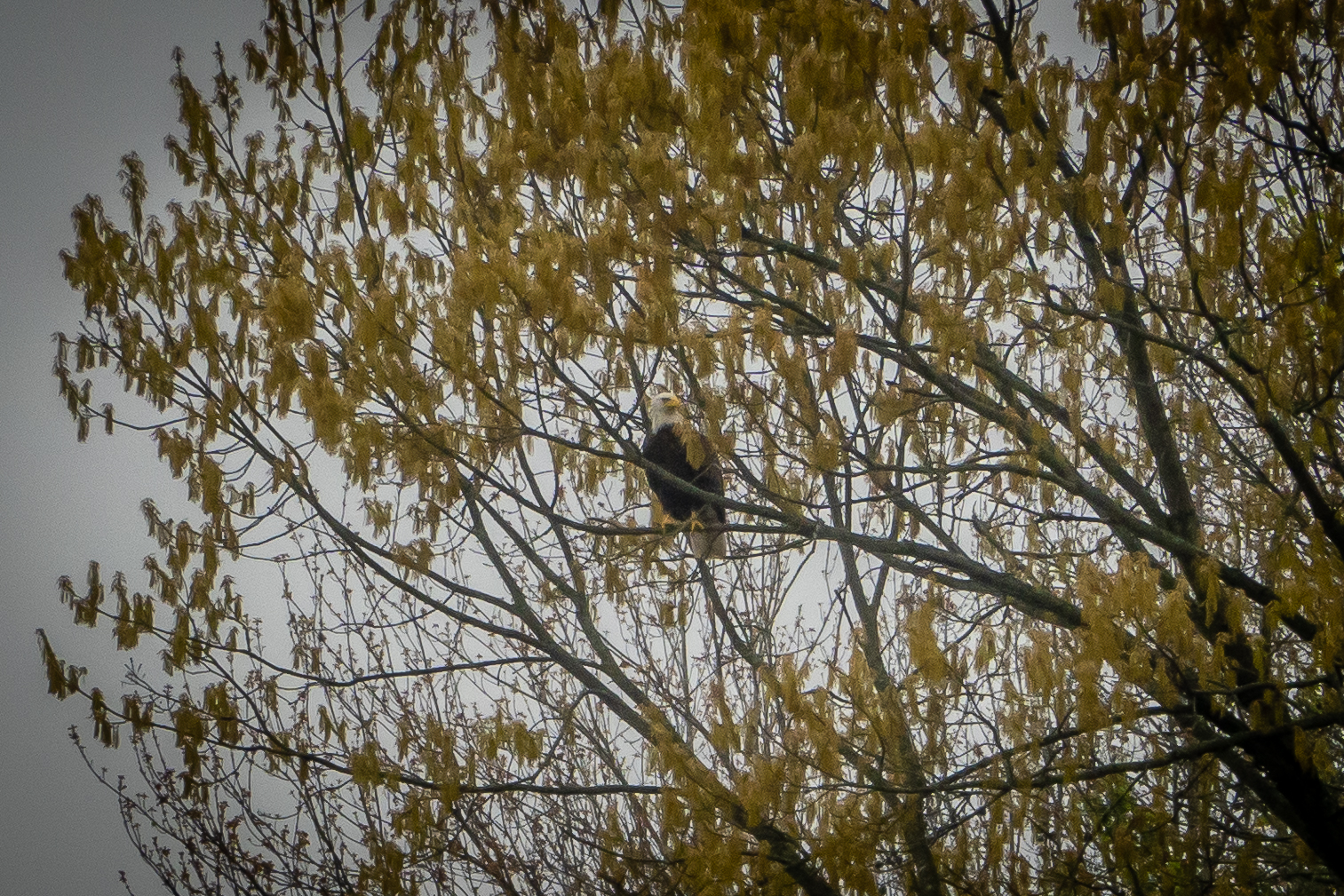
We are enjoying the solitude of Lake Hollenbeck behind the Cape Girardeau Elks Lodge. The only other person there the first couple of nights must be a local because they would leave early in the morning and come back around dinner time. We spotted a bald eagle flying around and landing in a nearby tree. I didn’t have time to get out my long telephoto lens but did get a picture of it perched in the tree. One morning I spotted a couple dozen cormorants on a dead tree fallen in the lake. After taking the picture of the birds, I realized there were many turtles up on the log as well. After the birds flew away, I got a picture and counted 28 or 29 of them.
Bald Eagle Just Visible
Lots of Cormorants
Turtle Party!
Another day trip took us west of camp to Bollinger Mill State Historic Site. It’s only about a 15 mile drive. The original mill on this site was built in 1800. It was rebuilt in 1825 with a limestone foundation that still exists today. The mill was burned down during the Civil War and yet again rebuilt, this time with brick and completed in 1867 and this is what still stands here today.
Bollinger Mill Entrance
Large Building
There is a major construction project taking place to shore up the foundation so the water from the Upper Whitewater Creek is not flowing thru the mill, it it was still a nice place to visit. The covered bridge next door dates back to 1868. The mill was open the day we stopped so we could explore but just the first floor and the basement. There lots of old equipment and the drive mechanism to transfer the water power via gears and belts to the various machines was rather involved. It was rather dark in the basement and without flowing water, we could only imagine how things worked.
Milling to Different Fineness
Large Drive Mechanism
Basement Level
Back outside, there was a cat that seemed to be interested in us and followed us around as we went thru the bridge and checked out the mill from the other side.
Heading Thru Covered Bridge
Water View of Mill
Pretty Bridge
After visiting the mill, we had one more place Chris had scoped out. The Pinecrest Azalea Garden is north of the mill close to Oak Ridge MO. It’s a private residence on 52 acres of land that the owners have turned into a beautiful park-like setting. As the name implies, the bulk of the plantings are azaleas but there are other plants and flowers as well as mature trees. We were just a little early in the season for most of the plants, but there were still plenty of plants in bloom.
Some Bright Red Ones Snuck In
There are numerous walking paths thru the gardens and there weren’t really signs to suggest a direction of travel to see everything, so we simply wandered. Most of the grass pathways were lined with daffodils in bloom. We likely only spent 30 minutes to wander the obvious parts of the gardens. We saw a very nice small pond with a gazebo but as we approached, there was a “no trespassing” sign so we assume it was on a neighbor’s property. If we had passed thru the area a couple weeks later, it would have been even more beautiful.
Pathway
For our last full day in the area, we wanted to get in a bit of a hike. The weather had turned much nicer so we headed to Trail of Tears State Park just about 10 miles north of camp. The park is dedicated to the forced relocation of American Indians between 1830 to 1850 as they were removed off their lands back east and moved to reservations in present day Oklahoma. The route taken had them crossing the Mississippi River thru this area. There are several hiking trails in the park and originally we planned to hike two of them. The first was Sheppard Point Trail - a 3.6 mile out and back hike with 640 feet of elevation gain.
Trailhead
Bridge Near Beginning of Sheppard Point Trail
Tree in Bloom Along Trail
It was a pretty walk with lots of flowers and trees in bloom. The May apples were in bloom which reminded us of our former property in western NY where we had tons of these plants. There were also a lot of trillium starting to bloom. The ones we spotted along the trail were a bit different than those we are familiar with deep red flowers. They might look a bit different simply because no of them had fully opened up yet, but nonetheless they were pretty.
May Apple in Bloom
Trillium
Bellwort
Another Trillium
Phlox
Given the name of the hike, we were expecting an overlook with an expansive view of the river below. In that regard we were a bit disappointed. There are two spots near the end of the trail where we could see the river but with all of the trees along the ridge, it wasn’t the best of views. The terrain had taken more out of our legs than we expected so by the time we got back to the car and ate lunch, we weren’t feeling ambitious enough for another hike.
Down a Steeper Section
Ho-Hum View at Sheppard Point
A Resting Spot
We drove down to the boat ramp and camping area right nest to the river. As we were checking out the view, another tug and 20 barges were passing by. This one was heading downstream and was moving right along.
Barge Heading Downstream at State Park
Closeup of "Kay A Eckstein" Tugboat
We head to the visitor center next to see some of the displays that gives great detail about the Trail of Tears. We asked the ranger a question about flowers we saw and ended up talking with him for more than 20 minutes. He suggested that if we want to get a good view of the river, we should do the simple option - drive up to the scenic overlook and walk the few hundred feet along the walkway to the viewing platform. We headed there next and the view was much more like I had hoped for on our hike. So if all you want is the best view of the river, head to the scenic overlook and skip the long hike. We got the best of both worlds, a pretty hike and a pretty view just not combined.
Visitor Center
Trail of Tears Transport
Owl Comes in for Food
Heading Out to Scenic Overlook
Looking Downstream
Looking Upstream
By Friday night, the camping area at the lodge was nearly full. Most of the campers were local lodge members out for a nice weekend by the lake. It got a little noisy but we got a chance to meet some of the people in the evenings. There likely is much more to see in the area but our 5 nights were coming to an end and we need to head north towards St Louis.


No comments:
Post a Comment