Map of this blog's locations click this link to open the map
Continuing on with our weeklong stop in Brevard North Carolina with a preview of the falls our next hike will bring us to.
 |
| Cove Creek Falls |
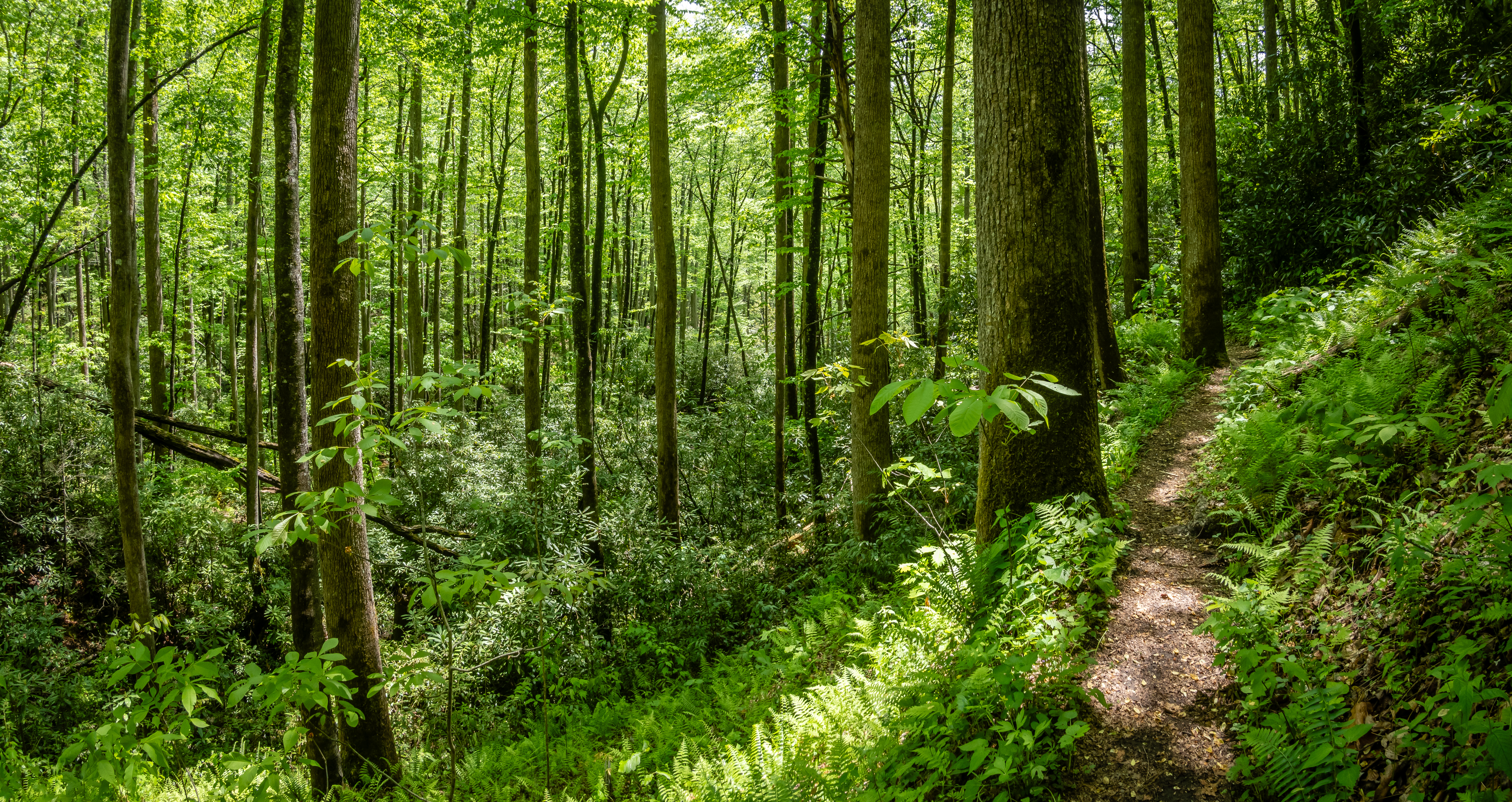
The next day the weather forecast was a bit more promising so we head into the Pisgah National Forest for a popular hike - the Cove Creek and Caney Bottom Trail. This is a popular 4.6 mile hike with 600 feet of elevation gain. The parking area supposedly fills up fairly early in the morning so we get out earlier than usual. We get to the parking area and it was already full but the overflow lot a tenth of a mile further down Forest Road 475 still had open spots. The trail starts heading up the gated gravel road to the Cove Creek Group Campground. The gate was open and somebody was directing traffic into the camping area. It was a pretty walk with lots of wildflowers along the road and a view of the creek. It appears that this section of the road was recently rebuilt from some previous flood damage.
 |
| The Start of Cove Creek Hike |
 |
| New Bridge Over Creek |
 |
| Crimson Clover |
 |
| Small Falls Along the Way |
About a half mile up the road is the turn on the left for the actual Cove Creek trail. We continue a rather steep ascent getting a view of the group camping area below. There are quite a few cars down there. Along the trail, Chris spots some flowers that she was familiar with but has never come across in the wild if you don’t count formal gardens or arboretums. Pink lady’s slipper is a member of the orchid family and is pretty large and quite attractive.
 |
| Turn onto Hiking Trail |
 |
| Pink Lady's Slipper |
Around the 1.2 mile mark is a side trail down to Cove Creek Falls. It was steep and slippery descent and after trudging up the hill, I didn’t like the fact that we were giving back some of our elevation gain especially since we would need to come back up in a short time. But it turned out to be worth the extra effort. The falls were rather pretty with about a 50 foot gradual drop. There were two women here when we arrived and when we looked at each other we realized we had met them under the picnic shelter at High Falls waiting out the storm yesterday. If I were them, I might wonder if we were stalking them to run into them on another trail when the area is full of hundreds of trail and many dozens of waterfalls.
 |
| Cove Creek Falls |
While Chris sat and talked with them, I searched for a nearby cache. This one was placed back in 2001 so it is 23 years old which is pretty impressive. I needed to crawl into a small cave in order to find it but I managed to do so without getting too dirty or finding some critter living in the cave.
 |
| Small Cave with Geocache |
We head out from the falls and continue north up Cove Creek Trail. Around the 2.5 mile point we reach the peak of the hike and start our way back down crossing over the creek at a foot bridge. |
| Vibrant Shelf Fungi |
 |
| Star Lily |
 |
| Bridge Crossing Creek |
At roughly the 3.5 mile mark we come to the intersection with the Caney Bottom trail which will lead back to the south on the eastern side of side of the creek. On this trail we get a view of the Caney Bottom falls. They may not be as impressive as the earlier falls but still worth the effort to do the loop to see them both.
 |
| Heading Down Caney Bottom Trail |
 |
| Views of Caney Bottom Falls - Normal Exposure |
 |
| Views of Caney Bottom Falls - Long Exposure |
This section of the loop trail is much more secluded as it winds thru the woods. We eventually work our way down into the group campgrounds where you will find pretty nice vault toilets. There was a group of people milling about and they all had bright safety vests on. They didn’t look like your typical group campers so we stopped to talk with them. Turns out the large group was here from some organized fishing group and they were volunteering to help some biologists with some treatment for hemlock woolly adelgid. This is a bug we are familiar with from our days back in western New York State. We did a program at Cornell University as they were trying to come up with methods for controlling the big to help save the hemlock trees. By coming thru the campground we did run into one section of the road that was flooded and we needed to carefully walk across some stepping stones off to the side. This was an excellent hike with a couple of falls along the way.
 |
| Beautiful Hike in the Woods |
 |
| Deep Red Trillium |
 |
| The Most Challenging Water Crossing on the Road! |
Chris had noticed on her trail map that right near the parking area for the hike was another set of waterfalls. We hadn’t scoped them out but they looked like they should be close to the road so it was worth the time to see what they looked like. Whaleback Falls turned out to be a rather popular place and was tough to get pictures of without lots of people.
 |
| Whaleback Falls |
Back at the car we decided to drive 3/4 further down FR 475 to the Daniel Ridge Parking area. There is a 4.5 mile loop trail from here that sounded good but maybe not after the 6.5 mile hike we already completed. However, just a half mile from the parking area is Tom’s Spring Falls. We figured our bodies could muster another 1 mile to check out the fourth falls of the day. The trail up to the base of the falls is a wide gravel service road. It does gain 100 feet in the half mile but is a relatively easy walk.
 |
| Starting Up Daniel Ridge Loop Trail |
 |
| Creek View |
The falls were about 100 feet tall so they were actually pretty impressive. The view from the main trail does have a fair amount of trees and brush blocking the view but there is a short steep side trail that gets us up close to the fall from the left side.
 |
| Tom's Spring Falls - Shot 1 |
 |
| Tom's Spring Falls - Shot 2 |
 |
Closer View of Falls
|
The map we have makes it look like the loop trail would get us to the top of the falls but it wasn’t clear what the view would be like and we didn’t have the energy to do it so we just head back to the car. As we were driving through Pisgah Forest, we went right past the ranger station. It appeared to be open so we made an impromptu stop to check it out. The ranger we spoke with was full of useful information about other hikes in the area. In fact he gave us more suggestions than we would have time to accomplish.
 |
| Azure Bluets |
 |
| Some Sort of Berry in Bloom |
 |
| Pisgah Ranger Station |
I had my eye on a hike out to Twin Falls which is also in the Pisgah Forest. My original plan was to follow an AllTrails loop trail that went up Buckhorn Gap and came back on Clawhammer Trail. It was listed as a 6.6 mile hike with about 850 feet of elevation gain. But after talking with the ranger yesterday, he had some insight that made us rethink our plans. The most important thing he told us is that Avery Creek Road which we would need to drive to the trailhead was closed beyond the Pisgah Forest Stables. This meant we would have 2/3 mile extra in each direction of the hike. The other thing was that the Clawhammer section was not as pretty and used heavily by mountain bikers so there may be more traffic to contend with. We opted to follow his advice and headed out to the large parking lot near the stables and start the long walk up the steep road.
 |
| Road Closed Near Stables |
 |
| Shelf Fungi |
At 0.7 miles, we take the right hand split from the road onto Avery Creek Trail. It drops down towards the creek before we need to start climbing again. It was a pretty trail right along the creek so the ranger was right about that aspect of his suggestion. What he neglected to tell us was how many times the trail would switch from one side of the creek to the other. The first crossing was the most challenging one. A downed tree of about 16 inch diameter was laying just above the waterline and supported on each bank of the river about 20 feet across. The water wasn’t real deep - maybe 10 inches. And it wasn’t moving all that quickly so the safest approach would be to just walk across the creek. But the water would come up over our boots and we would have soaking feet for the remainder of our hike.
We decided to see how good our balance beam game was. We weren’t looking for style points on the mount or dismount. We simply wanted to get across without falling. Chris went first. She started out reasonably well and got halfway across before things turned bad. The log was high enough above the water and the creek deep enough that her hiking stick was of no use in providing additional stability. Sensing that she was going to perform her dismount too early, she opted to drop down to a sitting position. Her feet were out of the water as long as she kept her knees bent. It took her some time to scooch across the log but made it with dry boots. For my attempt, I extended my hiking stick as far as it could go and started across. If I bent over far enough, the stick could just reach the bottom of the creek and give me the extra balance needed to make it across myself. At the opposite side, a “bridge out” sign states the obvious!
 |
| Chris' Unusual Approach |
 |
| Now They Tell Us! |
A little over a mile into the hike, we reach Avery Creek Falls. It was pretty but we didn’t feel the need to see if we could safely go down the steep bank from the trail to get to water level.
 |
| Decent View of Avery Creek Falls |
 |
| More Shelf Fungi |
For the next 2 miles or so of gradual uphill hiking, we needed to cross the creek numerous times. Some of the crossings had a very substantial and new looking wooden bridge. While others had a log cut down the middle to provide a relatively flat surface and even had a handrail. A few of the “bridges” were in really rough shape and looked like we should definitely take turns since they likely would not support the two of us.
 |
| A Nice Bridge |
 |
| A Decent Bridge |
 |
| A Questionable Bridge |
There were several crossings where there was no bridge. Each of these seemed to have at least two “options” for crossing. We would check out the first one and try to envision how we may hop from rock to log to rock and get across. Often we would conclude we should check out the second option 30 feet further up the creek only to realize that while the first choice wasn’t great, it was the lesser of two evils.
 |
| No Bridge |
 |
| Trillium |
We arrived at Twin Falls after 3.4 miles of hiking. It was a challenging hike but we felt accomplished for still having dry feet. They are called twin falls because there are two distinct water falls separated by a couple hundred feet. This worked out to be a great spot to stop and have our lunch. The falls sound very impressive but they are very hard to get a decent look at. The one to the left was much easier to see in their entirety. The one to the right was always behind more trees regardless of how close I tried to rock hop.
 |
| Left Side of Twin Falls |
 |
| Right Side of Twin Falls |
There is also a geocache hidden nearby that was placed in 2003. It was in between the two falls and required my crossing the water yet again to get close enough to look. It hadn’t been found in over 2 years so I wasn’t too optimistic that I would find it but I lucked out and found it in pretty good shape given its age. From the cache I was able to get closer to the left hand falls for an even better look.
 |
| Another Angle of Left Side |
 |
| Decent Flow |
It took some time to retrace our steps and perform all of the water crossings a second time. At about the 5 mile mark we make it back to Avery Creek Road. We knew there were a couple of geocaches up the road as well as something called Upper Avery Creek Falls. We decide to take the one mile detour with an additional 233 feet of elevation gain to check them out. We did find the geocaches but the view of the falls left a lot to be desired. They sounded impressive but we saw no safe way to get down into the valley for a closer look.
 |
| Using Fallen Tree to Cross Creek |
 |
| Upper Avery Creek Falls |
It was at this point that we heard a terrible sound. A clap of thunder and it sounded fairly close. This hike had been a beautiful woods walk, but by being in deep woods, we never really had a view of the sky to see that dark clouds had likely rolled in. We were about 2.5 miles from the car. Had we skipped those last two caches and the mediocre falls, we would have saved 2 miles and likely would have been back to the car when the storm hit.
 |
| Colorful Beetles on Fungi |
 |
| Blue-eyed Grass |
The good news was our hike should be almost all downhill from our current location but the car was still pretty far away. We were already 6+ miles into our hike so the legs could only move so fast even if it was going downhill. When we got to the point where we could take the Avery Creek Trail we had come up but that would mean we would have to repeat all of the water crossings, we decided to follow the road figuring there are likely bridges at any creek crossing. Plus if it did start to rain, we would have better footing on the gravel than on a single track hiking trail. We made it 2 of the 2.5 miles back to the car before the skies opened up. It poured, big drops and by the time we made it to the car, we looked like two drowned rats. Even our boots, that we had so carefully kept dry for the majority of the hike, were completely saturated.
We had a rather rainy start to our last full day in Brevard and it looked like we wouldn’t make it out. But after lunch, the rain had passed and it started to brighten up. We didn’t have a full day to explore but we wanted to get out for one more hike before heading out. Just north of Dupont is Holmes Educational State Forest. There are over 4 miles of hiking trails and it even had a geocache hidden on the grounds. It’s a short drive from camp so we decide to give it a try.
 |
| Entrance to Holmes Educational State Forest |
The main trail in the park is the Demonstration Trail - 3 miles in length and 500 feet of elevation gain. But there are also several shorter trails and the Talking Tree Trail sounded interesting so we head there first. Just off the parking lot is a cross section of an extremely large red oak tree. I suspect it used to have dates identifying some of the rings and what was was going on in the world at the time. While it wasn’t as big or old as some we saw out west, this one had to be over 200 years old.
 |
| 200+ Year Red Oak |
 |
| Meeting Room in the Woods |
The Talking Tree Loop has seven trees along its half mile loop that have a device that tells visitors about this particular tree species. The sign at the start of the trail warned us that several of them no longer work and they are in the process of getting replacements. It was a pretty trail and 3 or 4 of the trees were able to talk to us. There were quite a few spring flowers in bloom. I’ve always been a sucker for trillium so the walk is slow going as I stop frequently to take pictures.
 |
| A Talking Tree |
 |
| Possibly a Wood-lily? |
 |
| Trillium |
 |
| Solomon's Seal in Bloom |
 |
| Another Trillium |
Next we head over to the starting of the Demonstration Trail. The first 3/4 miles or so is a good climb. Even though we had gotten a lot of rain in the past 24 hours, the trail was in pretty good shape with only a few muddy places.
 |
| Off to the Demonstration Trail |
 |
| Bright Azaleas |
We had headed around the loop in a clockwise direction to get us to the one geocache hidden in the woods early in our hike. The cache hadn’t been found in 2 years but we found it hiding in an old stump easy enough. The surprising thing was the tall and round lock and lock container was almost completely full of water and even the couple of plastic pens were floating like colorful bobbers. The container didn’t seem to have a hole and the lid seemed to be secure so it wasn’t clear why it was full but it did require a bit more effort on our part to dry things out as best we could before continuing our hike.
 |
| Another Trillium |
 |
| Pens Floating in Geocache |
We knew the place closed at dusk and when we reached the Shortcut Trail, we decided that we should probably take it and save about a mile. When we got back to the parking lot, it looked like a worker was cleaning the restroom for the day and wanting to lock the place up so it was probably a good thing we took the shortcut. We ended up getting in around 4 miles or so in total and enjoyed the visit to Holmes.
 |
| Caterpillar Dangles Over Trail |
Just like the last time we stayed at this spot in Brevard, the week seemed to fly by we felt like there was so much more to see and do in the area. We drove thru a newer campground on our way back home to see if this one might work out for us during a future visit. It looked pretty nice with large level sites. We might need to come back and do a monthly rental so we can fit more of the hiking and possibly try some mountain biking trails. We will now continue north. We have 3 nights to work our way from Brevard North Carolina to Martinsburg West Virginia for a planned 2 week stay. More next post.


No comments:
Post a Comment