Map of this blog's locations click this link to open the map
We’re about half way into our two week stay at Cherry Creek SP just outside of Denver in Aurora Colorado. It’s a pretty nice campground with full hookup sites. The park does have a lot of trails but for the most part they are fairly flat and not all that interesting. The better hiking is about 20 miles to the west in the foothills. Since we know we will have ample hiking opportunities in the next few stops we have planned, we don’t spend a lot of time on the trails here. That doesn’t mean there aren’t other things to see in the area. Chris wanted to visit Denver Botanic Gardens so we reserved our tickets online for Friday morning. It isn’t too far from camp being on the outskirts of downtown on the same side of town as us. Parking spots were hard to come by but we found a spot a couple blocks away at a city park.
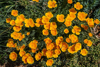
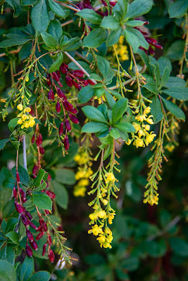
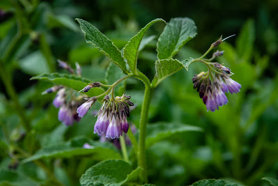
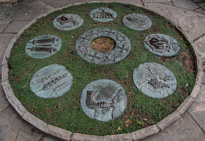
It was pretty crowded near the entrance building, but once inside the 24 acre garden, we found it didn’t seem too packed especially given how nice of a day we had from a weather standpoint. The temperature was expected to get close to 90 degrees later in the day, so we planned to check out the bulk of the outside gardens while it wasn’t too hot and head inside the several buildings during the heat of the day. The outside garden area is the majority of the property and figuring out a route that will take us through all the individual areas without a too much backtracking proved to be challenging. I didn’t attempt to keep track of the various plants and flowers I photographed so I won’t try to document them in this blog. I took nearly 150 pictures and ended up with quite a few “keepers”. We enjoyed the beautiful flowers maintained by a large group of gardeners.
There is a large sunken amphitheater near the entrance. I imagine there have been quite a few performances held there over the years. Today it was mainly being used by young children to burn off some energy.
 |
| Amphitheater |
 |
| Columbine |
One corner of the grounds has both the bonsai area and the Japanese garden. I typically like checking out the bonsai plants since it seems like incredibly tedious work to train the plants to grow how you want them. Not far from these gardens is the cactus & succulent house.
As we continue around the outer perimeter of the gardens, we are continually amazed my some of the flowers we are seeing. Obviously a large number of them are not native to Colorado. We came upon a couple of gardeners working one of the beds and we stopped to talk with them. We were curious how the place and the plants handled the heavy, late season snow. Apparently a large number of the plants that are in pots were brought inside some of the buildings to help them cope. It sounded like the damage wasn’t as bad as they were first expecting. In any case, we really weren’t seeing any of the after effects of the snow storm.
One section of the gardens was closed off to the general public. From the looks of things, there was a wedding reception being held there. For the short time we walked by, some violinists were playing soothing music. We attempted to head back to that area later in the day to see the flowers and plants but the party was just finishing up and they still needed to clean up the place. One of the trees along a path caught our eyes. Not for the leaves or flowers but the bark. It was rather colorful and unique looking.
 |
| Bark |
 |
| Mini Pumpkin? Pepper? |
There are a few buildings on the Denver Botanic Gardens grounds. The Science Pyramid is by far the most unusual design. Inside there are all sorts of interactive displays but the place was overrun by kids when we went inside so we didn’t really explore things too much. The Waring House in the southeast corner of the gardens is a very pretty building from 1927. It doesn’t appear to be open to the public but does have some nice gardens. On the north side of the gardens is the Freyer-Newman Center. This large building houses many different functions. An art exhibition was on display in several of the large rooms. I wasn’t sure taking photos was permitted so I don’t have any pictures of the artist’s work. Many of the pieces featured “cow intestines” which extends the definition of mixed media art to a whole new level!
If you really explore the gardens, you’ll find it is easy to spend well over 5 hours. There were likely places we missed but we find walking at a slow pace in a garden like this is just as tiring as a long hike in the woods. We took a break mid afternoon for some lunch at one of the two restaurants on site. We really enjoyed our visit here and highly recommend it if you’re in the area.
I have another friend that lives in the Denver area and we decided that our stay at Cherry Creek was the most convenient stop for us to get together. I’ve known Diane for almost forever. She was a good friend and classmate with one of my older sisters. She had attended college to become a teacher and as luck would have it, her first teaching job was my sixth grade teacher! I suspect not many people could even name their teacher from a specific grade school class, let alone keep in touch with them for decades to come. We met for lunch at a restaurant in Littleton and since we arrived a bit early, we wandered around town a bit to check it out and get a couple geocaches.
Neither of us was positive when we last saw one another but suspected it was either at a wedding or a funeral on the order of 20 years ago. Needless to say, we had a lot of catching up to do. We spent several hours at the restaurant but we finally realized the dinner crowd was arriving and they could use our table. We continued our discussion on a bench in town and got mostly caught up before realizing it was getting late. So nice to see an old friend again!
The following day, we decided to take advantage of some of the nice bike paths in the area. The Cherry Creek Trail extends from Denver through our the state park we are camping at and down south to the town of Franktown - nearly 38 miles. It would be easy enough to pick up the trail here in the park and figured it might be more scenic or less congested to head south. We had no really destination in mind, but hoped to turn around when our legs got to their halfway point. It was a nice paved trail and fairly wide. There were a few good hills to contend with and we’re still acclimating to the elevation. We made it about 10 miles and got to a Cherry Creek Valley Ecological Park right next to huge garden center that was quite busy.
We started to search for a special type of geocache called a “Intercache”. The concept was developed by one of our geocaching friends back in Western New York and a local person used the concept for the one here in this park. An intercache requires the use of a smart phone with cell access in order to complete. It would take us to quite a few locations before providing coordinates for the actual container. We were about halfway done when we looked back to the north and saw extremely dark clouds. A quick look at the weather app and it was clear that heavy rain was moving in back up near camp. We stopped our search and started pedaling as fast as we could go to travel the 9 miles back to camp. We made it back, and I just got the bikes covered before the rain started. The following day, we drove back to the same park and started our journey and found the intercache hidden near a creek but on the opposite side of the creek. Had the water been a bit lower, it might have been possible to cross and maintain dry feet. We opted for the safer but longer route to a nearby bridge.
 |
| Cherry Creek |
With our Jeep still in the shop waiting for a part that wasn’t expected to arrive for a month, we decided to not extend our first rental car with was a Nissan Altima and get something with a bit more ground clearance since we would be doing some dirt roads during our next few stops. The Ford Explorer should work fine for our needs. After the rental swap, we decided to head to another state park about 30 miles to the south. Castlewood Canyon State Park is about 2000 acres in size and has two entrances - one on the east and one on the west side of the park. Hiking trails connect the two section but the road does not. Cherry Creek runs the length of the park. We head to the main park entrance on the east side. It might be a bit further of a drive but looks to be the more developed portion.
It was a good plan with one glaring exception. We hadn’t fully checked the weather forecast. We are discovering that Colorado is similar to Florida in terms of having frequent afternoon showers or thunderstorms. Just as we pull into the Canyon Point parking lot and prepare for our hike, the sprinkles start. It wasn’t too much and it didn’t sprinkle continuously so we decided to go for it. The plan was to combine the Lake Gulch Trail with the Inner Canyon Trail to make a 2 mile loop. The views of Pikes Peak in the distance were quite pretty. We will be heading in that direction in a few days for our next stop on our Colorado tour.
 |
| Pikes Peak in the Distance |
The rain was holding off for the first half of the hike. It was a pleasant trail with lots of interesting rock formations along the way. When we got to the creek crossing, there were several very large boulders that helped us get across. I’m just glad it hadn’t started to rain too hard yet otherwise the rocks likely would have been quite slippery.
 |
| Sculpted Rock Along Trail |
 |
| Boulders Across Cherry Creek |
As we started along the Inner Canyon Trail, the rain began to get a bit more consistent. This section of the trail fallows along the creek with a couple of water crossings but at least these had actual bridges. I think we would have taken more time on the hike if we weren’t trying to beat the rain. It really looked like a nice area to explore more.
 |
| Steps Along Inner Canyon Trail |
 |
| Tree Grows in Middle of Boulder |
We made it back to the car without being totally soaked so we drove to another spot in this side of the park. There are several overlooks off of the Canyon View Nature Trail. We made it to the appropriately named Bridge Canyon Overlook. I got a few pictures but the rain started again with a bit more intent and we decided it may be foolish to check out the additional view points. Too bad this park is quite a distance from Colorado Springs or we might be tempted to come back to give it a better look.
 |
| The Bridge at Bridge Canyon |
 |
| View in Opposite Direction |
We didn’t have the best weather for our last full day at Cherry Creek. We waited for a brief opening to try a walk not far from the campground. The Wetland Trail is just under a 2 mile walk with practically no elevation change. I guess we have had a fair amount of precipitation recently and the small creeks we saw along the way were really flowing. At one bridge crossing the water was just a few inches below the point where the bridge might get washed away. Given the name of the trail and the torrent of water in the creek, we were surprised the trail itself was mainly dry with just a puddle here and there. This trail connects to many other so it could be turned into a long walk if desired.
 |
| Raging Creek |
 |
| Water Come Close to Bridge |
Our two weeks at Cherry Creek have come to an end. The problems with the Jeep didn’t make it our best stop but we still really enjoyed the area. Our next stop will be another Colorado state park in Colorado Springs, about 70 miles to the south.


No comments:
Post a Comment