Map of this blog's locations click this link to open the map
 |
| East Entrance to Park |
Valley of Fire State Park is about a 90 minute drive to the northeast of Boulder City. It is a must do stop in the area and even though we had spent a full day exploring on a previous visit, we felt there was much more to see. In fact, we had even considered camping in the park for a few days between our stay in Saint George and Boulder City since it could be easily reached on our route. But at this time, Nevada state parks do not have a reservation system for their campgrounds and we knew with our size of rig, it would be difficult to find a first come first serve spot. Based on what we had accomplished during that first visit (2019 Blog Post), we hoped that another full day would allow us to see most of the other highlights in the park. We drove there thru Lake Mead since it is a much more scenic drive than going on expressways around Las Vegas.This route has us enter the park at the east entrance. A self serve pay station gets us a day use pass to make us legal. Having done Elephant Rock Loop last time, we skip it and head to Arrowhead Arch Trail a quarter mile down the road. It’s a short but pretty trail that has lost of interesting rock formations along it as well as great distance views. We discovered what we believed to be the arch in question.
 |
| Arrowhead Arch Trailhead |
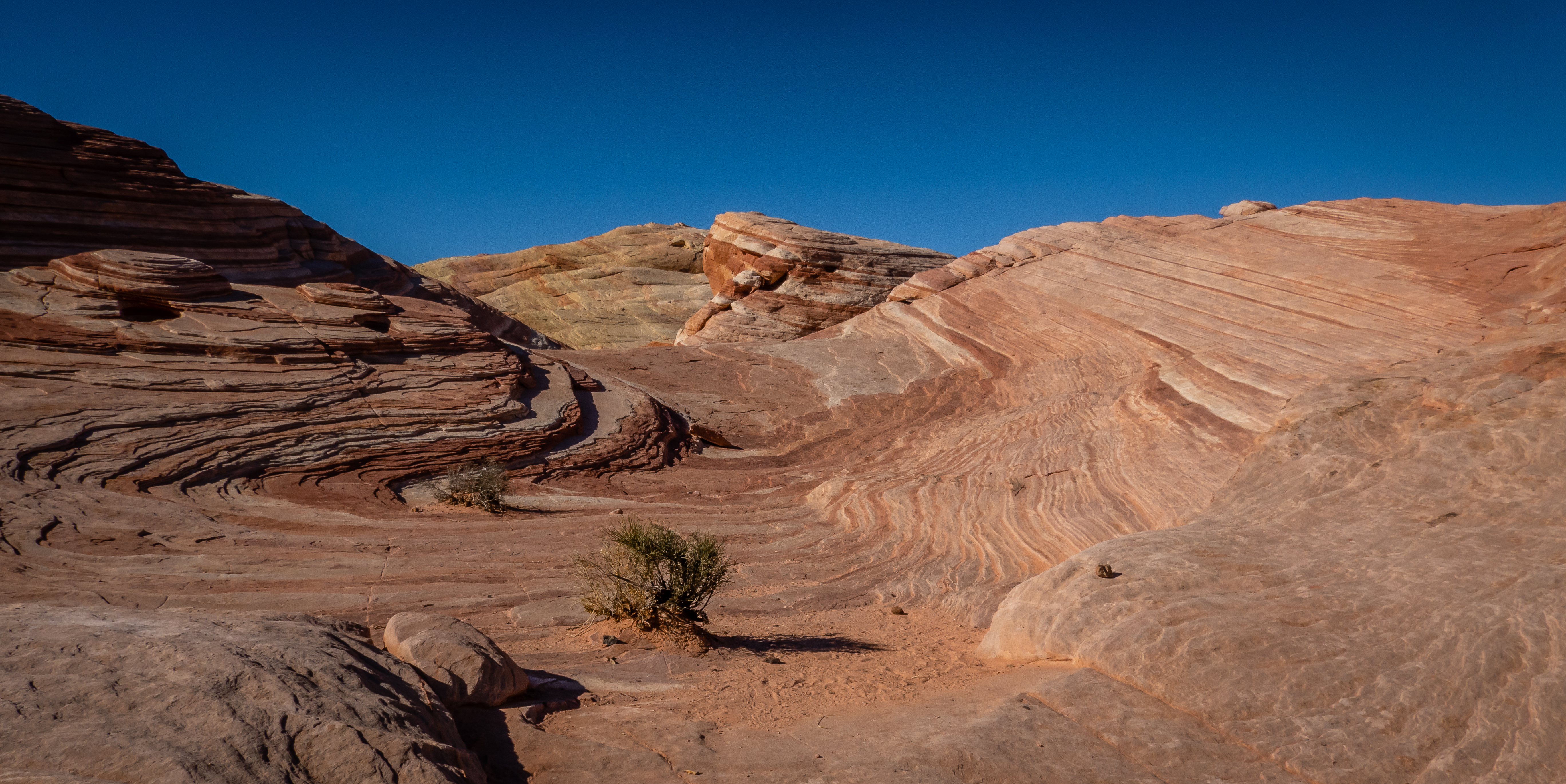
 |
| Nice View of Park |
 |
| Arrowhead Arch |
Our next stop was about a mile further along the main road and a short dirt road to The Cabins. These stone cabins were built in the mid 1930’s by none other than the Civilian Conservation Corps. We have seen examples of the CCC all over the country and are always impressed with their work. There are some petroglyphs on the rock wall behind the cabins from an even earlier time. There isn’t really a trail out of this stop so we continue to the visitors center after exploring the cabins. |
| Historic Cabins |
 |
| Petroglyphs Behind Cabins |
 |
| Inside View of Cabin |
 |
| View from Cabins |
We did take some time to look at the displays in the visitors center and watch the short movie about the park. Outside was a short trail to Balancing Rock. We have seen much better examples of balancing rocks over our travels but this one was okay.
 |
| Outside Visitors Center |
 |
| Inside Visitors Center |
 |
| View Behind Visitors Center |
 |
| Balancing Rock |
Our next stop was at the far northern end of White Domes Road. In all honesty, this was the main reason we had come back to Valley of Fire. The Fire Wave Trail goes through some absolutely stunning rock formations. Last time we tried this one, we were chased away by a nasty sleet and rain storm. The weather was looking better today and we were ready to be awed. We parked at the Fire Wave Trailhead and had lunch so we didn’t need to haul it along with us in our packs. The goal was the Fire Wave and Seven Wonders Trails - a 2.3 mile loop with only 200 feet of elevation gain. We decided to go in a counterclockwise direction which would put us on the Seven Wonders Trail first. Turns out this trail isn’t marked as well as we thought and after we walked a few minutes, we realized we were not heading the correct way. We backtracked and found the proper trail to the south.
 |
| Heading Down the Correct Trail |
This first portion of the hike has remarkable rock formations everywhere you look. It isn’t just the colors or the shapes but even the texture and patterns in the rocks. There were plenty of times where I needed to go up and touch the rocks to make sure they were real. It would be fun to walk with a knowledgeable geologist so that we might get a better understanding of how this area was formed. There was one area where we headed back up a different wash to see something our map listed as the Fire Cave. |
| Fire Cave |
 |
| Colorful Rocks |
There isn’t so much of a designated trail but there are the occasional trail markers to keep us going in the general direction. We likely were hiking at one of our slower paces along here simply because we wanted to go a few hundred feet and look all around to see how the rocks look from different directions. |
| Pick Your Route |
 |
| Chris Makes Her Way on Seven Wonders Trail |
 |
| Rock Patterns |
 |
| Follow That Trail Marker |
At about the 3/4 mile mark, this trail hits a dead end with an intersecting trail heading west or east. I go to the right since there is a slot canyon immediately there but after a quick look, we head to the east and follow the rest of this slot canyon towards White Domes Road. We ran into a large family group out for a hike and needed to pause at some of the narrower sections to let them thru. |
| Slot Canyon Section |
 |
| Slot Canyon Continues |
 |
| Nearing the Road |
After crossing the road, Pink Canyon continues to the northeast. There is even more slot canyon in this stretch of the hike. Some of it quite narrow with loose gravel to walk thru. There are a couple of smooth sandstone drop offs that were fairly easy to get up although if it had recently rained I suspect it would be much more challenging to get good footing to make it up them. |
| Heading Up Pink Canyon |
 |
| More Slot Canyon |
 |
| Worn Smooth from Water |
At the 1.5 mile point, the wash continues straight to the east but the intended trail take a hard left hand turn. The park makes this turn quite obvious by having several construction barriers blocking the wash with “wrong way” signs. This is the low point of the hike and starts to climb into the Fire Wave section. This area is also amazing and we take our time to explore. There are some rock cairns or just piles of rocks to help define the rough path, but we wander to the left and right of them as we work our way up.
 |
| Starting Up Fire Wave |
 |
| Patterns Galore |
 |
| Whites to Reds |
We had only made it to the mid point of the Fire Wave before the storm chased us back during our last visit, so it was wonderful to have a clear blue sky and pleasant temperatures during this trip. After getting past half mile or so of the Fire Wave section, we follow the trail back up to the parking areas. We had already awarded the Fire Wave Trail as a favorite even if it was a very abbreviated version of it. By adding in the equally stunning Seven Wonders Trail during this stop makes the combination one of the best all time hikes we have done. It isn’t all that challenging or long but the sheer beauty of the area will knock your hiking boots off.
 |
| Intense Color Change in Rock Layers |
We decided we hadn’t worn ourselves out yet so we headed over to hike the White Domes Trail. We hiked this one 3 years ago but it was a nice one and felt we deserved to see it again. We could have simply hiked the quarter mile from our current parking spot but we felt we would prefer to just drive the mile to the end of White Domes Road. The obvious trailhead is just to the south of the parking lot but we knew we could head north along the road for a few hundred feet and take the other trailhead which would allow us to hike this in the opposite direction as last time so it might seem like a new trail to us.
 |
| Rock Formation Near North Side of White Domes Trail |
We kept our eyes open for bighorn sheep. We had seen a group at this point in the trail last time, but I guess they are not creatures of habit since they were not there today. At the far south end of the loop, we head east thru a section of slot canyons before heading back to the north. There are remnants of an old western movie set along the way back up to the car. Going this direction does have some uphill climbing at the end but our legs managed to get us back to the car.
 |
| Into the Slot Canyon Section |
 |
| Now the Long Climb Up and Out |
 |
| Looking Back Down from Trailhead |
We had a geocache about a half mile hike north from the top of White Domes Road. It wasn’t a very difficult walk down a dirt road but when we arrived at ground zero, we found the obvious hiding spot with a small pile of rocks hiding something. The only problem was the was no container to be found. We looked around the area to see if it had been washed downhill but came up empty. In theory there is also a rock formation known as Duck Rock in the vicinity as well as some more petroglyphs but we were rather tired by this point and simply trudged back uphill.
We were starting to run out of daylight and energy but wanted to explore one more thing. Fire Canyon Overlook and Silica Dome is a pretty place - we had stopped for a look during our last visit. This time we wanted to hike up to the top of Silica Dome in order to get a geocache. Some
scenes from the movie Star Trek Generations were filmed in the general area and Captain Kirk's grave is around here as well. We spotted a road of sorts behind the restroom and it looked like it would wind it’s way over to the dome. The last several hundred feet was up some rather loose rocks on the side of the dome and the slope was quite steep. We made it to the desired location to get the required info for the EarthCache at this spot. The views were rather nice with the sun just about ready to set.
 |
| View from Silica Dome |
 |
| Silica Dome |
This state park has campgrounds near the western entrance so people are here after sunset but the day use pass technically was only good until sunset. We made one last stop at a place called Atlatl Rock. A large metal staircase takes us up to a platform that allows a very good view of some very nice petroglyphs. These are about 4000 years old and would not have been easy to get up here to create them prior to these stairs. We pulled out of the park just after the sun set and took the expressways back around Las Vegas to the Elks Lodge in Boulder City. This was a very full day of some excellent hikes and views - a definite “must see place” in the Las Vegas area.
 |
| Stair Up to Atlatl Rock |
 |
| Well Preserved Petroglyphs |
A few days later we would head out for another hike. This time we would head to the Sloan Canyon National Conservation Area to attempt the Petroglyph Canyon Trail. It’s a 4.1 mile loop trail with just over 550 feet of elevation gain. The actual loop portion of the trail is only 1.5 miles long with the rest of the hike a 2.6 mile out and back. There are warning signs at the trailhead to make hikers aware of the 6 dry waterfalls you will need to climb. There is a decent view of the Las Vegas Strip about 15 miles to the north.
 |
| Start of Petroglyph Trail |
 |
| View of the Vegas Strip |
The first half mile of the hike is up some typical desert single track that leads over to the wash. Once we make it into the wash, we find it starts out fairly wide and has a very thick, gravel bed to hike up.
 |
| Single Track Trail |
 |
| Into the Wash We Go |
A little over a mile and a quarter into the hike is a split. To the right is the Cowboy Trail, but we recommend going to the left which will have you going in a clockwise direction around the loop portion. In doing so, you we need to climb up the various dry waterfalls. The first couple of these are pretty tame and only require a small amount of rock scrambling to get up. The canyon starts to narrow somewhat but never gets the feel of a slot canyon. We knew to expect petroglyphs along the way so we kept our eyes open for them.
 |
| Easy Dry Waterfall |
 |
| Continue Up the Wash |
 |
| First Petroglyphs on Trail |
 |
| Another Dry Waterfall |
The last few dry waterfalls seemed to get progressively more difficult. As we would approach each one, we would need to survey the situation to determine which route looked most promising. The one that has a very smooth, nearly vertical surface wasn’t a pleasant sight. I was worried this may prove to be Chris’ stopping point. But we found that there were just enough openings in the rock to get both hand and foot holds and continue on.
 |
| More Difficult Falls to Negotiate |
The sixth one turned out to be the most challenging one. In the very middle of the falls is a large boulder wedged in between the two side walls of the canyon. There was no hope of scaling this one via that route. Both the left and right sides had very steep ledges of 15 to 20 feet. They were not smooth surfaces but neither side looked inviting to us from a climbing perspective. The right hand side was taller but possibly had better places for feet and hands. I opted to attempt the shorter left hand side and found just enough spots to hold onto with falling off. Chris picked the right side and started up. She made it partway up but ran out of places to continue and needed to make her way back down and head over to try my side.
 |
| The Sixth Dry Waterfall |
 |
| Chris Makes an Attempt |
I was concerned that she was going to get stuck there and we would need to abort the hike, but she managed to make it up even with her short legs! Shortly after the climb, we started to see dozens of petroglyphs. We took our time to explore the area to see how many we could find. Many of them are in very good condition. If only there was a Google Translate for petroglyphs!
After leaving this area, the canyon opens up again as we head up the wash. We did run into a guy heading the other direction and we wondered if he knew about the dry waterfalls ahead that he will need to climb down. I’m pretty sure we would not have been able to complete the loop in the opposite direction.
 |
| More Wash Walking |
We needed to pay close attention to the trail near the 2.1 mile mark. There is a hard right hand turn up the side of the hill along the Cowboy Trail. It would be quite easy to simply continue up the wash for quite a distance if you miss the turn. It was a rather steep climb for about the last quarter mile before hitting the high point along the loop. We get a fairly good view from up top before working our way down the half mile of rocky single track before reaching the wash again at the same trail split we had seen earlier. As we were heading down the wash, it was just past sunset and starting to get dark and quite chilly. We were a bit surprised to see two girls heading up the wash this late in the day. Hopefully they had some flashlights along since it would be dark soon. This was a neat but challenging hike for us.
 |
| View from Highpoint Along Cowboy Trail |
Our stay here at the Boulder City Elks Lodge was through December 15. Our next reservation was at the Lake Havasu City Elks Lodge on January 1. That left us with just over two weeks to fill. We hadn't put a lot of thought into where we would go but we knew there was another Elks Lodge in Needles California that would potentially work out since they have several full hookup sites. On a whim, I went to see what camping was available in Death Valley National Park. They have a very limited number of sites with utilities and those always seem to be reserved well in advance, but I did find we could get 4 nights in a row in a campsite without utilities. We decided that a visit to Death Valley sounded fun so we booked the site while it was still available. In order to get 4 nights in a row in one site, we would have to leave a few days early from Boulder City, but that plan should work to fill in some of the end of December.


No comments:
Post a Comment