Map of this blog's locations click this link to open the map
Having mountain biked some of the BLM land just north of our campground, I realized this wouldn’t be something Chris would entertain but County Road 22 doesn’t seem to have very much traffic, so maybe we could simply ride up the road for a ways. With the higher temperatures we’ve been experiencing, we set off early in the morning to see how it went. We ended up making it 6 miles up the road to a southern entrance to Wolford Mountain Recreation Area. It was predominantly all uphill with only a few short downhill sections in those miles. We gained just over 700 feet, so the ride back to camp was rather refreshing. At one point, we stopped to take a look at Gore Canyon which is quite visible even though it’s about 10 miles away.
 |
| Gore Canyon from 10 Miles North |
We had found that there was to be a wildflower walk in the town of Hot Sulphur Springs about a 15 mile drive to the east of camp on Sunday morning. We have enjoyed seeing all the wildflowers during our hikes in Rocky Mountain National Park and thought it would be nice to have experts along to help identify some of the flowers we had been seeing. We arrived to find a group of 20 or more people of all ages. This part of Colorado is high desert and being the middle of July, most of the wildflowers were well past their prime. But it was still a fun way to spend a morning.
 |
| View of Mountains in Hot Sulphur |
 |
| Group for Wildflower Walk |
 |
| Setting Off on Trail |
 |
| One of the Few Wildflowers |
 |
| Hawk Circles Above |
The next day we decided to go for a geocache that was hidden about a year ago but only found once since then. It was hidden up a forest service road in the Routt National Forest. It looked like it might be a nice area to explore. While the hide was only about 8 miles away, it would take a considerable drive to get there. The 18 mile drive on paved road was pretty and took us to some of the mountains west of Kremmling - gaining over 2500 feet in elevation. Then we turned onto the dirt forest service road. It was in fairly rough shape with some small washed out sections from recent rains. After a bit more than 2 miles and another 750 feet elevation, we were at a spot where we could start to look for the container. It was found pretty quickly and decided to walk up the spur road to see where it went. We only walked a 1/4 mile but we were above 10,000 feet at this point so it was a bit more effort. The view was just of a clearing below some power lines so not really all that interesting.
 |
| Powerline View at 10,000 Feet |
We could have take the known route back to camp by simply backtracking but we were feeling adventurous. If we continued back thru the forest, we would enter a place called Grand River Ranch. It wasn’t perfectly clear what this place was other than it is big. The whole property is more than 19,000 acres and it has been divided up into 20 “ranches” ranging in size from 160 to 7500 acres with 2 to 17 homesites on each ranch. It looks like a fairly exclusive place but a county road runs through it so we think we can drive back to Kremmling. The road is passable but it wouldn’t be easy in a normal passenger car. We stopped at a few points where the views were pretty spectacular. We never did see any homes, but I guess with lots this big, it is possible to be quite secluded. It was just a 10 mile drive to get back to pavement losing over 3000 feet elevation in the process.
 |
| View at Grand River Ranch |
 |
| Overlooking Kremmling |
 |
| Gated Entrance to One of the Ranches at GRR |
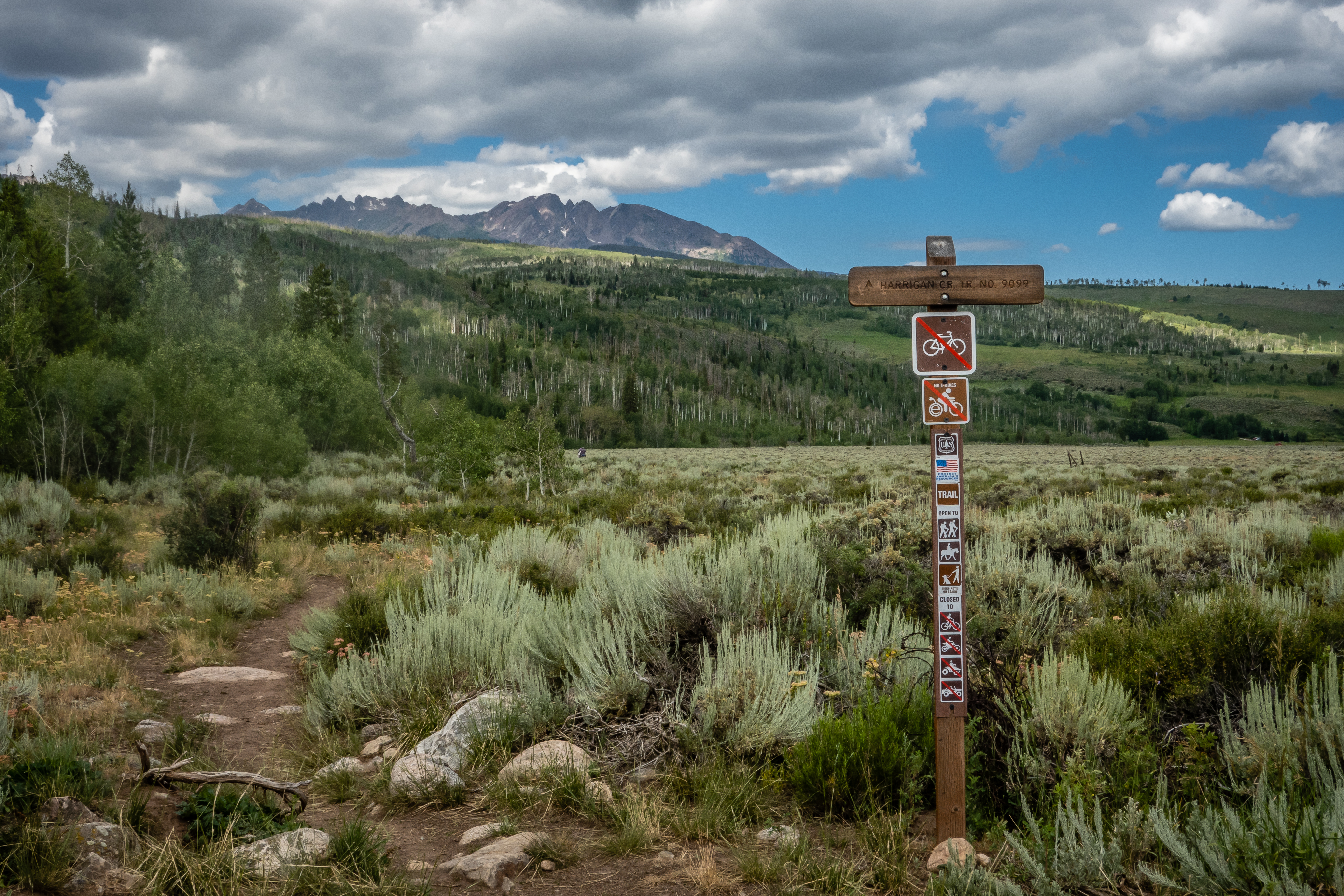
Our next hike would be back south towards Silverthorne. The Harrigan Creek Trail starts about a half mile from the Acorn Creek Trail we had completed a week ago. The trail is listed as nearly 20 miles in AllTrails, so we know we aren’t going to complete this one, but we figured we could go out a few miles and turn around. The listed parking area is no longer accessible since the gate to some ranch is closed and locked. There is a decent sized parking area just off of County Road 9. The difference in starting location will add an additional 3/4 mile at both the beginning and end of the hike but at least it is generally flat for that distance.
 |
| Start of Harrigan Creek Trail |
The next 2.5 miles are a pretty consistent 10% grade uphill, but it was a very pretty area and the trail was in reasonable shape. There were some wooded sections as well as some open meadows. The remnants of an old log cabin were situated in a beautiful location.
 |
| Overlooking Ranch Near Harrigan Creek |
 |
| Trail Continues Up |
 |
| Open Meadow |
 |
| Old Log Cabin |
Since we didn’t have a specific destination or distance we wanted to hike, we just kept heading up since it was a nice day and a pleasant hike. We did find a geocache hidden along the trail but there were no more further out the trail. The trail more or less follows the creek but doesn’t cross over it. There were a few wet spots and from the looks of things, this trail sees horseback riders. At one point, I noticed a point of interest on my Garmin called “Not Rock” down an intersecting trail at about the 3 mile point in our hike. Turns out the other trail was called the Not Rock Trail. It looked to be more of an old logging road that hasn’t been used in many years. |
| 'Shrooms |
 |
| Pretty View Along Trail |
 |
| Lots of Downed Trees |
 |
| Pretty Sego Lily |
 |
| Intersection with Not Rock Trail |
We had less than another half mile to get to my waypoint called Not Rock so we decided to check it out. There were lots of downed trees in this part of the forest. Occasionally we would need to climb over one that had fallen across the trail. I suspect this trail is used very infrequently. We got to the spot of the waypoint and looked around. Since we didn’t know exactly what we were looking for other than I assumed it was some sort of rock, or not? We found some unnamed rocks and sat down to enjoy our lunch before turning back.
 |
| Distance View with Downed Trees |
 |
| Butterfly |
 |
| Our Lunch Spot and Maybe "Not Rock"? |
 |
| Ready to Bloom |
On our way back down, the skies started to darken and we could hear the sound of thunder - hopefully distant thunder. It sprinkled a bit on us but not bad enough to get soaked. At one point a group of three on horseback were making their way up the trail. We had moved well off to the side, but just as the lead horse was approaching us, a large thunderclap startled him and the rider had a hard time keeping him under control. The light rain had covered the vegetation enough that our legs were soaked by the time we made it back to the car. It ended up being a 7.5 mile with about 1300 feet of elevation gain.
 |
| Toasted Mushroom? |
 |
| Hiking in Sprinkles |
 |
| Interesting Plant |
We headed back north the following day to the eastern side of Steamboat Springs. We weren’t looking for a real strenuous hike but wanted to see a new area. The Fish Creek Falls area is quite a popular location and has fairly limited parking. There is an entrance fee but the annual National Park Pass works as well. The lower falls is a very short walk to either an overlook or a short hike to the base of the lower falls. The upper falls requires a bit more effort - a 4.7 mile hike with nearly 1500 feet of elevation gain. We weren’t up for that much of a hike after yesterday’s outing. Another option from the same area is the Uranium Mine Trail. This is only a 3.1 mile out and back trail gaining 600 feet and sounded like a better option for us today
 |
| Off to Uranium Mine |
The trail is rather rocky for the first mile of climbing. It wasn’t completely peaceful the day we were hiking. There was some sort of timber harvest taking place across the valley at a ski resort. The sound wasn’t from chainsaws but a helicopter. Apparently the trees had already been felled and the helicopter was simply moving them about a half mile away. It was able to make the round trip in just a few minutes and likely completed many dozens of trips during our hike. As we gained elevation, the views kept getting better. There were spots where we could see Lower Fish Creek Falls and the observation overlook.
 |
| Helicopter Moves Timber |
 |
| Lower Fish Creek Falls |
 |
| Rocky Trail Continues |
 |
| Berries |
At about 1.25 mile into the hike, we reach the site of the uranium mine. There isn’t a whole lot left to see. There are some rail tracks that were used to haul the ore from the mine. The mine itself is sealed but it is possible to look thru the gate.
 |
| Gated Uranium Mine |
 |
| A Look Inside |
Since the trail continues on beyond the mine, we decided to see where it headed. It probably only goes another quarter mile or so and drop down to another creek. We found a shady place to sit and have our sandwiches. The spot seemed to be a haven for butterflies. Several different types of them. Some were puddling in a muddy area while others were concentrated on dry land possibly feeding on some sort of minerals leaching out of the soil.
 |
| Something Tasty? |
 |
| Mushrooms on Slope |
 |
| More Butterflies Congregate |
 |
| Creek View |
The hike back was much easier since it was mostly downhill but not so rocky to cause footing problems. |
| Heading Back |
 |
| Large Seed Head |
 |
| Rock Art |
 |
| Lower Fish Creek Falls Again |
Since we were so close to the lower falls, we felt we needed to take a look even though we were rather tired by now. The view from the observation overlook was okay but we decided to take the walk down to the base of the lower falls. There is a fairly steep section with no steps and lots of loose gravel so it wasn’t a stroll in the park, especially for our tired legs. Lots of people were down here. A bridge gets across the creek but most of the people were playing in the water. There is a geocache hidden nearby but it looked like it is in an area that is now closed off for restoration. We decided not to go for it given how many people were nearby. This was a fun day and a nice hike. I doubt we will make it back here to try the hike to the upper falls so what we tackled will have to do. We head to a grocery store in Steamboat since the one in Kremmling leaves something to be desired.
 |
| Closer View of Falls |
 |
| Visitors Enjoying Creek |

We took a couple of days off to recuperate from our hikes. Power was cutoff to the campground yet again as the crews replaced the pole the new larger transformer was on. With fresh legs, we head back south. This time we go a bit further than Silverthorne to the town of Frisco. It’s a 50 mile drive but a pretty easy one. Our destination is the North Tenmile #37 Trail - a 6.7 out and back hike with just over 900 feet of elevation gain. There isn’t necessarily anything at the end of this trail, it simply intersects the Gore Range Trail. So there isn’t a beautiful waterfall or killer view at the end, but it still sounds like a nice hike. The parking area for the trail is a bit odd. It’s right at the off-ramp for Interstate 70. Turn right into the parking lot, turn left to hit downtown Frisco. The first parking area was full as were the ones just across the interstate. We ended up having to drive into town to find parking along the street. It would add almost a half mile each way but we would have needed to get up earlier for a good spot.
 |
| Trailhead Parking at I-70 Offramp |
The trail pretty much follows the valley that the North Tenmile Creek flows thru. The first 0.2 mile of the hike is up a paved road - not what I was expecting. There appears to be some sort of water plant and the road allows access to service vehicles. Once the real hiking trail starts, it’s your typical rocky terrain we have grown accustomed to. At least with this hike, we are in a very green valley with lots of trees. We take a detour into the woods and down to the creek to find a geocache. After 15 minutes of looking without any luck, we decided we had come here for a hike so we continued on - we don’t have to find them all.
 |
| Start of Real Trail |
 |
| Boardwalk Section |
It’s a very pretty hike especially with the peaks on either side of us, rising nearly 1000 feet above the trail. There were areas with damage on the opposite side that I presume was caused by an avalanche at some point in time. Even now in late July, there are still patches of snow on the peaks to the south.
 |
| Possible Avalanche Zone? |
 |
| Still Some Snow |
As we got further up, some of the terrain to the north wasn’t so steep and there were often large meadows with lots of blooms. We still had nearly a half mile to go before we reached the Gore Range Trail and the turn around point when we hear our first clap of thunder. We had seen the clouds rolling on from the west but had hoped it would miss us. When it started to rain, we decided that continuing on to the end of the trail didn’t make a lot of sense. We even asked a couple heading back down if there was something worthwhile at the top and they told us not really. We turned around and tried to hike a bit faster to stay ahead of the storm. I guess it worked because we got out of the rain and even had some blue skies as we headed back to the car. We were able to slow our pace and take in some of the sights along the way.
 |
| Old Mining Site |
 |
| North Tenmile Creek |
 |
| Small Cascade |
 |
| Down the Rocky Trail |
 |
| Getting Close to Trailhead |
 |
| Ominous Clouds on Horizon |
Our luck was short lived. A block from the car, the real rains started and we ate lunch in the car while we waited for the downpour to let up. So far, being based in Kremmling hasn’t been a real detriment. There are some hikes in that area, but it isn’t that far to head up to Steamboat Springs or down to the Silverthorne area for even better hikes.


No comments:
Post a Comment