Map of this blog's locations click this link to open the map
During the planning stage for our 4 plus months in Colorado, we had wanted to find a few campgrounds that offered monthly rates. It turns out there aren’t that many of them that do extended stays. I suppose many of the campgrounds in the high country have short seasons so they can simply charge a daily or maybe weekly rate and still fill up so they don’t need to offer a monthly rate. Red Mountain RV Park in Kremmling did have both a monthly rate and availability when we were booking places back in December. Kremmling wasn’t necessarily a must do location in our books but it seemed to be close enough to some more popular hiking areas that we could find enough to do to spend the month of July.
It is only a 44 mile drive from our spot in Grand Lake so it would be a nice and short drive. Kremmling is situated in the Colorado River valley. It is 1250 feet lower in elevation than our last spot, but still over 7400 feet so it shouldn’t impact our high altitude conditioning. Kremmling turns out to be one of the colder towns in Colorado with the cold winter air sinking down into the valley. We are expecting temperatures in the mid to upper 80’s during our stay so cold weather shouldn’t be an issue. The campground just changed ownership between the time we reserved and the time we arrived. Fortunately there were no issues with our reservation and they had our spot ready for us. We pulled in next to another Newmar owner who had pulled in just before us. This turned out to be a couple that lives about 50 miles away so they were rather familiar with the area and were able to give us a few pointers on what we might want to see and do in the area.
We were arriving here on the Friday of the long 4th of July weekend and the place was pretty full. It looks like a large number of the people staying here are actually here for the season with their water spigots covered in thick insulation to prevent freezing pipes. Being the holiday weekend, there were lots of activities going on in town and other nearby communities. We did a bit of research and found a free concert for Saturday afternoon back over in Granby, only about 30 minutes back east. It was being held at Granby Ranch - a small ski resort. Three bands would hit the stage starting at 3, 5, and 7 PM. We hadn’t heard of any of the bands but figured it would still be fun.
 |
| Rocky Mountain Columbine |
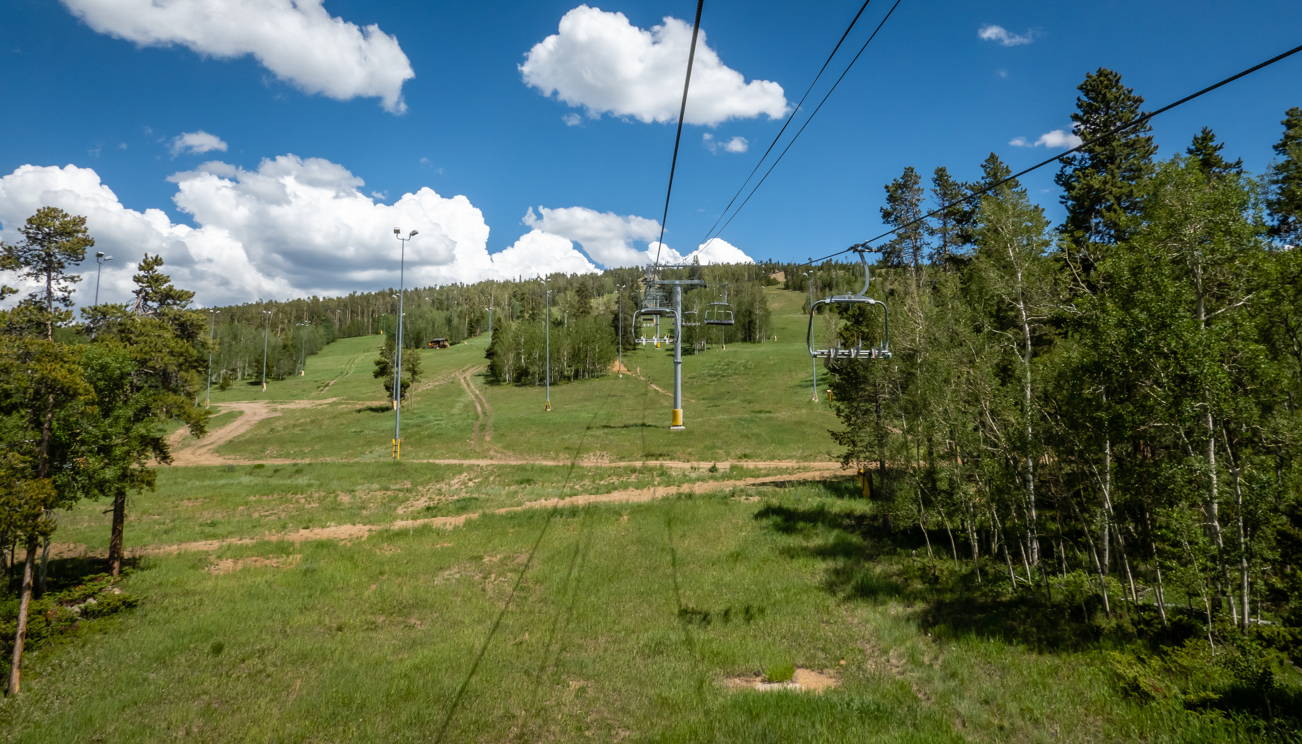
We drove over around 2 and found it was already starting to get crowded. We had a beautiful afternoon and this seemed to be the place to be. It was definitely family oriented with a long line of kids waiting to get their face painted or balloon artwork. We left our chairs in the car and figured we would take advantage of the chair lift that was left open until 7 PM. During the summer months, they are configured for taking up mountain bikes and bikers but the course was shut down earlier in the day to avoid conflicts with the concert goers. We went in and signed our waivers and paid our $10 per person to get a lift ticket. The lift that was open went just over 3/4 mile but rose nearly 850 above the concert area. |
| Base of Chair Lift |
 |
| On the Way Up |
 |
| Approaching the Top |
The attendant up top suggested we head back a short trail for a great overlook facing southeast. The area was setup with about 200 folding chairs and a small wooden platform. Obviously this was the perfect spot for a wedding ceremony with the Rockies as a backdrop. |
| Wedding Venue with Killer View |
 |
| View from Platform |
Our plan was to hike back down to mountain to the concert area. There are lots of ski trails and plenty of mountain biking trails, but it wasn’t perfectly clear the best ones for hiking. We used a couple of geocaches to help determine the trails to take and off we went. The trails were a bit steeper than we had planned and we were wishing we had brought along our hiking sticks. I’m not sure there were many of the trails that I would have been able to safely mountain bike down so I don’t feel tempted to come back in the future to try out my downhill skills!
 |
| Map of Ski Trails |
 |
| Heading Down a Trail |
 |
| Great Views Along the Way |
One of the geocaches was near a yurt partway down the trail. It was pretty good sized and looked a bit like a UFO from a poorly made sci-fi movie as we first saw it from above. Some of the trails we intended to take were probably fine for skiing in February but were a bit overgrown with brush and weeds this time of year. But we eventually made it back towards the concert using the sound of the band as our beacon. A security guy stopped us on our way into the concert field - he wanted to make sure we hadn’t carried in any contraband alcohol that we had stashed up on the mountain earlier in the week. |
| Yurt or UFO? |
 |
| More Columbine |
 |
| Passing Under Chair Lift |
 |
| Large Crowd at Concert Below |
We grabbed our chairs from the car and sat up in the grass. Chris stood in line to get some food and drinks and we enjoyed some of the music. We decided to take one more trip up on the lift to see the views from early evening. It was clear that a storm was in the area and we hoped it would stay away from our spot. Another geocache was hidden at a warming hut near the top of the chairlift but beyond a rope declaring the area closed. We had skipped this one on our first trip up, but asked the attendant if we could sneak over without getting in trouble. He didn’t mind so we headed over and found this one underneath the structure of the yurt. We opted to take the easy way back down for this trip especially since it was starting to get dark. By now, the headline band had taken the stage. “The Other Brothers” are a Colorado band that performs Allman Brothers Band songs. We enjoyed some of the music but realized we were rather tired by this point and decided to beat the traffic and head out a bit early. |
| Another View from Up Top |
 |
| Another Yurt with Geocache Below |
 |
| Coming Back Down Lift |
 |
| Concert Stage |
On July 4, Kremmling was having a festival in a local park with fireworks that evening. It was just a couple miles from camp so we likely could have seen them from our rig, but figured it was worth the drive into town to check them out up close. The town has about 1600 residents and a quarter of them were in the small park behind the visitors center. We grabbed a beer and sat down to listen to a band play on the stage. |
| July 4th Festivities in Kremmling |
We asked a local firefighter where the fireworks were being set off from and he pointed to the cliffs behind town. Kremmling has a rather unique piece of geology 1/3 mile to the north of town. A large cliff juts 300 feet above town and the fireworks will be set off from the western side of the cliff. |
| Cliff Behind Kremmling from Google Earth |
We scope out a decent spot to have a clear view of the sky and the launch point to see any “ground” display they might have planned. Apparently we had picked a really good spot because by the time the show started, there was a large group of people. We have seen some wonderful fireworks displays at the Western Winter Blast Pyrotechnics Show in Lake Havasu City back in 2018, so the bar has been set pretty high in our heads. The show Kremmling put on was actually pretty good for such a small town and setting them off from the nearby cliffs made for a fun evening. I took well over 100 pictures and I include some of my favorites.


 |
| Green Mountain Dam |
 |
| Looking Down Spillway |
 |
| Stream of Water from Power Plant |
We continue on the dirt road for several more miles. It’s in reasonable shape with some washboard sections. In the “town” of Heeney (I guess a population of 65 could be considered a town?) is a business with a unique name and I needed to take a picture to prove it exists! The last 2.5 miles is down a much narrower and rough dirt road. There are a few sections where it’s only wide enough for one vehicle and I hope someone isn’t coming the other way. We make it to the parking lot and find more than a dozen other vehicles out here so we won’t be alone in the woods. |
| Interesting Store Name |
 |
| At the Trailhead |
We discovered that the mosquitoes were in full force around this lake so we sprayed ourselves and headed out in a clockwise direction which will take us along the southeastern side of the lake first. It was a pretty hike with lots of wildflowers in bloom. As we approach the south end of the lake we can see Cataract Falls in the distance. The trail doesn’t actually get us very close to the falls but we can definitely hear them in the woods.
 |
| View of Lower Cataract Lake |
 |
| A Sea of Columbine |
 |
| Butterfly Poses |
 |
| Falls Above the Lake |
From the south end of the trail, we have a slight detour to find a geocache that hasn’t been found in over a year. It isn’t too far off the trail (maybe 1000 feet or so) but it is about 200 feet or so uphill in that short distance. We spent quite a bit of time trying to find a way to ground zero. The steepness didn’t help, but the real problem were all the fallen trees. There always seemed to be one that was too large to get over so we needed to go around. After 25 minutes we were still 700 feet from our desired location but we were roughly at the proper elevation. We hope we could spot an easy approach from here but instead we heard the sound of thunder. Knowing how challenging our detour was when things were dry, we didn’t want to risk needing to come back down during a storm. We safely made it back to the trail empty handed. Chris took a sharp branch to the leg but it fortunately only tore her pants, not her skin. |
| Nearly Impenetrable Woods |
We crossed the bridge over the water from the falls. We could still hear thunder occasionally and we hustling to make it back to the car before the rain got there. It was a pretty hike but the threat of rain on the return trip kept us from thoroughly enjoying it. |
| Bridge Over Cataract Creek |
 |
| Water Heads to Lake |
 |
| A Deer Spots Us |
 |
| Storm Nearby |
The next day we took it easy and celebrated our anniversary. There aren't a ton of dining options in town but we found a nice small brewpub with good beer and food.


No comments:
Post a Comment