Friday, July 29, 2016

Ferry Ride to Washington Island

Map of this blog's locations click this link to open the map

We had wanted to head to Washington Island at the end of Door county peninsula with our bikes while we were up here. The island is roughly 5 miles wide and 6 miles tall, so we figured bikes made more sense than the Jeep. With a careful eye on the weather forecast, we picked our last full day in Door County.  It turned out to be a correct call - mid seventies, low humidity and hardly a cloud in the sky.

The ferry ride takes about 30 minutes to do the 7 miles. It runs every 30 to 45 minutes but was over an hours drive to get to the ferry terminal. We made good time on the drive and just got on board the 8:15 ferry before they departed. There were only about 8 or so cars, a few people on foot and us with bikes.

View from Ferry Approaching Dock

Chris had mapped out a route that included both geocaching and sightseeing stops on just about all areas of the island. Our first stop was was the Washington Island Stavkirke.  It is a beautiful small Stave Church modeled after ones found in the Middle Ages in Norway. It is built on property adjacent to the Lutheran church.

Having built a timber frame home ourselves, we could really appreciate the woodworking skill that went into making this. The exterior has weathered to look a little older than it is, but the inside is brand new looking. It is open for the general public to come and enjoy. As geocachers, we got the added bonus of finding a nearby cache after counting things like windows, doors, crosses and benches to determine the cache location. The lighting was not great at the time we happened to be there, so the pictures don't do it justice.

Inside View

Next was a ride to a nearby beach at a small harbor. The area was very beautiful. Next was the ride to the observation tower kind of near the center of the island, but on the way, we went by a pioneer farm that is setup for the public to tour, with signs describing buildings, old implements and tools. We stopped and spent a half hour wandering around. We saw some things that even I had owned and only recently sold as part of our downsizing.
Pretty View at Beach

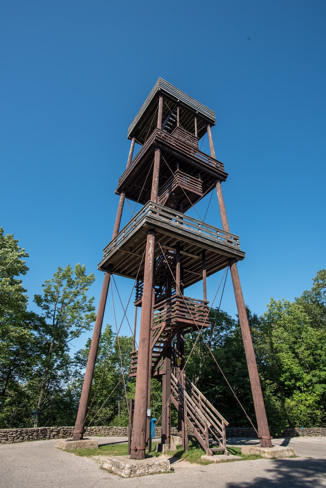
We eventually made it to the tower. There are a lot of steps from the parking area just to get to the base of the tower and then all the steps to climb to the top. Amazingly, Chris seemed to have only slight hesitation climbing this one and possibly even enjoyed the view.
View from Tower

On the northeast corner of the island, we needed to stop for lunch. At first all we saw was more like a little trailer serving burgers and hotdogs. Not exactly what we were hoping for. But after a little more investigation, we spotted what turned out to be quite a nice lunch spot, and it was crowded. We ended up sitting with a mother and daughter that were just touring around themselves. They mentioned a couple other things we might want to check out while here.

By mid-afternoon, the roads were just a bit more busy with vehicles and the riding was taking its toll on us. As we headed back towards the ferry terminal, we stopped at the lavender farm. Chris did a little more sightseeing than I did since the smell of the flowers was not doing my allergies any favors. There were some interesting outbuildings and row upon row of lavender plants. Apparently they wanted way more money for a sprig of flowers than Chris was willing to spend, which I was glad about.
An Elaborate Drying Building

One Lavender Farm

And the Competition Just Down the Road

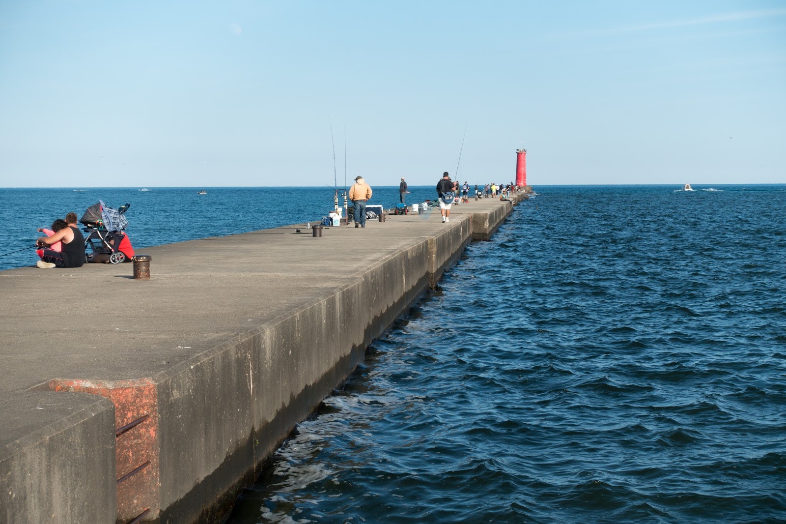
After stopping for a well deserved ice cream cone, we went to check out one last beach. Apparently there was some sort of triathlon in progress. There were guys in full body suits doing laps in the water around some buoys, and every now and then we would see a cyclist come in.

The coming weekend was to be some sort of big running event so I'm glad we didn't have to contend with the crowds for that. The ferry ride back was much more crowded. In fact they shoe horned the last car into a spot I was positive was not big enough. We ended up doing just over 33 miles biking around the island.

After loading the bikes on the rack, we started our drive back south to our campground. In the cute little town of Sister Bay, we noticed a building that had grass for the roof cover.  Now we had stopped in this town a few days earlier and had noticed it as well but this time was different because now there were goats up there! As quick stop in the parking lot to get out and take a few pictures. You don't see that everyday, but I suppose it makes sense to use goats rather than a mower or weed whacker.
A Restaurant with Goats on Roof

Doing the Job


Thursday, July 28, 2016

A Trip to Two Rivers and Manitowoc

Map of this blog's locations click this link to open the map

Chris' grandparents had lived in Two Rivers which is maybe 30 miles north or Sheboygan. The day we had gone to Sheboygan, we ran out of time to head here. But it's only a little over an hours drive from our current campground. Of course, an hours drive turns into a 3 plus hour drive for geocachers.

It was a pretty drive along the coast of Lake Michigan although the day itself was mostly overcast and gloomy. We stopped in the little town of Algoma. It has a nice beach area and a boardwalk all along it for nearly a mile. Only a few people were out on the beach looking for shells, so finding the nearby geocaches was no real problem.

Another stop along the way was Point Beach State Forest. Another pay facility, so our annual pass we bought is getting well used. There is a neat looking light house, but apparently it is also the residence of the keeper so is off limits.
Impressive Residence and Light House

We eventually get down to Two Rivers mid-afternoon. Our first stop is a virtual cache (one where there is no physical container) celebrating Two Rivers' fame of being where the first ice cream sundae was created.

We walked around town a bit with Chris not recognizing much since it had grown a lot. We decided that even though it was not the warmest of days, it seemed appropriate that we honor the town by getting a sundae. Turns out we had parked right next to the building that is the museum for the sundae, but not just a museum, but also an ice cream parlor. So in we went.

This place was loaded with memorabilia from back in the day. The main room had an elaborate copper ceiling. Two older gents were manning the place and the first asked if we wanted a tour. We declined and said we had a mission for a sundae. The second man dished up my sundae in a special souvenir dish - plastic that changes color when cold. Pretty sure that wasn't part of the original sundae experience.

While we were enjoying the ice cream, the one guy told us that we really should look around and if we don't have time to see the whole place, we should at least go upstairs and check out the old ballroom. We admittedly weren't that interested, but decided we should at least make him feel good by heading upstairs. I will admit the room was pretty intense with murals on the ceiling, ornate moldings and all sorts of period pieces and art work.
One Corner of the Ballroom

As I wandered one way, Chris checked out another wall only to gasp when hanging on the wall was one of Alpha Wilsman's water color paintings of some birch trees. Alpha was Chris' grandmother and we had several of her paintings in our house. I'm pretty sure their must have been some divine intervention for us to have been directed to the one room with this piece of art. It truly made her day!
Painting by Alpha Wilsman

Next we drove to where her grandparents had lived. Good thing Chris still had her old address book because I doubt we would have found it. There was a house at that address, but it was not their original home. What Chris remembered most was a playground across the street which is now a series of condominiums.

We still had some time and energy, so we headed just one town further south - Manitowoc. One of the virtual caches we did there, had us go to several locations. One was past the huge Budweiser plant right on the water and the second stop was to a pier of sorts out to a small lighthouse for the channel. We needed to know how many steps were on the lighthouse. It was just too far to tell from shore so off we went.

It was a very windy day so the waves off Lake Michigan were crashing over the walkway. I carefully walked the nearly quarter mile to the structure and stood in the shadow of the building to get out of the wind's force. When I look back Chris was not there! But instead of being blown off the walkway, she had decided to stay put on the other side and watch me do the dirty work.
Looking Back to Shore

Chris' View the Whole Time

With the answer needed we headed to the final spot which is the location where a piece of Sputnik IV had crashed on September 6, 1962. We do learn some interesting things by way of geocaching. The spot is next to a neat museum that was closed for the day but did have a nice piece of art out front. A man with flowers on a bicycle entitled Late For a Date.


Wednesday, July 27, 2016

Off to Lambeau Field

Map of this blog's locations click this link to open the map

We wanted to change up sightseeing a bit and do some day trips to slightly further locations away from all the parks in Door county. The weather forecast for one of the days was a risk of rain in the afternoon, so we decided to head to Green Bay and attempt to get in a Lambeau Field tour in before the rains hit. With the plan of afterwards heading to a library to use the wifi to catch up on real life activities that seem to get put off when we are in tourist mode. Plus with Labor day coming up, we wanted to actually plan out some of our remaining trip to the Upper Peninsula and mainland Michigan so we aren't stuck with no place to stay.

As we drove into Green Bay, you could see the stadium off in the distance, but with all the construction on the expressways, it seemed to take forever to actually pull into the parking lot. I am not a huge Green Bay fan, so I did not have any real knowledge of Lambeau Field. But my preconceived notions were completely wrong. Instead of a smallish well used facility, we were greeted to what appeared to be a brand new stadium.
Chris Barely Visible Dead Center
We entered thru the gift shop, but calling it just a gift shop would be a huge disservice. This place was huge. And as long as you wanted something with a big letter G on it, they had it. Up the escalators to the main visitors atrium. Several hundred people were milling about and we eventually spotted the line to buy tour tickets. The next tour we could get into wasn't for 45 minutes. So off we went back outside to attempt the 3 geocaches in the areas around the stadium.

The first one was in a bush, just 100 feet from where the statues of Vince Lombardi and Curly Lambeau stand guarding over them. The other side of the parking lot has a large indoor stadium that appears to be the practice field for the team when the weather is bad. As we were signing in on this cache, a woman and her young son, approached and asked if we were geocaching. Nowadays we seem to expect people to ask if we are playing Pokemon Go! We told her yes and she asked where it was. Apparently the whole family was there not long before us and could not find the well disguised cache. I suspect she will get them back to look again.

Our tour group was maybe 20 people and two guides - one to talk and the other to herd. At first I thought Aaron Rogers was joining us for the tour, but turned out that one in ten people there were wearing his jersey - or so it seemed. I suspect it was a good thing I didn't have on any Vikings garb, or I might not be writing this now.
View From Up High
It was a 90 minute tour with all sorts of stops along the way. From the roof area to the field and past the locker room, but not into it. One of the luxury suites was pretty amazing. Comfortable seating for 159 of your closest friends. You too can get it if you don't mind spending $55,000 for the privilege!
Great Spot to Watch a Game

Super Bowl Rings

As we entered at field level, we were given some pretty stern warnings about the turf. Thou shalt not walk on it, reach down and touch it, and God forbid if you were to pick a blade of the grass. They didn't mention snipers above, but that was the impression I got. The timing was pretty good, it was just starting to sprinkle and from the dark clouds, I suspect the next group might get wet.
At Field Level - But NOT On Turf!

The Sacred Field


Tuesday, July 26, 2016

Fun on the Bay

Map of this blog's locations click this link to open the map

With so many parks on both the bay and lake sides, we needed to have another day of visiting a few of them. This time we opted to stay on the bay side. Our first stop of the day was Ellison Bluff State Natural Area. This is an out of the way location but was surprised again by number of people checking it out.

Most just come to the main viewing spot, get out of their cars and take a picture or two. Some do the additional work to go down the steps to a lower viewing platform. Since we had gotten a late start, we had our picnic lunch with another beautiful view over the water. That's two days in a row, if you're counting! It gave us plenty of time to observe the visitors come and go.

We ended up actually taking the trail from the lower platform into the woods with the main goal of finding a geocache. Supposedly this was a terrain one cache which is to indicate it would be handicap accessible. Pretty sure they don't make wheelchairs with the needed off road capabilities that this one would have required.

Next on the list was Door Bluff county park. This place had a great trail that followed along the edge of the bluff overlooking the water. Usually there were a few rows of trees between the trail and your view, but that almost made the glimpses you did get that much more enjoyable. At one or two locations, the trail was right next to the steep drop off with no obstructions. All in all, a wonderful hike.
View of Green Bay from Bluff
Next we headed back south to Peninsula State Park. As I was driving, Chris asked if I wanted to do an interesting sounding cache. Of course she knew the answer to that, so she navigated me to Anderson Store Museum in Ephraim WI. One of the buildings in this little area, is now an art gallery, but has something much more intriguing going one with it. The clapboard building is rather large and is covered in graffiti. Apparently people are actually encouraged to sign their names on the building! We had not planned on this, so we could only use our minuscule pen rather than paint and brush, but we still got our geocaching name and date in an open spot.
One Side of Building
Our Geocaching Name - rushrutter

By the time we got to the Peninsula State Park, it was getting close to dinner so our time there was kept short to appease our stomachs. Unfortunately the observation tower in this park was closed. Of course Chris claims she would have climbed to the top otherwise - hmmm, not sure I believe that! We did have to stop at the lighthouse but we could only check it out from outside since we were to late for the tours.


The Tower Not Climbed
Lighthouse

We headed into the quaint little town of Fish Creek, found a nice place for dinner and a couple beers. Since we wanted to watch the sunset at a little park aptly named Sunset Beach Park, we had a second round and then headed to the park. By the time the sun started to set, there were close to 75 people there! The clouds didn't cooperate for us this evening, so the pictures weren't the best, but it was still a nice atmosphere.
Mediocre Sunset at Sunset Beach

Blurred Wave Action


Monday, July 25, 2016

On to Door County Wisconsin

Map of this blog's locations click this link to open the map

We spent a total of 11 nights in the West Bend area and really enjoyed our stay, but it was time to move on to see what else Wisconsin has to offer. We decide to head just a little further north to the big peninsula that juts out into Lake Michigan effectively creating Green Bay, for which the city on the southern end is named. Door county includes the majority of this land mass and is a big destination spot for all sorts of tourists - us included.

The drive up was pleasant. I opted to take a slightly more western route just to see something new. Our timing was good because we drove through Oshkosh just before the big airplane event they hold each year. The field was already full of tents and campers getting an early start on the activities. We may need to consider adding this to our bucket list for some future year.

We end up finding a campground that can accommodate us for a week. Quietwoods South is a nice enough place but since it is nearly full, mostly with seasonal rigs that haven't been moved in some time, we end up in what seems to be more of an overflow area. But with 30 amp electric and water, it will work as our base for our day trips exploring the area. They even have a nice pool and water slide park that is usually crowded with lots of screaming kids, but it provides a good place to cool down in the evenings after a long day of sightseeing and hiking.


Star Trails Picture from Quietwoods Spot
The first destination is Cave Point Park. This is a county park immediately next to Whitefish Dunes State Park. Both places were quite busy for a Monday. But the weather was great so many others had a similar idea. The main attraction at Cave Point is a horseshoe shaped feature hollowed out from the side of the 20 foot tall drop off to Lake Michigan. It might be 40 foot wide and 75 feet long.

Mostly kids were coming up to the top of either side of the cliff and jumping off - usually accompanied by loud screaming.


Often the jumpers would stand there for a minute or more getting up the courage to take the plunge and were often "assisted" by a friend that would give them a push. But the thing that we found most fascinating was the young couple that had placed what looked like a simple strap I might use to fasten cargo to a truck or trailer. It was one inch wide and was attached to trees on either side of the horseshoe about 2 feet over ground level. It was tensioned with the ratchet mechanism but seemed to have at least a foot of give when they would stand on it.

Initially the girl was trying her tight wire act, but since the strap was also right across the main path for the jumpers to reach their leaping point, she was constantly being interrupted. Her boyfriend came over to give her encouragement, but she opted to let him go.
It doesn't look it, but he recovered!

We eventually tired of watching the jumpers and headed down the trail that overlooks the lake. At points there were easy ways down to the shoreline and at one of these we discovered what could only be described as cairn building training area. There were easily 100 of these precariously balanced rock creations in this stretch. Some were nearly 5 feet tall with others being only a foot. Many people would stop and build their own before heading out.

After having a picnic lunch with a beautiful view of Lake Michigan, we headed into Whitefish Dunes SP. We did a few geocaches, a little bit of hiking and even went down to the swimming beach area to soak it all in. Mid afternoon, we decided to head to Potawatomi State Park which is on the Green Bay side of the peninsula, but with it only being about 8 miles wide, it doesn't take long to get there.

The highlight, for me at least, was the observation tower. We both started the climb, but by the time I was up top, I realized that I had lost Chris somewhere along the way. I felt the thing was quite stabile, by apparently Chris' stomach was not in agreement and she opted to stop at the deck near the half way point.
Chris at the half-way point

Here is the view she missed from the very top.


Saturday, July 23, 2016

A Trip to Sheboygan

Map of this blog's locations click this link to open the map

Another obvious day trip was to Sheboygan. Chris spent many of her formative years there but hadn't been back since a trip after college. This was going to be a real test of her memory.


What I find odd about not just Sheboygan but much of Wisconsin is the complete lack of creativity in road naming. Most of the more major roads are named "EE", or "K", or "DK". And to the best of my ability, I could find no rhyme or reason to the naming. If one cross street had been named Road G and the next one named Road H, I probably could have lived with it. I guess my engineering desire for order gets in the way - something I should get over.


The drive was easy enough and we even managed to find the road her childhood home was on. But as we turned down the road and I asked which house was the one she lived in, we ran into a little problem. She remembered it as the third house from the corner. But when she lived here, it was a new development with newly planted trees and many vacant lots. I guess 30 or so years of being away can have that affect.


We slowly drove down the street, which wasn't too hard since it's only a few blocks long and a dead end at that. Of course the people that were out sitting on their porches probably found it odd to see a car with NY plates "casing" their houses!  After we hit the end and turned around, Chris did decide which house was hers and it happened to still be the third one from the corner!

Next we went to a nearby little park. Chris and her friends would play there. It is an old Indian Burial Mound. The sign she remembered at the entrance was still there as was the viewing port into one of the mounds. Personally it seems a bit creepy and might explain why Chris to this day doesn't like scary movies.


Since we couldn't find the geocaches in this park, we needed to drive around town some more. We eventually found both her grade school and high school, although both were not exactly where she had remembered them.

We stopped at the pier at the center of town and walked around a bit. There were dozens of people out fishing off the pier that afternoon. Many of the fishing poles were just laying on the pier maybe 4 or 5 feet  apart. Then I noticed that most of them had a bottle or can about a foot away from the pole near the reel with the fishing line looped over it. I reckon that is the "fish on line" detection system, but one guy was using a nearly full bottle of beer for his - I hope he doesn't catch something and waste the beer.


I think Chris enjoyed her trip back home. We took a different way back to the campgrounds and did make a big discovery. We now  know the answer to this question - "Where's Waldo?" Oh, and by the way, "V" street runs thru the middle of town! 


Monday, July 18, 2016

A Day Trip to Milwaukee

Map of this blog's locations click this link to open the map

One of the day trips Chris wanted to take while in the area was to the Milwaukee Zoo. She had gone there as a child and had many fond memories. We picked a warm but reasonably nice day and got there shortly after it opened.


Our first stop was  at the gorilla exhibit. The building is rather large but at each window we saw  the same thing - nothing. Apparently they were being fed or still asleep. Finally we saw some acrobatic spider monkeys. Guess we will need to stop back later.


We wandered around all corners of the zoo getting to see a wide variety of animals. The most entertaining was one of the bears. It was pacing back and forth over a 30 foot section of its outdoor area adjacent to the dropoff keeping us safe. As it got to the right side, it would do this interesting 180 degree turn, nearly falling into pit below. It kept doing this over and over for the five minutes we stuck around.


Vibrant Peacock

Baby Giraffe

Finally Saw Them

Wrinkles

After spending nearly six hours at the zoo, we decided to leave and do a brewery tour. The Miller factory was not far away, and if we hurried, we would get there before the last scheduled tour of the day. The visitor center is quite nice with a decent size gift shop. I found a few shirts I would have liked, but I would have needed to get rid of others in order to have room in the motor home.

They have their own motor home!
We ended up having a very large group of close to 25 people. The tour itself starts with a short movie explaining the history of Miller and all the brands they have purchased over the years. Then we head to the packaging building. The volume and speed numbers were staggering. One fun fact was that a tractor trailer full of bottles of beer would last you 22 years of drinking a six pack a day!


Next was a walk to the old underground cellars built over 150 years ago. They were designed to have the cavities between each cave be filled over the winter with ice from frozen ponds and then stay cold year round. I was surprised at how nice the mural was in the cave we toured.
Mural in the cellar
Next we crossed the road and headed to the beer gardens. They let you have three 8 ounce glasses and have 6 different brews to choose from. Not bad for a free tour. Some of the buildings reminded me of Kodak Park with the combination of old and new and some brick buildings many stories high with no windows.

After we nursed our drinks, we decided to try a geocache that was in downtown Milwaukee. It had well over 500 favorite points. From the description, we had no real idea what we were looking for. We initially drove by the location which was pretty much an alley between a couple non-descript buildings. We ended up parking a few blocks away and walked back. We looked around outside a little bit but eventually realized it must be in one of the buildings.

We noticed a line of 6 or more people standing at a entrance to a building nearby. We looked around there, but it wasn't even clear what they were waiting for since there really isn't much signage. We  talked to one woman who was heading out a different door and discovered it was a restaurant and was an interesting place with decent food. Since we were hungry, we decided to give it a shot so we got in line and waited.

Each group got called in one at a time by Miss Moneypenny - she was sort of the hostess. The first question was "What's the password?" Each of us needed to whisper it into her ear. Chris apparently got close just by dumb luck when Moneypenny said she was only off by one word. Turns out Chris whispered "I'm looking for a geocache." Since neither of us knew the password, she forced us to perform 3 Chinese ninja poses with sound effects! After the fact, we discovered that there was video camera in the entry and it was broadcast to TVs throughout the dining area.

The whole resturaunt had a spy theme. We were greeted by our handler (waitress) and all customers were called agents. We asked her about how to locate the geocache and were told she might be able to help us out. After we put in our drink orders, she came back with them and a sheet of instructions that we needed to follow. After ordering dinner, we start walking around the other areas in the elaborately decorated restaruant. At first we though our sheet would lead us to the geocahe, but turns out all guests get the same sheet and are all trying to figure out where the instructions lead you.

While we were exploring and being completely confused what we were to be doing, our handler came and found us to say our food was ready. We headed back, had a really good dinner. After finishing our meal, we still had our original mission to complete. We went back to the one bar where the bartender was also a magician. We stood and interacted with him and were quite amazed how good he was at card tricks. Especially since we were standing within a few feet of his hands the whole time.

Finally we asked him if one of the cases we saw on the shelf behind him were the geocache, but alas they weren't. But he did tell us to go to the main bar and ask that bartender. Sure enough, the ammo can was hidden up on a shelf behind a picture at the back of the bar. We signed in feeling accomplished even if not completely sure what we had just experienced.


Saturday, July 16, 2016

West Bend Wisconsin

Map of this blog's locations click this link to open the map

We got lucky when we called our first choice for a campsite in West Bend and they had a site for us for the full 10 days we want to stay. Now that we know exactly where we are going, we can hitch up the Jeep and head out. The timing was good. A thunderstorm had rolled through the area earlier in the morning but was east of us now and the weather looked to be good for the drive.

It wasn't until we got on the outskirts of Milwaukee that we ran into a fair amount of traffic mainly due to construction. Generally I don't mind driving the motor home, but when the lanes are defined by Jersey barriers and traffic is weaving back and forth, a wide rig that's 57 feet long isn't all that much fun. But things got better as we headed north from there and soon the drive was back to normal.


Lake Lenwood Beach and Campground turned out to be very nice. Our specific site was a bit of a challenge to get the big rig into, but once there, it was nice. Here are a few shots from around Lake Lenwood.


From the beach area looking towards the campgrounds.


From the campground area at sunset.
Spike at your own risk!
Cannot say I have ever run across an all steel volley ball pole and net setup like this.
I guess if you break a bone, or get a concussion, you can be called for some sort of net interference.
Just seems to be a pretty severe penalty.


We decided that we had to do Wisconsin's oldest geocache. It is only about 12 "crow" miles from our camp. But we also wanted to do a cheese making tour. We found one in the general direction of the state park and headed there first. Widmer's Cheese Cellars was in a smaller building than I was imagining. When you walk in, there is a small (no more than 10 people) viewing area overlooking the cheese making equipment. The viewing area was nearly full of 4 older couples watching the video and the guys making the cheese.

We talked with one of the visitors and discovered they are a group of fellow RVers on a long trip from Sun City Arizona. We shared a few stories and they shared the large cheese sample tray that was brought out for them. After they left we watched the workers a little more and picked out a few different cheeses that we liked, then we left before the other half of their group showed up.


One tank was being emptied of curds while the second one was being cooked and mixed.

The geocache we wanted to do is in Pike Lake State Park. Unlike Illinois, Wisconsin charges for entry into it's parks. $11 per park, or $35 for an annual pass for non-residents. We decide that there will likely be other state parks we want to check out so we went with the later. The park ranger at the desk was nice and knew all about the geocaches in the park. He mentioned the one right outside the office, but I had already signed the log before going in.


We have managed to find the oldest active cache in 14 states so far. Not all of them have been in the nicest locations, but this one was at the top of one of the highest points in SE Wisconsin. Okay, maybe it's not much more than a hill but it was a nice trail up and there is even an observation tower at the top - one that Chris reluctantly climbed all the way to the top.

View from tower on top of Powder Hill
After enjoying hikes on a few more trails in the park, we decided to head to the town of Slinger. There are quite a few geocaches with a very high number of favorite points and we wanted to see why. Here are a few pictures of the fun we were greeted with. For those non-geocachers out there, the following caches are not the norm but do exist.


A gadget cache right outside the Slinger fire station. It was complete with lights and sirens!
One of the several free library stations scattered around the town with a hidden compartment to hide the log book.


Chris went for that one extra piece of cheese she probably shouldn't have.


Here I am launching a rocket - sort of.