Thursday, September 20, 2018

Mount Desert Island Wrapup

Map of this blog's locations click this link to open the map

It’s hard to believe that we only have one more week to go in our monthlong stay here in Trenton Maine. Time flies when you’re having fun especially with so much to do both inside Acadia as well as the surrounding area. We might need to look at coming back here during some future visit. Who knows, maybe even staying for a full season?

Having had an easier day walk yesterday, we plan for a real hike for Friday. The shuttle bus system comes in really handy so we don’t need to plan for a loop hike or an out and back hike. We can start at one location and hike to another location and simply use the bus to get us to and from our car. The plan is to hike Champlain Mountain. This one has numerous approaches. The Champlain Ridge Trail can be used to either from the north or the south. These approaches tend to be the least steep but also longer. The trails from either the east or west are a bit steeper. The Precipice Trail is a popular one for those with a great sense of adventure. There are iron rungs, ladders, handrails and bridges to navigate to make it up the nearly vertical portions of the hike. It’s probably more like a climb than a hike and Chris isn’t game for this one. I guess if I want to do this one, I’ll need to search around at the campground for a climbing partner. We pick the Beachcroft Path that comes in from the west. We can take the bus to Sieur de Monts and pick up the trail from there. Once at the top of Champlain Mountain, we will have a few options back down and pick up the bus at either Sand Beach or Otter Cliff depending on how it goes.

Pretty Barn Near Geocache on Way to Visitor Center
The trail starts out heading to a pond called “The Tarn” before crossing the road and starting the climb in earnest. We gain elevation quickly - a kind way of saying it’s steep. But there are plenty of switchbacks to make it seem reasonable. Along the way, there are many granite outcroppings to stop and see the view of The Tarn. There are plenty of exposed granite slopes to climb, but unlike our Pemetic Mountain hike from a few days ago, it was dry so footing was great. As we neared the top, we could see out over Bar Harbor and saw a big cruise ship just offshore. 
Overlooking The Tarn and Part of Dorr Mountain

Cruise Ship at Bar Harbor
There were quite a few people up top but with so many different approaches, our hike never seemed crowded only running into a few people during our climb. We ate half our lunch while enjoying the view of Bar Harbor then headed south along the ridge trail. The views from up here are great. To the left is the ocean while to the right is Dorr and Cadillac Mountains. This section of the trail is a gradual downhill with only the occasional spots where you need to negotiate some steeper terrain. Some of the maples we’re vibrant reds and oranges and most of the low blueberry bushes were in all their fall glory. 
Top of Champlain Mountain - 1058 Feet

Heading Down Ridge

Overlooking Coast

Colorful Maple

Bright Bushes with Door and Cadillac Mountains as Backdrop

Brighter Bushes
As we head south, we start to see glimpses of The Bowl - a spring-fed kettle pond that sits just over 400 feet up the mountain. Initially the views are from well above, but we eventually work our way down to the water level. It’s about as idyllic of a setting as I can think of especially with the glimpses of autumn colors in the trees. At this point we could head down to Sand Beach, but we are feeling good and the weather is great so we continue south and back uphill to the peak of Gorham Mountain. This one isn’t bad at all but it does help that we only have a couple hundred feet of climbing coming at it from this direction. A brief stop to have a snack and take in the view was well deserved. Of course a sea gull spotted us and came in hoping to get some easy food.  Coming down the south side of Gorham Mountain went fairly well. At one point we are presented with the choice of taking the Cadillac Cliffs spur trail. We figured a trail with “cliff” in its name might be poor choice given we are already at 5 miles for this hike. We hadn’t thoroughly investigated what trail to follow to get to an official bus stop so we just guessed and pushed on. We eventually got to a road and after I crossed, Chris hollers at me to come back, the shuttle bus was going by and she flagged it down. I ran back and got on the bus our 5.5 mile hike ended quickly and in no time we made it back to the car. A fun and beautiful hike indeed. 
Overlooking The Bowl

At The Bowl
 
Peak of Gorham Mountain

Looking Back at Sand Beach and Great Head

Optimistic Sea Gull
Champlain/Gorham Hike Track
The following day of recuperating took us to two interesting stops. The first was the Woodlawn Museum in Ellsworth. We weren’t there for the museum per se but the trails in the woods behind the museum. There are pretty nice trails with three consecutive loops making it easy to make the hike be short, medium or long. A couple geocaches on the property dictated how far we went. After this we stopped at Birdsacre, part of the Stanwood Wildlife Sanctuary. This place is dedicated to caring for many disabled birds. The place is quite unique with multiple areas housing the various birds. Out favorite was likely the great horned owl. It intently watched us as we watched it. Occasionally making it known, he was not happy with us being there by making a strange hissing noise. There are many trails in the woods behind the facility and we explored a couple miles of them in our search for another geocache. It was a nice spot to investigate and only six miles or so from our campground. They don’t have a set admission fee but do ask for a well deserved donation. 
Hoot or Hiss?

Colorful Berries

Queen's Throne
Our rest day worked and with our time in the area being short, we took advantage of the nice weather to do the hike up to the highest mountain on MDI - Cadillac Mountain.  We had driven there earlier in our stay, so we aren’t doing it purely for the views but it just seems like we have to do the hike to make it legitimate. Like many of the mountains within Acadia, there are numerous trails to get to the peak. We resort to the Joe’s Guide to Acadia website I have mentioned before to give us insight to which one to take. The Cadillac North Ridge Trail seems to be the most popular option. It is 2.2 miles one way to the peak but it comes close the the road to the summit, making for less of a wilderness experience. The Cadillac South Ridge Trail is 3.5 miles one way and a little less steep with great views along the way. We prefer to save the less steep route for our downhill portion. But there is another option that is much less popular - the Gorge Path. This trail heads up the gorge between Cadillac and Dorr Mountains from the Park Loop Road. Being only 1.9 miles, it obviously is the steepest but we figure we will give it a shot.

We drive to the visitor center and hop on the Loop Road bus, asking the driver if he could stop at the Gorge Path trailhead. This isn’t an official stop like the Cadillac North Ridge trailhead is and it’s about 0.6 miles beyond the that stop. The driver confirms our request and after 8 people get off at the other stop, we are the only ones to get off at this one. There are a few cars in the parking area so we know we aren’t the only ones on the trail. The trail more or less follows along the seasonal stream between the mountains crossing over it multiple times. Water level isn’t an issue although I suppose it could be at times. The path is easy to follow with granite steps in place at some of the steeper sections. After 1.5 miles of gorge hiking we make a right hand turn to head up the east face of the mountain. The difference in the view and the type of trail is fairly striking. Before we were in the damp and dark confines of the woods in the gorge, but the climb brings us to the light of day with views of Dorr Mountain and scrambles up some of the steep trail to the summit. There are plenty of places to stop along the climb to soak in the view and simply catch your breath. 

Looking Back Down Gorge Trail
Granite Steps

Looking at Dorr Mountain

View of Bar Harbor
As we come over the final steep portion, we run into scores of people that have opted for the easy route to the top. We stop for a bit to have half our lunch, enjoy the views and simply rest while a light breeze dries our clothing from the climb. We take advantage of the restrooms that we typically don’t have at the midpoint of our hikes and figure out how to get to the South Ridge Trail - hint: it’s near the restrooms. This ends up being a nice and relaxing descent over mostly large granite stretches of exposed granite. We only have troubles near one intersection and need to backtrack to stay on the intended trail. 
Heading Down South Ridge Trail

Looking Through Bates Cairn

Panoramic View
At about the one mile point on the way down, we do the brief detour to something called Eagles Crag. It takes us to a nice viewpoint that otherwise would be missed but no eagles were spotted. Our plan was to continue down the trail, across the road and into the the Blackwoods Campground to catch the shuttle bus back. At one point, Chris points out we have 40 minutes before the bus leaves and if we miss it, we will have an additional one hour wait. We pick up the pace a bit to make sure we get there in time. There were a bunch of cars parked along the trailhead across from the campground so we know some people had done the hike in from this point. There is a foot trail into the campground but since we were unsure exactly where the bus stop was and where this trail went, we opted to follow the paved road into the campground figuring we would at least be able to flag down the bus if need be. It turned out to be just over three quarters of a mile walk to the bus stop. We walked up and saw half a dozen people waiting for the bus so we suspected we hadn’t missed it. After 7.1 miles and 1500 feet of elevation we wanted to sit down and rest, but before we could, the bus pulls up. Talk about good timing.
View at Eagles Crag

Pool in Granite
We hadn’t had a lobster dinner yet in the several weeks we have been here. Early on, we tried a lobster roll that was good, but I suppose no trip to this part of Maine would be complete without a lobster dinner. Finding a place wasn’t going to be an issue - they are everywhere. We weren’t looking for atmosphere so much so we just picked a lobster place about half a mile from camp. DownEast Lobster is definitely a no frills place but reviews were good so we gave it a try. Before going there, we watched a few YouTube videos on how to eat a lobster. I think the last time we had one was back in the late 1980’s at my friends rehearsal dinner! With our newfound knowledge, we ordered our meals and sat on the outside deck over the main building. It was a pleasant evening and as we started our meal, it was just as well we weren’t at some fancy-smancy restaurant. Eating lobster is work and a messy proposition. They were good but maybe we aren’t the biggest lobster fans. Lobster rolls are a lot easier to eat but I would still prefer a nice grilled salmon over lobster.

Another thing we haven’t done yet was to go to Bar Harbor at low tide to walk over to Bar Island. The day after our hike worked out for this with low tide being in the late morning. We found a parking spot in an all day lot so we wouldn’t need to worry about moving the car after 2 or 3 hours. We got to the road heading down to the water about an hour or so before low tide. As it was, there were lots of people already out on the bar that runs between island and town including a truck with stand up paddle boards and a few Segways. We head across the rocky bar to the island and do the roughly 2 mile round trip hike to the peak of the island that provides a nice view back over to town. 

Heading onto Bar to Bar Island


View from Top of Bar Island


After coming back across the bar, we head over to the College of the Atlantic to grab a geocache hidden on campus. There is a large whale skull near the cache that is interesting to see. Next, we head to Village Green to catch the bus to Jordan Pond with the intention of seeing a few of the carriage road bridges we hadn’t gotten to yet. The parking at Jordan Pond was full so taking the bus was a smart move. To get to the Stanley Brook Bridge, we start on the lesser-known Seaside Trail. It was a nice quiet walk although partway down the trail, we ran into a crew of people doing some major trail maintenance. The bridge itself is quite beautiful. It has was built in 1933 and has three arches. The large middle arch is for the road while the smaller arches on either side permit the trail and brook to pass under the carriage road above. There are also slots in the top of the bridge that remind us of those we saw at Fort Knox for shooting attacking forces, but I suspect these are simply an aesthetic feature.
Whale Skull
Stanley Brook Bridge

Stanley Brook Bridge from Above
After a detour further down the Seaside Trail to grab a geocache, we cross over the Stanley Brook Bridge and walk down the carriage road to get to the Jordan Pond Seal Harbor Bridge. This is a pretty but understated bridge. 
Jordan Pond Seal Harbor Bridge
It took a bit of a walk and studying the maps to figure out how to reach the last bridge for this adventure. The Cobblestone Bridge is the oldest of the carriage road bridges built in 1917. We did finally reach the bridge and it was well worth the walk. Other than granite cap stones and some granite along the graceful arch, the bridge is built of cobblestones. Access around the bridge is good permitting close examination from all angles. The stones themselves have a wide variety of shapes and colors. Having done some stonework on our last house, I can appreciate the effort required to build something like this. It seems to be holding up quite well given it is over a century old.
Cobblestone Bridge

Cobblestone Bridge from Below Arch

Say Cheese
The return trip to Jordan Pond was made easy by simply following the Jordan Stream Path. It was a pretty walk that crosses over the stream a few times before reaching the pond. What was intended to be an easy “off” day, turned into a 5 mile walk for the three bridges and several miles for the walk out to Bar Island and the campus. We caught the bus back to town and eventually made it home.
Looking at Bar Island Near High Tide
Chris knew I had wanted to do one of the more challenging hikes like the Precipice Trail, but knew that wouldn’t work for her so she investigated other options and came up with one she thought she may be able to psych herself into attempting but that included some cliffs and ladders. The day we picked was cloudy with rain expected later in the afternoon. We figured if we headed out early, we could get the 2+ mile hike in at Beech Cliff before the rain hit. The trail starts at the Echo Lake beach parking lot. There is a bus stop here so if you attempt this during a crowded time, the bus might work as an alternative mode of transport. The initial flat section of the trail adjacent to the lake isn't long enough to get warmed up before it starts gets steep. Initially the climbing is just up a path with granite steps placed along the way but it eventually reaches the cliff portion of its name and we get the first of a series of iron ladders to climb. They seem to be quite well anchored to the cliff and being metal they don’t seem to be wimpy. So as long as my wife isn’t wimpy, we might make it! 
Up, Up and Away
First Ladder

Chris Forces a Smile Coming Up Ladder

More Steps Along Sheer Cliff
As I patiently wait for Chris to get the nerve to come up the ladder, I’m able to take in the great view of the lake and empty beach below. The clouds are hanging low over St Sauveur and Acadia Mountains on the other side of Echo Lake. After making it up the four 10 foot ladders along the path, we make it to the top of this trail. We do the Beech Cliff Loop portion of the trail that has even more great views for the half of the Loop looking over the lake. There is a much easier way to get to this spot. Drive to the Beech Mountain parking lot and take a short trail to the loop. I think Chris was proud of herself for overcoming her fears and making it here the “hard” way. 
Chris - Slow and Deliberate but Safe!
Nice View of Echo Lake and Beach
From Beech Cliff Loop Trail Overlook
From the loop trail, we head back down the Canada Cliffs Trail. Even I’m not sure it would be a good choice to retrace your path down the Beech Cliff Trail. Between the ladders and general steepness of the trail, that direction could be a real challenge. The Canada Cliff Trail was in good shape and not too steep. It hadn’t started raining yet which was our saving grace. Coming down this one when it’s raining would add another level of difficulty. The trail eventually makes its way down and then turns north back to the parking lot being adjacent to the road for the last portion of it. It was just starting to sprinkle as we got in the car. This was good timing on our part but we nearly got out of our car to question the three people putting on their rain gear as they headed out in a now steady rain on the same path we had couple hours earlier. Hope they enjoy the rainy hike. 
Our Beech Cliff Track
One last hike we wanted to get to before we leave the area was to check out the “Bubbles” at the north end of Jordan Pond. North and South Bubbles are the two rounded peaks that are the prominent features seen from the south end of Jordan Pound. We picked out a loop trail out of the Bubble Rock parking area that would take us to the two bubbles and then north before heading down to Eagle Lake and come back along the trail along the lake. We drive back to the visitor center to catch the bus. We were talking with another couple at the bus stop and they mentioned that the last bus was standing room only. Having been here 4 weeks and taking many bus trips, we had never been on a bus that was that crowded. But sure enough, the next bus shows up and there were only 2 seats left for the six of us getting on. Apparently a large cruise ship was in town and several thousand people were out exploring Acadia - lucky us. 

When we heard the announcement that the bus was arriving at Bubble Pond, we squeezed through the crowd to exit the bus. It was only after the bus pulled away that we realized we were supposed to get of at Bubble Rock not Bubble Pond! Another bus heading our way was going to be 30 minutes so we study the trail maps and come up with a plan B. We would follow a carriage road until we could get on the Jordan Pond Carry Trail on the east side of the lake and follow it around to the Eagle Lake Trail. It added about a mile to the intended hike but also forced us to follow the route in the opposite direction that we had planned. Not the end of the world but an annoyance nonetheless. 

Eagle Lake with Low Clouds
Rain wasn’t in the forecast but it was cloudy. In fact there were low hanging clouds over the nearby peak giving an eerie mood to the hike. Portions of the Eagle Lake Trail were quite rocky, making for slow going on what we expected to be an easy portion of the trail. We head north until this trail intersects the North Bubble Trail which heads south and starts to climb. The first landmark we reach is something called Conners Nubble. We have never run across the term “nubble” in all our hiking. Even after the fact, it isn’t clear that nubble refers to a land feature. At only 588 feet in elevation, it definitely isn’t a mountain but maybe it’s bigger than a hill? Who knows, but we will be on the lookout for other nibbles to hike to as we travel the country. The view from Conners Nubble was nice even on this overcast day.
Very Rocky Trail Along Shore of Eagle Lake

View of Lake from Conners Nubble

At the Nubble, Next a Bubble
About a mile beyond the nubble was the North Bubble. Another odd term for a mountain in our books. This peak is at 872 feet and is about 100 foot taller than the South Bubble. The view from up there down over Jordan Pond is pretty nice. The plan is to head down to the north end of the pond in order to get over to one of the few carriage road bridges we have yet to see. After lunch on North Bubble, we start down and this was the one tricky portion of the hike. Had we not messed up the bus stop, we would have been hiking up this part of the trail. We managed to handle the slick portions and not fall on our butts.
North Bubble View of Jordan Pond
When we got to the spur trail that heads over to South Bubble, we decide we might as well go take a look. It added just less than half a mile to the route. The view here wasn’t as impressive as from the North Bubble. We then backtrack and follow a rather steep trail down to the Jordan Pond path which we take around the north end of the pond to Deer Brook Trail. It’s less than a quarter mile up the trail before we get to the carriage road and the bridge we were in search of - Deer Brook Bridge. There are 16 Rockefeller built bridges within Acadia and we had seen 14 of them in several bike rides and hikes. With this bridge, we only have one more to go. This one is an impressive 2 arch bridge built in 1925. We now have a 1.5 mile walk along the carriage road back to the bus stop at Jordan Pond House. Fortunately it is mostly downhill and other than a slight sprinkle, it’s an easy walk. One of the big draws in Acadia is to head to Jordan Pond House Restaurant to have popovers and tea on the lawn overlooking the pond. We have heard that without reservations, you could wait a couple hours to get served. Even people only here for a few days will work this into their schedule. We’ve been here a month and haven’t found the time to give it a try. Maybe next time?
South Bubble

Deer Brook Bridge

Deer Brook Bridge

Jordan Pond
Nubble, Bubbles and Bridge Track
With our last full day, we head back to MDI to do a few geocaches we had skipped. The island has fifty or so and we have done well over half of them, so our goal wasn’t to “clear out” the island. But there were three in the Asticou area that sounded interesting. Thuya Garden overlooks Northeast Harbor from a hillside off of Peabody Drive. The small parking lot on the west side of the road can hold about 10 cars. A crosswalk leads the way to the trail that heads up the steps to Thuya. There are a good number of granite steps heading up, but there are plenty of chances to rest along the way including a few covered shelters that fit into the landscape as if they belong there. There was one geocache on a side trail on the way up to the gardens.
Overlooking Northeast Harbor

Natural Looking Shelter
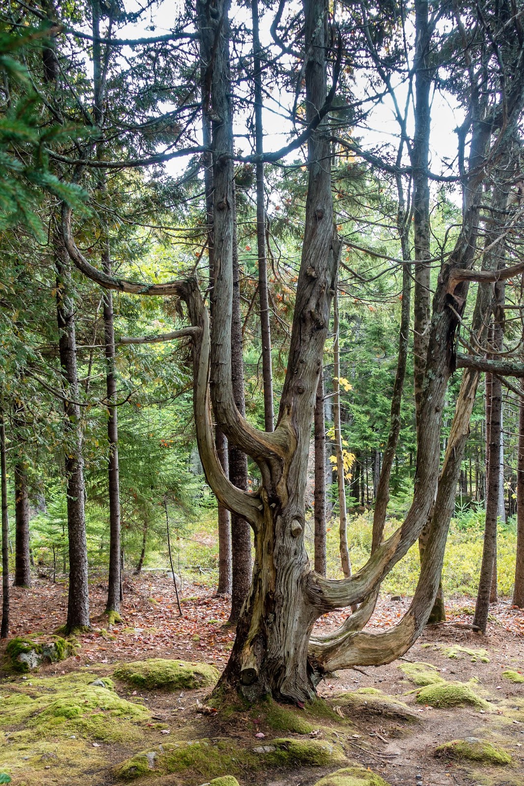
Unique Tree
The gardens are open to the public but do have a donation box as you enter through the beautiful wooden gates. The sign also requests visitors shouldn’t engage in any “horseplay” or “shenanigans”. Will do! The gardens were still in full bloom which was a bit surprising for late September. We slowly walked around slowly, admiring the beautiful blooms and meticulously cared for grounds. The sign must have worked because even with a couple dozen people wandering the gardens, there was no horseplay to be seen.
Beautiful Gate at Thuya


Monarch Caterpillar


Not Quite Open


A back gate in the garden fence leads to trails that go up to Eliot Mountain. A geocache on the way there is the oldest one on the island. We figure we might as well continue to the top. At only 450 feet, it’s not a very tall peak and doesn’t offer a view. Rather than backtracking to the car, we continue on the trail hoping to be able to find a trail down to another nearby garden - Asticou Azalea Garden. Even though the trails on the Garmin didn’t match the trail we were on, we managed to eventually work our way down to the garden. This one is quite different than Thuya but equally beautiful. A trail around a pond with all the plantings was quite nice and relaxing. This one had fewer flowers but some of the trees were starting to get their autumn colors. From here, it was a short walk back to the car. And this concludes the monthlong stay at Narrows Too Campground in Trenton Maine. Next stop is Schoodic Woods Campground on the quiet side of Acadia National Park.
Serene Setting

Asticou Azalea Garden