Map of this blog's locations click this link to open the map
We have less than a week to go here in Buena Vista. We have scoped out many other things we had hoped to do or see while we were in town but it looks like a month isn’t enough to get to everything. One thing we wanted to see was the mining museum in Leadville. We had a rainy afternoon predicted so we decide to head north, see a couple other things in the area and then go to the museum when the rain hit. We have driven to and hiked at many of the mountain passes over the Continental Divide but there are two others just north of Leadville. We had already driven the motorhome over Fremont Pass when we first came to BV. So that left Tennessee Pass - sitting at 10,424 feet in elevation. There are large pullouts on either side of the road and what appears to be a good number of hiking trails that start from here. We weren’t here for a hike but simple sightseeing. A very large stone monument lists about 1000 members of the 10th Mountain Division that lost their lives during WW II.
 |
| Tennessee Pass |
 |
| 10th Mountain Division Memorial |
About 5 miles over the pass is Camp Hale. This was the camp where the 10th Mountain Division was out of. There is an overlook that had a geocache so we headed there to see what we could see. From this vantage point, we could see the valley where the camp was but not much of it is left. About 6 weeks after our visit, Camp Hale will be designated a National Monument. So maybe there is (or will be) more to see - maybe we will make it back? |
| Valley Where Camp Hale Sat |
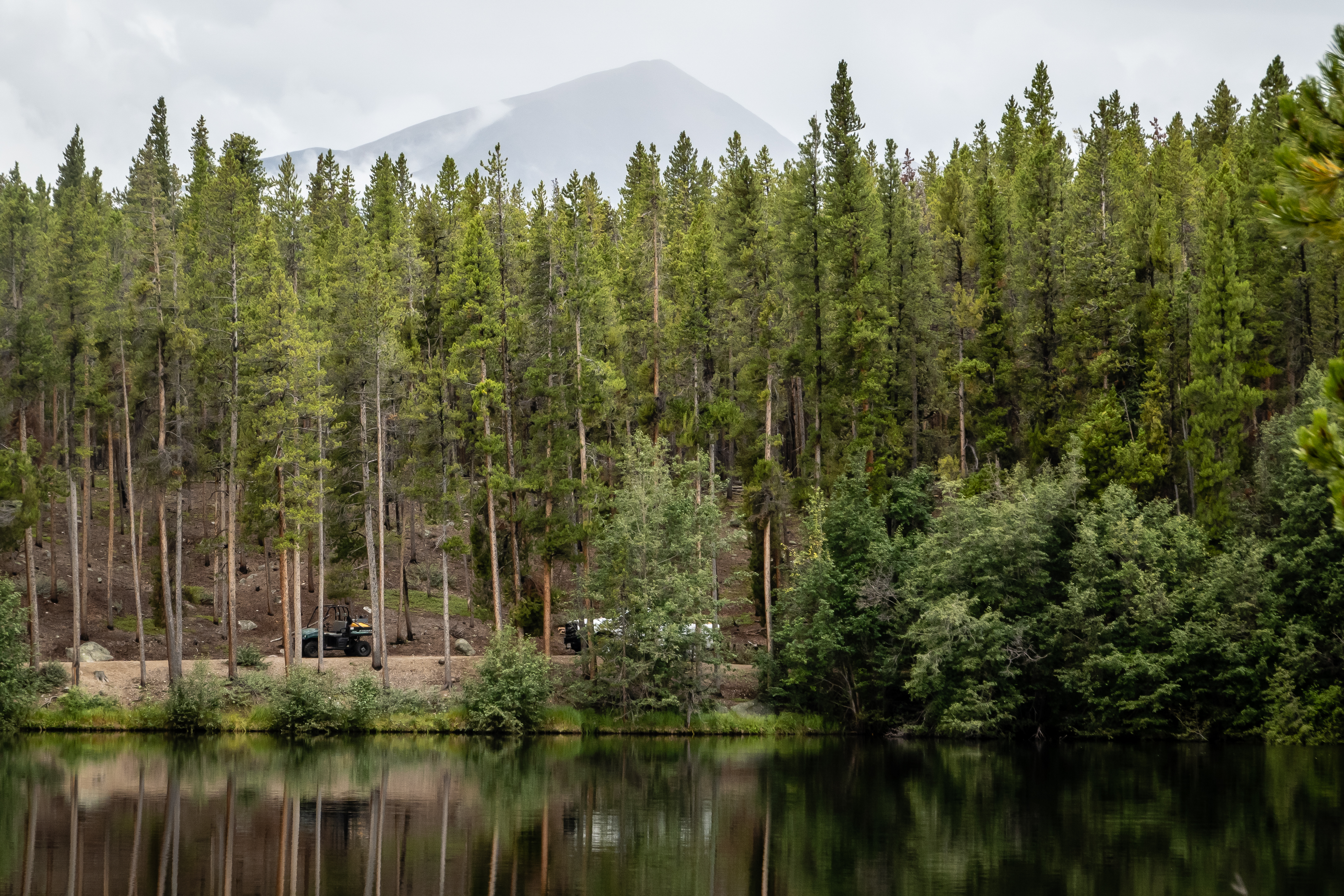
The clouds were rolling in but it hadn’t started to rain yet so we headed back towards Leadville to check out Turquoise Lake. It’s over 4 miles long and covers about 1800 acres. There are roads that circumnavigate the lake and a number of geocaches hidden along the way. We go to a couple of the “overlooks” but the trees obscure the views. We only got to a couple of these spots before the rain hit. It probably is a pretty lake when it is a nice sunny day but it wasn’t too interesting this day. We found an overlook with a good view, had lunch and then found a spot to walk around. It looks like the water level is at least 15 feet lower than normal. |
| Minimal View of Turquoise Lake from "Overlook" |
 |
| Turquoise Lake at Lunch Stop |
 |
| Getting a Sense of How Low Lake Levels Are |
We drive into Leadville to visit the National Mining Hall of Fame and Museum. It sounded like an interesting place to spend a few hours and it’s only $14 per person. It’s a rather large place with 5 levels between a couple of buildings. The volunteer gives us a map and tells us a suggested route. The first area houses some of the minerals they have on display. It wasn’t quite as large of a display as we saw at the Colorado School of Mines in Golden Colorado, but there were still some very impressive rocks on display. |
| Mining Museum in Leadville |
 |
| Malachite |
There are many other things on display in this wing of the museum. An old car that utilized molybdenum even way back in 1923. Molybdenum is one of the main minerals found in this area and is used for all sorts of metal applications. The tandem bicycle we had was made with a chrome-moly frame so we are somewhat familiar with it. There are displays of old lamps and lighting used in the mines. There were a couple of small cages that were used to house the canaries used as early gas detectors. |
| 1923 Wills Saint Claire |
 |
| Somebody Had Too Much Time to Kill |
 |
| Mini Shovel |
 |
| Metal Working Sculpture |
 |
| Canary Cages from the Coal Mine |
 |
| Old Mining Lanterns |
We work our way over to the 3rd level with even more displays. The diorama room is rather impressive. There are over a dozen of them showing all sorts of different mining techniques used over the years. There are very nicely done and gave a sense of how difficult mining was in the old days. There are all sorts of rooms dedicated to some particular item like the Scale Room, or the Gold Room or the Coal Room. Some of the displays are actually setup like you’re walking thru the old mine. It was fun to explore although the lighting made photography a bit more challenging. One of the rooms had a display of an old Kodak STAR 110 camera - that one is a relic!
 |
| Diorama |
 |
| Hoist from Mine |
 |
| Drilling for Blasting |
 |
| Scale with Gold Bars |
 |
| Kodak Star 110 Camera - A Classic |
 |
| Smile! |
As we continued on, we find the fifth floor is the Hall of Fame section. There are hundreds of pictures of men and some women that were important to the history of mining in some manner. I think someone would need to be much more into mining to find this very interesting. I got bored and head out thru a door out to a terrace that overlooks the town of Leadville. Good thing the rain had stopped, because I turn around to come back in and discover the door is locked. There was a sign with a phone number to call if you get locked out but personally I think there should be a sign on the way out the door that warns people about the door locking behind you. I call Chris since I knew she was just up the stairs in the hall of fame area, but another visitor happened by and I must have had a pathetic look on my face and he let me in. There is another are that is dedicated to minerals on the moon. Maybe someday that information will come in handy. We enjoyed our time wandering thru the museum. Maybe it isn’t a “must do” but it worked out well on a rainy day. |
| A Small Portion of Mining Hall of Fame |
 |
| Beware the Looking Terrace Door! |
 |
| Rocks Under UV Light |
 |
| Geology of the Moon |
Since the weather turned nice, we stopped by the Leadville Fish Hatchery on the south side of town. This one isn’t quite as large or commercial looking as the others we have visited in Colorado. There is beautiful visitor center which was unfortunately closed. There are a few raceways but it doesn’t seem like there is much trout capacity here. Since the place wasn’t open, we only had the signs to go by.
 |
| Entrance to Leadville National Fish Hatchery |
 |
| Beautiful Visitor Center |
 |
| Raceways at Hatchery |
 |
| Trout Expecting Food |
The other unique thing about this hatchery is it has a little over a one mile loop trail thru the wooded area surrounding the buildings. We had a geocache to find along the way so we decided to check it out. The recent rain made for wet but not muddy trails. I was amazed by how many mushrooms there were. We found the cache and continued around the loop. Turns out there are actually several ponds in the woods that are used for raising trout. It’s a nice setting and a pleasant walk. The property used to be the site of the Evergreen Lakes Hotel from the late 1800’s. The old hotel is long gone but it did have a view Colorado’s tallest peak - Mt Elbert - on clear days. We made it around the loop and headed back to BV.
 |
| Mushrooms in Woods |
 |
| Boardwalk in Need of Repair |
 |
| A Small Holding Pond |
 |
| Cloudy Afternoon |
 |
| Just a Glimpse of Mt Elbert |
 |
| Creek in Woods |
We had spotted the Midland Bike Trail during a hike just south of town and decided we should give it a try. We didn’t do our due diligence in scoping this one out like we typically do. We knew it was a 10 mile out and back trail that followed an old railroad line. It was listed as a beginner/intermediate ride. The first quarter mile was easy enough and a pretty ride. What we didn’t realize was that the old railroad tracks went over several large gullies via trestle bridges and these bridges are long gone. At the point where the track would have gone over the bridge, the drop off is rather steep and rocky. Bypass trails are in place, but this is where the intermediate portion of the trail comes into play. They were still rather steep down and back up with lots of loose rock. We were forced to walk our bike on much of the downhill sections and all of the uphill sections - not so much fun. |
| Switchback Along Trail |
 |
| Narrow Path Blasted Thru Rock |
 |
| Overlooking Where Trestle Bridge Should Be |
 |
| Side View of Large Gully Missing Bridge |
It took us some time to get the 5 miles to the turn around point and we were not looking forward to needing to repeat that route again. We had our lunch in the shade of a large tree by the Shields Gulch Trailhead and came up with a different strategy. We were only about half a mile from US-24. We could follow that road for 4 miles to get to County Road 304 which would take us back to where the car was parked. The highway was rather busy and didn’t have great shoulders but we made it since it was mostly downhill and required little pedaling. The real problem was once we got to CR 304. It was only 1.4 miles to the car but there was nearly 400 feet of elevation to make up. Chris decided to wait at the overlook park and have me go for the car. Given the steepness of the road, I debated about leaving the bike with her and simply hiking up to the car but I decided to give it a try. It was a hot afternoon and I found I needed to stop to catch my breath rather frequently but I made it and picked up Chris on the way out. Midland Bike Trail turned out to be a bit more challenging and less fun than we had bargained for.
 |
| Dirt Road Off of US-24 |
Just south of BV is an area called Browns Canyon National Monument. In attempting to figure out what there was to see there, we weren’t finding much information. It’s a large area on the east side of the Arkansas River but there wasn’t a visitor center or even very many trails. The Turret Trail sounded like one we might enjoy but we were going to do a slight variation on that hike by taking the River Bench Trail near 2 miles into the hike. Instead of being a 6.8 mile out and back with nearly 1100 feet of elevation gain, our modification will drop the mileage to about 5.5 and cut the elevation in half. The Turret Trail starts out near the Ruby Mountain campground. There are some wonderful views even from the parking area. |
| Mountain View at Trailhead |
The first 2/3 mile gains about 250 feet but is rather pretty. There are some wonderful rock outcroppings that are reminiscent of Chiricahua National Monument in Arizona. The trail never goes into the rocks but they are still neat to see from a distance. As we gain elevation, we start to get some great views of the 14ers to the west. As we work our way down the backside of the hill, we hit the flat portion of the hike. It wasn’t as interesting as the climb up and down plus there is no shade so there is maximum sun exposure. |
| Strange Rock Outcroppings in Woods |
 |
| Views of Distant Mountains |
At the 1.8 mile mark we kept our eye open for the River Bench Trail which should veer off to the right towards the river. We didn’t realize the trail we were looking for would be as substantial as it was and even had a sign at the split. We worked our way along the trail which crosses several large washes. Others had complained about getting turned around at these washes but we didn’t have any issues. We got to an overlook of the Arkansas River and did a little bit of a rock scramble to sit on a very large boulder in the shade with a nice view of the river. |
| Large Rock Feature Near Trail |
 |
| Coming Out of Wash |
 |
| Made it to the Arkansas River |

We sat and had our lunch and got a chance to see several rafters go by. As we start to head back, we notice dark clouds on the horizon. We should have learned by now that there is always a good chance for an afternoon thunderstorm regardless of the weather forecast. Sure enough as we were climbing the hill with about a mile to go, it started to rain. Fortunately it only lasted for a few minutes. We ran into a couple huddled under a tree trying to decide whether they should continue on. We told them it wasn’t the most exciting trail once they get down the hill. Back at the car, I went to get one geocache that was just 300 feet away. It was hidden on the side of a steep hill and I was having a tough time finding it. Just as I located it and signed the log book, the skies opened up again, but this time it was sleet instead of rain. I was amazed by how the sleet accumulated so quickly and covered the car. We waited until the precipitation stopped to drive out the dirt road. We had quite the muddy car when we got back to camp. |
| Small Rafting Group |
 |
| Storm Clouds Ahead |
With three days left before heading out, we managed to get two more hikes in - both on different portions of the Colorado Trail. The first one would start near the Shavano Campground on FR 240. There were several cars parked at the trailhead and one woman was prepping her mountain bike for a ride. As we started north up the trail, it is a rather steep climb. I kept wondering if the cyclist was going to come this way because it didn’t look like a trail that could be biked. As we climb up to a ridge line, the views of the valley below are great. |
| Great Colors and Lighting |
 |
| Working Our Way Up |
 |
| Overlooking Valley |
 |
| Mushrooms |
Once to the top of the ridge, it levels off substantially and is a pleasant hike. One section is thru an Aspen grove. It’s a bit early for fall colors but I bet it’s gorgeous here when the leaves turn vibrant yellow. We had crossed thru a cattle gate and could occasionally hear some mooing in the distance but it took some time before we came upon them. Several of them were right on the trail and we were a bit nervous about weaving our way thru them but they didn’t seem too upset with our presence. |
| Entering Aspen Grove |
 |
| Moo! |
We ended up going up to a place called Blanks Cabin. We knew this because of a geocache hidden here. We found the container but somehow couldn’t find the cabin. We weren’t sure if we were looking for a full cabin, one falling down or only the foundation from the building but in any case we never saw it. There was a great view of Mt Shavano from here and we found another trailhead that was very full. It looks like this one is the starting point for the hike up to the top of Mt Shavano at 14,231 feet. We ended up hiking 2.5 miles before heading back down the hill to the car. It was a rather pleasant hike with some excellent views. |
| Mt Shavano |
 |
| Butterfly |
 |
| Gentian |
 |
| Flowers Along Trail |
The following day was another section of the Colorado Trail starting very near the Narrow Gauge hike we did near Chalk Creek on CR 290. It’s actually part of the same segment of the trail (#14) but at the far north end. The first mile of the hike is all uphill and rather tiring after yesterday’s hike. But the incredible views we were getting glimpses of were motivating us to trudge on. We found one geocache on the way up and another hidden near the peak of our hike. |
| Pretty View Along the Trail Up |
 |
| View at the Top |
We debated about turning back but there was another cache and it was only another 1.5 miles. The views across the Chalk Creek Valley were nice. It was a bit of a downhill before hitting a flat section thru sparse woodlands. The cache was near a cow water station but not like anything we have seen before. It was an old tire from some huge vehicle. It stood over 3 foot tall and was about 25 feet in diameter. We ended up not being able to find the cache and we now had about 3 miles to go to get back to the car. One of the features on the mountainside across the valley had some large cave like openings and they really looked like the eyes of some alien creature. We eventually made it back to the car with almost a 6 mile hike. |
| View Across Chalk Creek Valley |
 |
| BIG Tire Turned Watering Pond |
 |
| Alien Head |
 |
| Rocky Trail Up |
We spent our last day getting ready to travel. After spending a month in BV, we have lots of things to put away. That’s the problem with staying extended times in one location, everything seems to come out from its storage spot.
While we were here for the last month, we started to seriously investigate what our next car should be. Our current Jeep Cherokee is over 8 years old and has over 107,000 miles. Given the issues we had earlier this spring in the Denver area, we think it’s time to upgrade. The problem is we have never purchased a vehicle out of state so we need to understand how to register, pay taxes and all the other fun stuff that my local dealer back in Rochester would normally handle for us. There was also the dilemma of what to get. There are not that many vehicles that can be towed “4 down” anymore so in some sense, we have a limited set of vehicles to choose from. More on this front in upcoming blog posts. Next stop, Black Canyon of the Gunnison National Park - likely one you haven’t heard of before.