Map of this blog's locations click this link to open the map
In searching for other things to see and do in the area, we stumbled upon the Montezuma Audubon Center in Savannah only about 20 miles to the northeast of camp. It didn’t look to be a real big place but thought it looked interesting - plus there was a geocache hidden on the grounds.
 |
| Welcome to Montezuma Audubon Center |
While it was a Saturday, we weren’t expecting the place to be so crowded. There were about a dozen cars in the parking lot. As we headed into the visitor center, we discovered that there was some sort of program taking place. There wasn’t a whole lot of information inside, so we headed out for our walk. We passed a large group of people, that had moved out of the large classroom and were standing along the path watching an instructor setting a trap. We didn’t stick around to see what they were learning to catch. We start our walk through a wooded area before emerging onto the paths that go around a couple of ponds. I bushwhack into the place where the geocache is hidden while Chris stayed out on the trail.
 |
| Overlooking Pond |
The vegetation that surrounds the water was fairly high so it was tough to get a good view of the pond but we must have been heard or seen because a large group of ducks takes off and flew over us. The group circled a couple of times before moving on to a different spot. At the time, I would have simply call them ducks but upon closer examination of the photos I took, I noticed that they seemed to have a rather distinct teal and black pattern on their wings. Referencing my bird app, they were likely green-winged teals. I zoomed in on one of the birds in flight to get a better view of the wing pattern.
 |
| Green-winged Teals |
The trails here are likely only a mile or so long, so it doesn’t take us very long to walk around the grounds and see all there is to see here. I feel they need to build a duck blind next to one of the ponds so we can get a better view of the birds that visit this location. We walk over to another geocache hidden off the property by a bridge over Crusoe Creek. We were unsuccessful in finding the cache but it was a nice view. We head out and drive through Montezuma National Wildlife Refuge again hoping to spot more birds.
 |
| Looking Back at Visitor Center |
 |
| Crusoe Creek |
A couple days later, we head back to Auburn New York. We thought the weather was supposed to be decent and we had a several different parks with geocaches to be found. We got a late start so we arrived at Emerson Park which is on the northern end of Owasco Lake. We were surprised to see there is a manned booth at the entrance to the park. Turns out that there is an entrance fee if you are launching a boat but it is free otherwise. We parked and ate our lunch while watching a couple dozen people with bicycles having their catered lunch in the nearby shelter. They were on some sort of bike tour of the Finger Lakes and this was their lunch break for the day.
It is a pretty park with a boat launch and a few boat slips on the outlet of the lake. We head off to tackle one of the caches that hadn’t been found in nearly 2 years. This one had a few stages so we knew it wasn’t going to be quick. With the information from stage one found, we saw that the next stage was just a quarter mile away. We knew there were some trail heading in the right direction, so we decided to just go for it instead of moving the car. While the trail we found along the outlet was nice, it didn’t get us to the spot we needed so we had to backtrack and just walk across a field. We spent 10 minutes searching in a somewhat wet and muddy area before we finally spotted the cache. But it turned out to just have the coordinates for the next stage. This one was only 400 feet away but we could see the woods in that direction were pretty much a swamp.
 |
| Looking South on Owasco Outlet |
 |
| Looking North |
It was then that we hear a rumble of thunder in the distance. A quick check on the weather app confirmed there was a storm cell heading our way, so we knew we needed to be quick. We attempted to do a hike back up the outlet trail around the back side hoping the cache was beyond the swampy area. But it turned out coming from this direction was just as wet. With the storm approaching, I just decided to go for it. I was able to get within about 100 feet of the final location with dry boots, but I could tell, there was no chance of staying dry the whole way. By the time I got to the container which was sitting on an old stump out of the water, I was in water up to my knees - and it wasn’t the best smelling water. I signed the log and trudged through the water until I hit high ground again. But by now the storm was right on top of us. We made it back to the car with just a few sprinkles and then the skies opened up. So much for our plans for the rest of the day.
 |
| Nice Homes Along the Outlet |
The following day our weather forecast was studied much more closely and all indications were for a nice day. Off to Macedon we go. We had an Adventure Lab and several geocaches we wanted to find. We head to Macedon Canal Park to start our visit. This town is right along the Erie Canal and this park is right next to Lock #30. We start our journey by heading into the Butterfly Nature Trail. This trail heads out a small spit of land that had the present day Erie Canal on one side and the old “Enlarged Erie Canal on the other side. It is a nice trail with many sculptures, flower beds and fairy houses along the way.
 |
| Entrance to Nature Trail |
 |
| Wood Carvings |
 |
| Fairy House |
 |
| Odd Colored Berries |
 |
| Overlooking Erie Canal |
The Adventure Lab in Macedon has 10 stops associated with it, so we are taken all around town as part of the tour. One stop was at the library where a geocache is hidden too. This cache was very creative and had us looking all around the inside of the library for information to find the final container. I suppose the librarians are accustomed to geocachers going from one area to another in a seemingly random manner. The final container for this one was a very creatively painted wooden box that at first glance didn’t look like it should be the cache but once I lifted the lid up, we realized this was it.
 |
| Old Barn Gets Fresh Coat of Paint |
 |
| Elaborate Geocache in Library |
Macedon is a cute town and the fall decorations were starting to be put up. One of the homes we walked by on our way back to the car was already fully decorated for Halloween. This family went above and beyond in the various things on display. I found the horse drawn hearse complete with a horse skeleton and driver with a top hat to be rather creative.
 |
| Decorated for Autumn |
 |
| Mural in Macedon |
 |
| Spooky Hearse |
Back at the car, we noticed there was activity taking place at the lock so we head over to watch a boat coming out of the downstream gate. It was a boat similar to those we have seen on the canal during previous visits. The odd thing was that three more of these boats came out one after another. One of the boats pulled over to the side and a guy jumped off. Turns out he works for the company that rents these boats and we were watching the training session for 4 groups that were just starting their journey. Since going through the locks is an important skill to have for this type of excursion, they were going thru the lock in both directions before they would be cut loose to explore the canals.
 |
| One of Four Rental Boats Come Out of Lock #30 |
We stood by the lock and watched the boats go through. I’m fascinated by how the locks work. This one uses a gear drive to open and close the doors while the one by us in Waterloo is a hydraulic system. As the last boat was coming out of the lock, the guy hollered over to us to see if we wanted to join them. Apparently they had one of the larger boats and had an extra bedroom. I was tempted but this would have been just a little too spontaneous for us! We did look into the business - Erie Canal Adventures. They have a few different sizes of boats from 34 foot up to 42 foot and offer 3, 4, or 7 night rentals. Prices range from about $2600 for the short boat for 3 nights to nearly $5200 for the long boat for a week. It does look intriguing.
 |
| Four Boats Waiting for Lock to Fill |
Lime Hollow Nature Center is just outside of the town of Cortland. We noticed it because there are 7 geocaches hidden there as well as an Adventure Lab but when we investigated the place online, we realized this would be a neat place to explore even if there weren’t any caches. It’s about a 60 mile drive from camp and the Jeep’s GPSr did a great job of routing us on some backroads that we can safely say we have never been on before.
 |
| Lime Hollow |
The property encompasses nearly 600 acres and has 13 miles of trails, so it isn’t a small place. We decide to stop at the main visitor center first to get a sense for the trail system and what to expect. Plus three of the five stops for the Adventure Lab are near here.
 |
| Stained Glass in Visitor Center |
Most of the geocaches are in the southern portion of the park and while the trail system is connected, there is another parking area and trailhead on that end of the park that should work as a better starting point. We head out from the visitor center to do some of the more popular trails and access one of the caches. The facility is open year round and can be used for snowshoeing and cross-country skiing in the winter months. There is some pretty creative artwork along the north end of the park’s trail. There were several groups of schoolchildren out on some sort of field trip.
 |
| Lime Hollow Trailhead |
 |
| Unusual Bench |
 |
| Two Birds on a Head? |
 |
| Bear Along the Trails |
This is definitely one of those places with so many trail choices that having a decent trail map is helpful and almost necessary. We only had the one cache to go for from the north end of the park, but we were struggling to make sense of our maps and the actual trails we were on. At one point we came out of the woods to find a large meadow. We suspect the trail we need is on the far side of the field so we simply cross the field instead of trying to figure out the “correct” route. It worked out and we found the required trail right along the western edge of the property. The adjoining neighbor has an interesting sense of humor and has one of his “no trespassing” signs attached to a human skeleton hanging from a tree branch. Our route back to the car took us past Baldwin Pond.
 |
| Meadow |
 |
| Serious No Trespassing Sign! |
 |
| Baldwin Pond |
After enjoying our sandwiches while sitting on the porch of the visitor center, we drive over to another portion of the park that is a standalone parcel. A loop trail of just under a mile will give us a view of something called the Chicago Bog.
 |
| Chicago Bog |
Just down Gracie Road from the bog is another parking area. A road leads down to some USGS station, but there is a gravel parking lot at the top of the hill before the gate to the facility. This was a pretty section of the park and much less utilized although the trails were in good shape. We managed to find the remaining geocaches and enjoyed the serenity of the area. We probably got in about 6 miles of hiking in Lime Hollow.
 |
| Cattail Pond |
 |
| Odd Fungus |
 |
| White Berries |
It was mid afternoon by now but there was another Adventure Lab that provided a walking tour of downtown Cortland. We hoped we had the energy to complete the 5 stops associated with the tour. We discover Cortland is quite the busy place. I suspect much of it comes from the fact that it is a college town with SUNY Cortland being prominently situated in the downtown district. In our past life, we may have driven through Cortland but I don’t recall ever stopping here, so it was interesting to explore some of the historic buildings. The mural at the old Cortland Corset Company was pretty impressive. We had also worked on an interesting puzzle cache before coming here, so we needed to stop by the final location to sign in. All in all, we enjoyed our visit to the Cortland area.
 |
| Beautiful "1890 House" |
 |
| SUNY Cortland Alumni House |
 |
| Cortland Corset Company |
The next day we stayed closer to home. We had heard about Three Brothers Wineries in Geneva from one of our neighbors at camp. They were working part time at the place and it sounded like a good place to check out. What is a bit unusual about the place is there are three different wineries in the complex as well as a brewery! When we had looked at the different wines offered there, it seemed like many of the choices were on the sweet side and we much prefer dry wines. But the War Horse Brewing Company seemed to have a rather extensive array of beer choices, so we head into that building for to try some beers. With 2 dozen choices, we each got a flight of beers to try out. The place is rather eclectic with an obvious “war” theme to go with the name. We each found one beer we really liked so we ordered pints and sat and relaxed.
 |
| Lots of Beers on Tap |
 |
| Incoming! |
As we left, we wandered around the complex a bit to see what the winery tasting rooms looked like. These seemed nearly as eclectic as the brewery was but there were some great seating areas overlooking the vineyards with just a glimpse of Seneca Lake in the distance.
 |
| One of the Wineries at Three Brothers |
 |
| Nice View for a Wine Tasting |
Another day trip would have us heading north toward Lake Ontario. The Sterling Nature Center is about 45 miles from camp. We were originally thinking of going to Fair Haven Beach State Park but there were more hiking trails at Sterling and is only a few miles further northeast along the lake. We have been here before but it was 13 years ago so other than us having found some geocaches here in 2010, we don’t really have any memories of the place. We arrived at the parking lot and found lots of construction taking place. From the looks of things, a brand new visitor center is being built and is taking shape nicely. At first glance, it seems to be a much bigger facility than the area would require but maybe things have changed and Sterling has big plans?
 |
| Impressive Visitor Center Under Construction |
The trails are still accessible and once we get away from the construction zone, it becomes a quiet and relaxing area for a walk. There are about 8 miles of trails within the 1400 plus acres the preserve encompasses. We only have one geocache to locate here, so our hiking options are pretty wide open. We start off on the Heron Trail and as luck would have as we came up on the nearby pond, a heron flew off.
 |
| Following the Heron Trail |
There was a sign for a small spur trail to the Beaver Wetland. It was a short walk so we decided to check it out. From the old, dead trees on the water, I suspect this large pond was the work of some busy beavers. The Interpretive sign points out the nests precariously perched on the tall trees and explains they are heron nests. I wish we could have seen one of those birds in a nest because they don’t appear to be sturdy enough to hold such a large bird.
 |
| Overlooking Beaver Wetland |
 |
| Heron Nests |
Continuing up the Heron Trail toward the lake, we follow a wide creek or just a portion of the larger pond. There are some early fall colors on the trees. The Dogwood Extension Trail has a bridge to get us over the water. Our plan is to head over to the Bluff Trail and take that along the ridge overlooking Lake Ontario but there are signs stating the trail is closed because of damage. There wasn’t anyone around and as geocachers, we have done some seriously gnarly hikes and from what we could see, this one would be a piece of cake. There is a good view of the lake and beach from above just at the trail closure signs. We behave, and backtrack to continue over to two loops on the north side of the preserve on the opposite side of the Beaver Wetland. The Vernal Pool Loop and another offshoot of that named the Two Tail Trail were a bit more overgrown. Nothing too drastic but it is clear the majority of visitors never make it to this part of the park and given there were no real good viewpoints of the Beaver Wetlands, it was a section of the park we could have easily skipped.
 |
| Reflecting Water |
 |
| View of Lake Ontario from Bluff Trail |
We now need to backtrack over the bridge and go look for the geocache. Once that was found we had a few trail options. We picked the Lake Trail since it seems to go right along the water. There is a rather steep decline to get to the beach, but it is kind of a neat hike. In spots the beach is 20 to 30 feet wide and there are lots of fallen trees to step over or climb over depending on their size. There was one spot that was a bit of a challenge to get past without getting wet feet but we made it. We enjoyed our brief time at Sterling Nature Reserve.
 |
| Along the Lake Trail |
We made it back to the car and ate our lunch in the parking lot while we decided what, if anything, we need to visit while we were this far north. The town of Oswego has another historic fort and it is less than a 30 minute drive. We decide we have time and energy to go there. The fact there is an Adventure Lab at Fort Ontario helped us make our decision. Located on the shore of Lake Ontario, this fort was originally build in the early 1840’s. This makes Fort Ontario about 80 years younger than Fort Stanwix in Rome that we visited about a month ago. So this fort isn’t a national historic site but it is a state historic site.
 |
| Fort Ontario in Oswego |
It costs $4 per person to enter so a visit doesn’t break the bank. We arrived as a large group of children were being toured around the grounds. We decide to head in the other direction around the star shaped fort. There are a handful of buildings situated around the center courtyard of the fort. The interiors of each are decorated according to how the building was used - barracks, officer quarters, powder magazine, etc. most of the buildings were open enough to walk thru. One of the buildings was being renovated but they only had those rooms being worked on closed off to the public.
 |
| Beautiful Stone Building in Fort |
 |
| Bunk Beds in Barracks |
 |
| Cannon Balls Ready |
 |
| Gun Powder |
 |
| Officer Quarters |
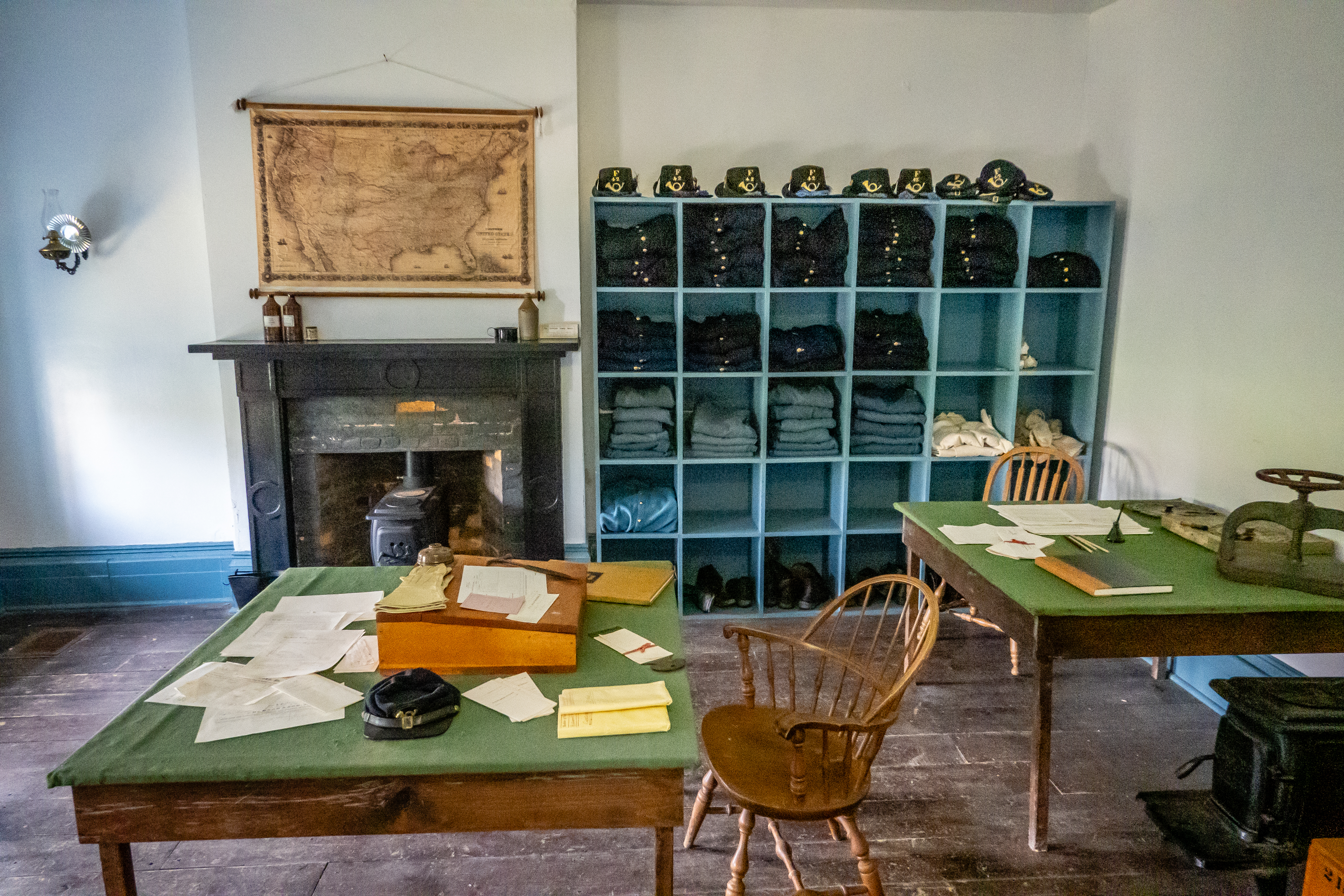
 |
| Supply Room |
As we meandered around the grounds, we found we could go into the underground stone casements and look thru the narrow shooting ports. There was one volunteer that was helping to lead the group of children around the fort. He was dressed in a full uniform which looked rather warm.
 |
| Underground Room |
 |
| Shooting Port |
 |
| Ready for Battle |